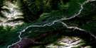
Telegraph Creek Satellite Image Map
Download Free Aerial Photo 104G14 at 1:50,000 scale
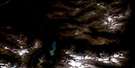
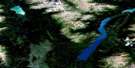
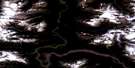
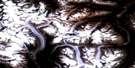
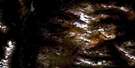
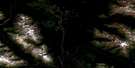
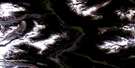
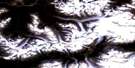
Telegraph Creek Satellite Imagery
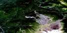
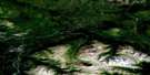
To view this satellite map, mouse over the air photo on the right.
You can also download this satellite image map for free:
104G14 Telegraph Creek high-resolution satellite image map.
Maps for the Telegraph Creek aerial map sheet 104G14 at 1:50,000 scale are also available in these versions:
Telegraph Creek Surrounding Area Aerial Photo Maps
 |
 |
 |
 |
 |
 |
 |
 |
 |
 |
 |
 |
 |
 |
 |
 |
© Department of Natural Resources Canada. All rights reserved.
Telegraph Creek Gazetteer
The following places can be found on satellite image map 104G14 Telegraph Creek:
Telegraph Creek Satellite Image: Beaches
Buck BarTelegraph Creek Satellite Image: Indian Reserves
Guhthe Tah 12Guhthe Tah Indian Reserve 12
Réserve indienne Guhthe Tah 12
Réserve indienne Stikine River 7
Réserve indienne Telegraph Creek 6
Réserve indienne Telegraph Creek 6A
Stikine River Indian Reserve 7
Telegraph Creek Indian Reserve 6
Telegraph Creek Indian Reserve 6A
Telegraph Creek Satellite Image: Islands
Three Sisters IslandsTelegraph Creek Satellite Image: Lakes
Alkali LakeSawmill Lake
Three Mile Lake
Telegraph Creek Satellite Image: Mountains
Brewery MountainChaîne Côtière
Coast Mountains
Dodjatin Mountain
Gordon Mountain
Grass Mountain
Mount Glenora
Mount Gordon
Zagoddetchino Mountain
Telegraph Creek Satellite Image: Major municipal/district area - major agglomerations
Regional District of Kitimat-StikineTelegraph Creek Satellite Image: Conservation areas
Mount Edziza Recreation AreaTelegraph Creek Satellite Image: Rapids
Bad RapidBad Rapids
Buck Riffle
Telegraph Creek Satellite Image: Rivers
Bad CreekBodel Creek
Brewery Creek
Callbreath Creek
Dagaichess Creek
Damnation Creek
Dodjatin Creek
Eight Mile Creek
Glenora Creek
Hyland Creek
Kunishma Creek
Line Creek
Mess Creek
Ned Shears Creek
Nedshears Creek
Nightout Creek
Nine Mile Creek
Seven Mile Creek
Shakes Creek
Stikine River
Susie Creek
Telegraph Creek
Tsikhini Creek
Tudadela Creek
Ware Creek
Winter Creek
Yehiniko Creek
Telegraph Creek Satellite Image: Unincorporated areas
GlenoraTelegraph Creek

© Department of Natural Resources Canada. All rights reserved.
104G Related Maps:
104G Telegraph Creek104G01 Iskut River
104G02 More Creek
104G03 Sphaler Creek
104G04 Flood Glacier
104G05 Scud River
104G06 Scud Glacier
104G07 Mess Lake
104G08 Refuge Lake
104G09E Kinaskan Lake
104G09W Kinaskan Lake
104G10 Mount Edziza
104G11 Yehiniko Lake
104G12 Chutine River
104G13 Tahltan Lake
104G14E Telegraph Creek
104G14W Telegraph Creek
104G15E Buckley Lake
104G15W Buckley Lake
104G16E Klastline River
104G16W Klastline River
