Herschel Island Satellite Image Map
Download Free Aerial Photo 117D12 at 1:50,000 scale
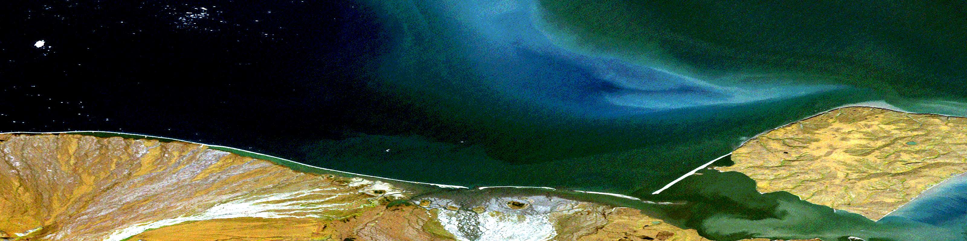
Herschel Island Satellite Imagery
To view this satellite map, mouse over the air photo on the right.
You can also download this satellite image map for free:
117D12 Herschel Island high-resolution satellite image map.
Maps for the Herschel Island aerial map sheet 117D12 at 1:50,000 scale are also available in these versions:
Herschel Island Surrounding Area Aerial Photo Maps
 |
|||
 |
 |
||
 |
 |
 |
 |
© Department of Natural Resources Canada. All rights reserved.
Herschel Island Gazetteer
The following places can be found on satellite image map 117D12 Herschel Island:
Herschel Island Satellite Image: Bays
Mackenzie BayOrca Cove
Thetis Bay
Thrasher Bay
Herschel Island Satellite Image: Capes
Avadlek SpitCalton Point
Lopez Point
Nunaluk Spit
Osborn Point
Welles Point
Herschel Island Satellite Image: Channels
Workboat PassageHerschel Island Satellite Image: Islands
Herschel IslandHerschel Island Satellite Image: Conservation areas
Herschel Island Territorial ParkIvvavik National Park of Canada
Parc national du Canada Ivvavik
Herschel Island Satellite Image: Rivers
Difficult CreekFirth River
Kugaryuk Creek
Malcolm River
Herschel Island Satellite Image: Seas
Beaufort SeaBeaufort Sea
Mer de Beaufort
Mer de Beaufort
© Department of Natural Resources Canada. All rights reserved.
