St Shotts Topo Map Online
Download Free Topo Map Sheet 001K12 at 1:50,000 scale
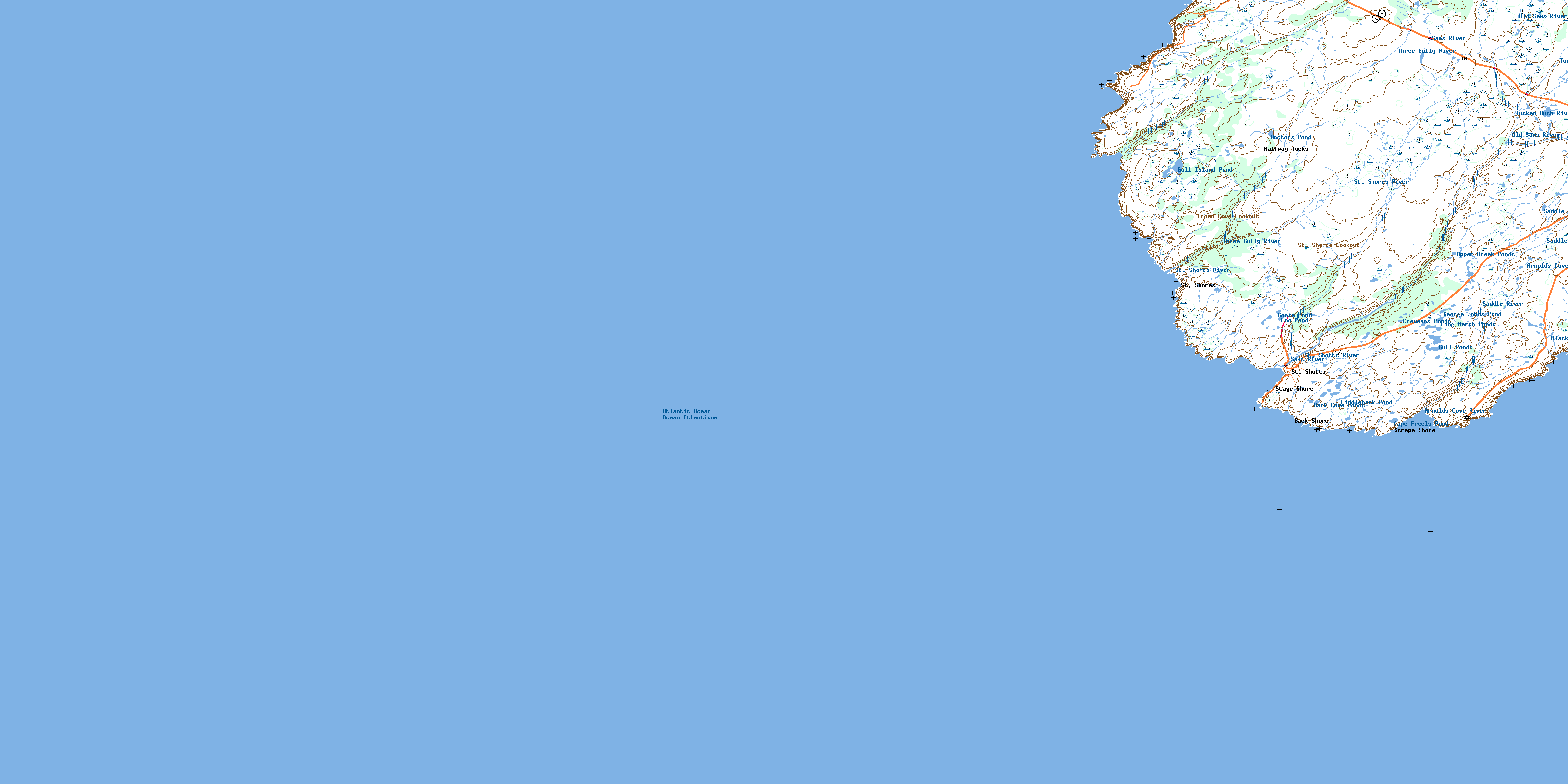
001K12 St Shotts Topo Map
To view this map, mouse over the map preview on the right.
You can also download this topo map for free:
001K12 St Shotts high-resolution topo map image.
Maps for the St Shotts topo map sheet 001K12 at 1:50,000 scale are also available in these versions:
St Shotts Surrounding Area Topo Maps
 |
 |
 |
|
 |
 |
||
© Department of Natural Resources Canada. All rights reserved.
St Shotts Gazetteer
The following places can be found on topographic map sheet 001K12 St Shotts:
St Shotts Topo Map: Bays
Arnold CoveBack Cove
Blackhead Cove
Boat Cove
Broad Cove
Bull Cove
Cannon Cove
Cape Freels Cove
Cape Pine Cove
Copper Cove
Green Gulch
Gull Island Cove
Hazel Cove
Holyrood Bay
Johns Cove
Kestrel Cove
Long Cove
Marines Cove
Nancy's Gulch
Paddys Black Hole
Sculpin Cove
Seals Cove
Shag Rock Cove
Shag Rock Cove
Shoal Point Cove
Spy Cove
St. Mary's Bay
St. Shores Cove
St. Shotts Cove
The Cove Jim Got Paddy
The Gut
Trepassey Bay
Watern Cove
Watern Cove
Wild Cove
Windy Gulch
Worry Cove
Wreck Apple
St Shotts Topo Map: Capes
Avalon PeninsulaBluff Head
Broad Cove Head
Cannon Cove Point
Cape Freels
Cape Pine
Cape Pine Head
Crewe Point
Drakes Point
Eastern Head
Flat Point
Flat Rocks of Broad Cove
Gull Island Point
Johns Cove Point
Kestrel Point
Laurel Point
Meigle Point
Pickapie Hill Point
Shoal Point
St. Shores Point
Sword Point
Watern Cove Point
Western Head
St Shotts Topo Map: Forests
Falls BreakFork Break
St. Shores Woods
St. Shotts Woods
St Shotts Topo Map: Islands
Gull IslandSt Shotts Topo Map: Lakes
Back Cove PondsBlack Head Pond
Boat Cove Gulch
Cape Freels Pond
Creweens Ponds
Doctors Pond
Fiddleback Pond
George Johns Pond
Good Water Gulch
Goose Pond
Gull Island Pond
Gull Ponds
Long Break Pond
Long Marsh Ponds
Loo Pond
Lumpycock Pond
Saddle Pond
Upper Break Ponds
Western Head Gulch
St Shotts Topo Map: Mountains
Broad Cove LookoutGut Hill
Kings Ridge
Long Hill
Peters River Hill
Pickapie Hill
Sand Carriers
St. Shores Lookout
The Castle
White Stick Hill
St Shotts Topo Map: Rivers
Arnolds Cove RiverBaby House Brook
Gull Island Brook
Old Sams River
Peters Brook
Saddle River
Sams Brook
Sams River
St. Shores River
St. Shotts River
Three Gully River
Tucken Bush River
St Shotts Topo Map: Shoals
Freels RockGull Island Ridge
Henry Rock
Jib Rock
Johns Cove Shoals
Moor Rock
Shag Rock
Square Rock
St Shotts Topo Map: Towns
St. ShottsSt Shotts Topo Map: Unincorporated areas
Back ShoreHalfway Tucks
Scrape Shore
St. Shores
Stage Shore
St Shotts Topo Map: Low vegetation
Bog GroundSt. Shotts Country
The Neck
© Department of Natural Resources Canada. All rights reserved.
