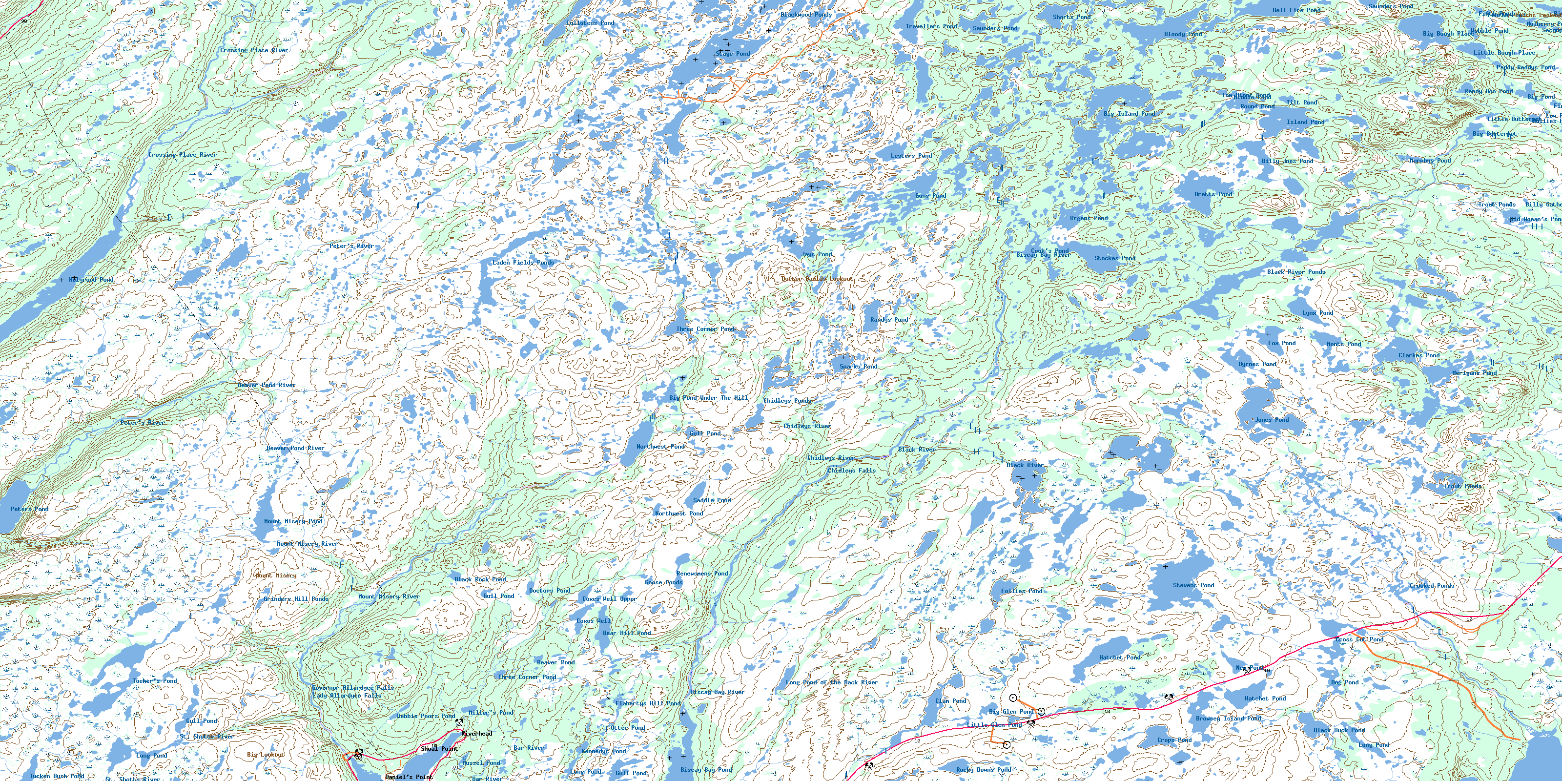
Biscay Bay River Topo Map Online
Download Free Topo Map Sheet 001K14 at 1:50,000 scale
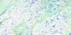
001K14 Biscay Bay River Topo Map
To view this map, mouse over the map preview on the right.
You can also download this topo map for free:
001K14 Biscay Bay River high-resolution topo map image.
Maps for the Biscay Bay River topo map sheet 001K14 at 1:50,000 scale are also available in these versions:
Biscay Bay River Surrounding Area Topo Maps
 |
 |
 |
|
 |
 |
||
© Department of Natural Resources Canada. All rights reserved.
Biscay Bay River Gazetteer
The following places can be found on topographic map sheet 001K14 Biscay Bay River:
Biscay Bay River Topo Map: Bays
Chance CoveHallerans Cove
Northeast Arm
Northwest Arm
Pound Cove
Trepassey Bay
Trepassey Harbour
Biscay Bay River Topo Map: Capes
Avalon PeninsulaBiscay Bay River Topo Map: Falls
Chidleys FallsGovernor Allardyce Falls
Lady Allardyce Falls
Biscay Bay River Topo Map: Islands
Browsey IslandChidleys Island
Nagles Island
Seven Islands
Watsons Island
Biscay Bay River Topo Map: Lakes
BackwatersBear Hill Pond
Beaver Pond
Big Bold-Face Pond
Big Bough Place
Big Butterpot
Big Glen Pond
Big Island Pond
Big Pond
Big Pond Under The Hill
Billy Gatheralls Pond
Billy Joes Pond
Biscay Bay Pond
Black Duck Pond
Black River Ponds
Black Rock Pond
Blackwood Ponds
Bloody Pond
Bretts Pond
Broosey Island Pond
Browsey Island Pond
Burnt Wood Pond
Butterpot Pond
Byrnes Pond
Carew Gully
Chidleys Ponds
Clam Pond
Clancy Pond
Clarkes Pond
Cook's Pond
Coxes Well
Coxes Well Upper
Crooked Ponds
Crops Pond
Cross Cats Pond
Cross Cut Pond
Cullotens Pond
Debbie Poors Pond
Doctors Pond
Dog Pond
Fifth Pond
First Pond
First Pond
Flahertys Hill Pond
Follies Pond
Fourth Pond
Fox Pond
Goose Ponds
Grinders Hill Ponds
Gull Pond
Gull Pond
Gull Pond
Gull Pond
Guns Pond
Guss Pond
Hatchet Pond
Hatchet Pond
Hatchet Rock Pond
Hell Fire Pond
Hollies Pond
Holyrood Pond
Island Pond
Island Pond
Jays Pond
Jones Pond
Kennedys Pond
Laden Fields Pond
Laden Fields Ponds
Lesters Pond
Little Bold-Face Pond
Little Bough Place
Little Butterpot
Little Glen Pond
Long Pond
Long Pond
Long Pond
Long Pond of the Back River
Low Pond
Lynx Pond
Merigans Pond
Middle Pond
Miller's Pond
Molleys Gullies
Monts Pond
Mount Misery Pond
Mulberry Pond
Murphys Pond
Mussel Pond
New Pond
Northwest Pond
Northwest Pond
Northwest Pond
Old Woman's Pond
Organs Pond
Otter Pond
Paddy Reddys Pond
Passage Pond
Peters Pond
Ponds On The River
Randy Boo Pond
Randys Pond
Renewsmens Pond
River Head Pond
Riverhead Pond
Rocky Downs Pond
Round Pond
Saddle Pond
Saunders Pond
Saunders Pond
Second Pond
Shorts Pond
Sixth Pond
Sparks Pond
Stage Pond
Stephen's Pond
Stevens Pond
Stockes Pond
Three Corner Pond
Three Corner Pond
Tilt Pond
Tocher's Pond
Tom Dinns Pond
Travellers Pond
Trout Ponds
Trout Ponds
Tucken Bush Pond
Tuckens Gully
Wobble Pond
Biscay Bay River Topo Map: Mountains
Bear HillBig Lookout
Big Stoney Ridge
Brazils Rock
Butter Pot
Chidleys Ridge
Doctor Baulds Lookout
Green Hills
Grinders Hill
Little Stoney Ridge
Long Hill
Long Ridge
Lower Drop
Middle Drop
Millers Hills
Mount Misery
Pitchs Lookout
Red Hill
The Lookout
The Neck
Tims Crossing Place
Tims Hill
Upper Drop
Biscay Bay River Topo Map: Conservation areas
Avalon Wilderness ReserveChance Cove Provincial Park
Biscay Bay River Topo Map: Rivers
Ambies BrookBack Brook
Bar River
Beaton Brook
Beaver Pond River
Big Drop River
Biscay Bay River
Black River
Chance Cove Brook
Chidleys River
Cootes Pond River
Crossing Place River
Harrys Brook
Laden Field's Brook
Mars Brook
Mount Misery River
Mussel Brook
Northeast Brook
Northwest Brook
Old Woman's Brook
Peter's River
Portugal Cove Brook
Redmans River
Riverhead River
St. Shotts River
Stoney River
Tochers Brook
Biscay Bay River Topo Map: River features
Beachy PoolChidleys Pool
Crooked Pool
Deer Crossing
Lady Allardyce Pool
Rennies Pool
Sandy Pool
Watsons Pool
Whale Back
Winters Pool
Biscay Bay River Topo Map: Shoals
Bobbys RockFlat Rocks
Hornet Rock
Paddock Shoal
Slidin Rocks
Biscay Bay River Topo Map: Towns
FermeuseBiscay Bay River Topo Map: Unincorporated areas
Daniel's PointRiverhead
Shoal Point
Biscay Bay River Topo Map: Valleys
Hansers BreakLittle Juniper Break
Long Marsh
Three Corner Pond Break
Tochers Drook
Biscay Bay River Topo Map: Low vegetation
Beaver Pond BottomBlack Bottom
Burnt Knap
Gull Pond Bottom
Quakers Meadow
Shoe Cove Marshes
The Meadow
Western Bottom
© Department of Natural Resources Canada. All rights reserved.
