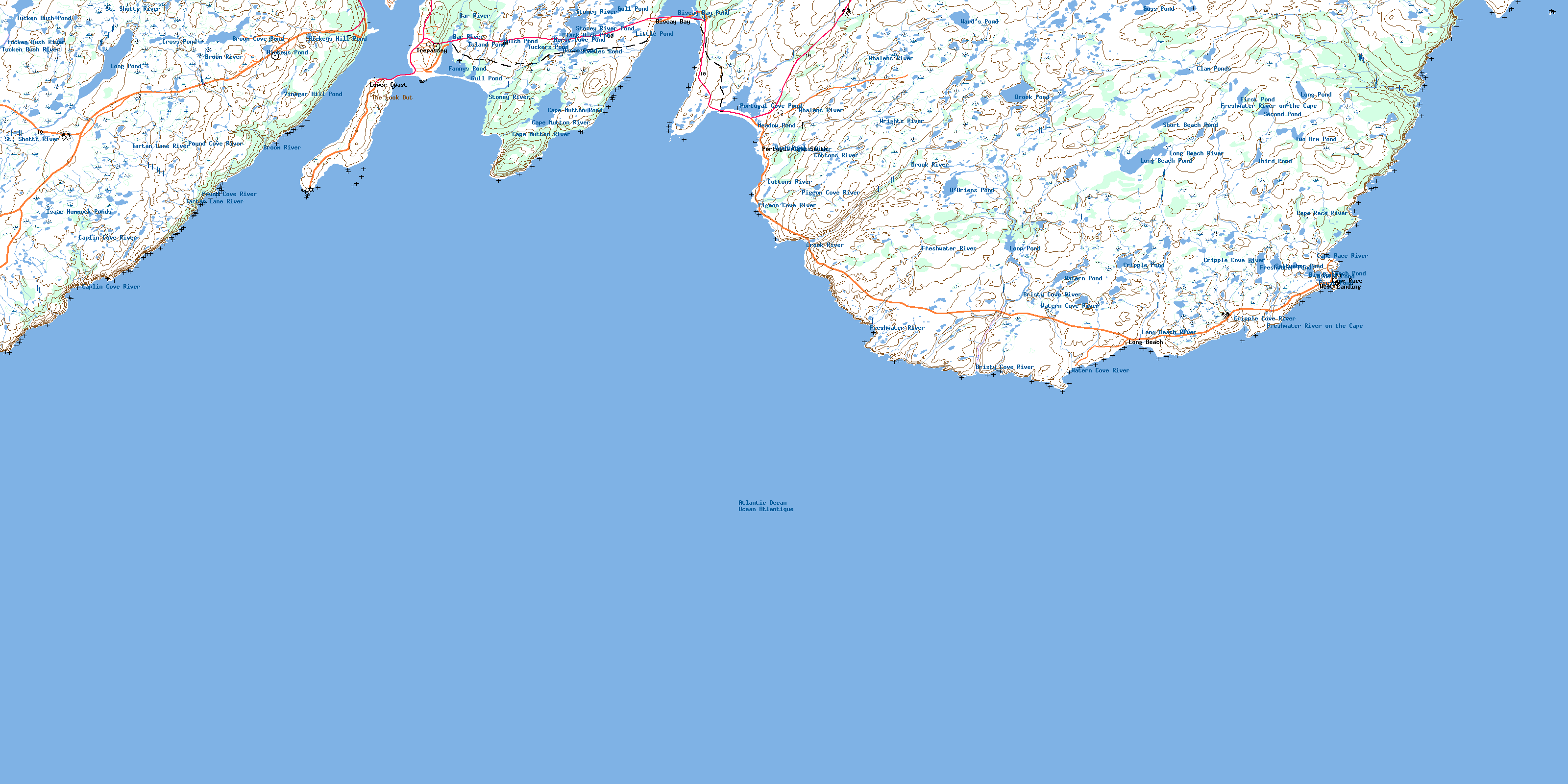
Trepassey Topo Map Online
Download Free Topo Map Sheet 001K11 at 1:50,000 scale
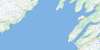
001K11 Trepassey Topo Map
To view this map, mouse over the map preview on the right.
You can also download this topo map for free:
001K11 Trepassey high-resolution topo map image.
Maps for the Trepassey topo map sheet 001K11 at 1:50,000 scale are also available in these versions:
Trepassey Surrounding Area Topo Maps
 |
 |
 |
|
 |
 |
||
© Department of Natural Resources Canada. All rights reserved.
Trepassey Gazetteer
The following places can be found on topographic map sheet 001K11 Trepassey:
Trepassey Topo Map: Bays
BacksideBackside (of Trepassey)
Big Johns Cove
Big Pound Cove
Biscay Bay
Biscay Bay Gut
Bobs Cove
Brians Gulch
Bristy Cove
Broad Cove
Broom Cove
Butlers Cove
Cape Cove
Caplin Cove
Chance Cove
Clam Cove
Coombs Cove
Cripple Cove
Daleys Cove
Drift Cove
Drook Cove
Eastern Cove
Frenchman's Cove
Freshwater Bay
Freshwater Cove
Freshwater Cove
Freshwater Cove
Front Cove
Gull Rock Cove
Humbug Gulch
Johnsons Gulch
Larders Cove
Laurentian Gulch
Little Pigeon Cove
Little Pound Cove
Long Cove
McCurrys Cove
Money Gulch
Moores Gulch
Mutton Bay
Natch Block
Northeast Arm
Northwest Arm
Pigeon Cove
Portugal Cove
Portugal Cove Gut
Pounden Cove
Sand Cove
Savadown Cove
Seals Cove
Thimble Cove
Trepassey Harbour
Watern Cove
Western Gulch
Yarders Cove
Trepassey Topo Map: Beaches
Long BeachPurgatory Beach
Stoney Beach
The Dock
Trepassey Topo Map: Capes
Avalon PeninsulaBack Cove Point
Beach Point
Big Johns Point
Blackhead
Boat Cove Point
Brook Point
Canteens Point
Cape Mutton
Cape Mutton Head
Cape Race
Cripple Cove Point
Cripple Rock Point
Daleys Point
Daniel Point
Drook Point
Eastern Head
False Baker Head
Fishers Point
French Mistaken Point
Frenchmans Point
Freshwater Point
Front Cove Point
Jagged Point
Long Point
Long Point
Meadow Point
Meadow Spit
Mistaken Point
Moores Point
Pickers Point
Portugal Cove Point
Portugal Point
Powles Head
Powles Peninsula
Shingle Head
Sims Point
Waddleton Point
Western Point
Woody Head
Trepassey Topo Map: Cliffs
Baker HeadCorrigans Ladder
The Rookery
Trepassey Topo Map: Forests
The CopseTrepassey Topo Map: Lakes
Big PondBiscay Bay Pond
Black Duck Pond
Brook Pond
Broom Coal Pond
Cape Mutton Pond
Clam Ponds
Cripple Pond
Cross Pond
Fannys Pond
First Pond
First Pond
Freshwater Pond
Gulch Pond
Gull Pond
Gull Pond
Guss Pond
Hickeys Hill Pond
Hickeys Pond
Horse Cove Pond
Horse Pond
Isaac Hummock Ponds
Island Pond
Leech Pond
Little Pond
Long Beach Pond
Long Pond
Long Pond
Loop Pond
Meadow Pond
Middle Pond
O'Briens Pond
Portugal Cove Pond
Saltwater Pond
Second Pond
Short Beach Pond
Steeles Pond
Stoney River Pond
Third Pond
Tucken Bush Pond
Tuckers Pond
Two Arm Pond
Vinegar Hill Pond
Ward's Pond
Wash Pond
Watern Pond
Whalens Gully
Trepassey Topo Map: Mountains
Bread and Cheese HillCahills Rock
Halfway Hill
Hickeys Hill
Kennedys Ridge
Long Hill
The Look Out
Trepassey Topo Map: Conservation areas
Chance Cove Provincial ParkMistaken Point Ecological Reserve
Trepassey Topo Map: Rivers
Back BrookBar River
Bristy Cove River
Broom River
Cape Mutton River
Cape Race River
Caplin Cove River
Cottons River
Cripple Cove River
Drook River
Freshwater River
Freshwater River
Freshwater River on the Cape
Island Pond Brook
Long Beach River
Pigeon Cove River
Portugal Cove Brook
Pound Cove River
St. Shotts River
Stoney River
Tartan Lane River
Tucken Bush River
Watern Cove River
Whalens River
Wrights River
Trepassey Topo Map: Shoals
Bells of Clam CoveBillies Rock
Black Rocks
Cape Race Rock
Cripple Cove Rock
Cripple Rock
Drook Rock
East Rock
Emerald Shoal
Horseshoe Rock
Meadow Bank
Pig Bank
Point Rock
Savadown Rock
Sinking Rock
Skinner Rocks
The Shoals
Western Rock
Trepassey Topo Map: Towns
Portugal Cove SouthTrepassey
Trepassey Topo Map: Unincorporated areas
Biscay BayCape Race
Daniel's Point
Drook
East Landing
Long Beach
Lower Coast
Tartan Lane
Valna Fad
West Landing
Trepassey Topo Map: Valleys
Gull Pond GulchLong Gulch
Millers Break
Tobins Break
Trepassey Topo Map: Low vegetation
Long Beach BottomTrap Hummock Marsh
© Department of Natural Resources Canada. All rights reserved.
