Burk's Falls Topo Map Online
Download Free Topo Map Sheet 031E11 at 1:50,000 scale
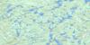
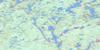
031E11 Burk's Falls Topo Map
To view this map, mouse over the map preview on the right.
You can also download this topo map for free:
031E11 Burk's Falls high-resolution topo map image.
Maps for the Burk's Falls topo map sheet 031E11 at 1:50,000 scale are also available in these versions:
Burk's Falls Surrounding Area Topo Maps
 |
 |
 |
 |
 |
 |
 |
 |
 |
 |
 |
 |
 |
 |
 |
 |
© Department of Natural Resources Canada. All rights reserved.
Burk's Falls Gazetteer
The following places can be found on topographic map sheet 031E11 Burk's Falls:
Burk's Falls Topo Map: Bays
Doe BayLawtons Cove
Mirror Bay
Burk's Falls Topo Map: Falls
Burk's FallsStirling Falls
Burk's Falls Topo Map: Geographical areas
ArmourBethune
Butt
Chapman
Finlayson
Joly
McCraney
McMurrich
Muskoka
Nipissing
Parry Sound
Perry
Proudfoot
Ryerson
Sinclair
Strong
Burk's Falls Topo Map: Islands
Askin IslandBenfair Island
Birch Island
Blueberry Island
Bobby Island
Buckskin Island
Bucktooth Island
Crescent Island
Duck Island
Emerald Island
Gameja Island
Garden Island
Joy Island
Loon Island
Nottawa Island
Pine Island
Pine Island
Pollys Roost Island
Prince Edward Island
Reazin Island
Rock Island
Squirrel Island
Strawberry Island
Twin Island
Wegilbomac Island
Burk's Falls Topo Map: Lakes
Alderdyce LakeAlfred Lake
Ana Lake
Askin Lake
Barre Lake
Bartlett Lake
Bay Lake
Beaver Lake
Bee Lake
Bernard Lake
Bethune Lake
Betty Lake
Bevan Lake
Bijou Lake
Blue Lake
Bluesky Lake
Bridge Lake
Brock Lake
Buck Lake
Burnt Lake
Canty Lake
Chain Lakes
Charlie's Lake
Clam Lake
Clear Lake
Coffee Lake
Cripple Lake
Crooked Lake
Cuyler Lake
Deer Lake
Dewfish Lake
Doe Lake
Duck Lake
Dump Lake
Dunstan Lake
East Ryan Lake
Elbow Lake
Emsdale Lake
Fetterley Lake
Fetterly Lake
Fifteen Lake
Finger Lake
Fourteen Lake
Fox Lake
Frank Lake
Gaitche Lake
Graphite Lake
Grass Lake
Greenish Lake
Groom Lake
Hart Lake
Hassard Lake
Hayward Lake
Himbury Lake
Hodson Lake
Hog Lake
Horn Lake
Hungry Lake
Ink Lake
Irving Lake
Island Lake
Jacks Lake
Jewel Lake
Katrine Lake
Kelsey Lake
Kernick Lake
Kippen Lake
Lac à Laurin
Larson Lake
Little Beaver Lake
Little Bethune Lake
Little Blue Lake
Little Butt Lake
Little Clam Lake
Little Doe Lake
Little Hungry Lake
Little Patterson Lake
Little Peters Lake
Little Pevensey Lake
Little Proudfoot Lake
Little Trout Lake
Little Whetstone Lake
Long Lake
Long Lake
Loon Lake
Lower Raven Lake
Mama Lake
Mason Lake
Mayer Lake
McCann Lake
McGuire Lake
Middle Shanty Lake
Mining Corporation Lake
Minnow Lake
Morgan's Lake
Music Lake
Musie Lake
North Lake
Nulty Lake
Oliphant Lake
Owl Lake
Papukiwis Lake
Pearceley Lake
Penuel Lake
Perbeth Lake
Perry Lake
Peters Lake
Pevensey Lake
Pickerel Lake
Pine Lake
Pool Lake
Proudfoot Lake
Rainy Lake
Ridge Lake
Rochester Lake
Round Lake
Sand Lake
Schamerhorn Lake
Shawshaw Lake
Simpson Lake
Snowshoe Lake
Sollman Lake
South Branch Lake
Spruce Lake
Spry Lake
Sweny Lake
Tank Lake
Tea Lake
Thirteen Lake
Thirty Lake
Three Mile Lake
Tim Lake
Travis Lake
Twentyeight Lake
Upper Raven Lake
Whetstone Lake
Widgeon Lake
Wilkins Lake
Willie Lake
Woodrow Lake
Burk's Falls Topo Map: Major municipal/district area - major agglomerations
MuskokaBurk's Falls Topo Map: Other municipal/district area - miscellaneous
ArmourChapman
Joly
Lake of Bays
Magnetawan
McMurrich
McMurrich/Monteith
Perry
Ryerson
Strong
Burk's Falls Topo Map: Conservation areas
Algonquin Provincial ParkBear Creek Conservation Reserve
Bridge Lake Outwash Plain Forest Conservation Reserve
Chain Lakes Conservation Reserve
Upper Raft Lake Conservation Reserve
Burk's Falls Topo Map: Rivers
Alderdyce CreekBear Creek
Beggsboro Creek
Bernard Creek
Cashman Creek
Cripple Creek
Deer Lake Creek
Greenish Creek
Iagoo Creek
Jacks Creek
Larson Creek
Little East River
Little North Magnetawan River
Little Tonawanda Creek
Magnetawan River
North Magnetawan River
Proudfoot Creek
Sollman Creek
Stirling Creek
Tank Lake Creek
Tonawanda Creek
Widgeon Creek
Burk's Falls Topo Map: Towns
KearneyBurk's Falls Topo Map: Unincorporated areas
AholaBerriedale
Carss
Chetwynd
Clear Lake
Doe Lake
Emsdale
Hartfell
Katrine
Katrine Station
Kennedys
Lake Bernard
Pevensey
Pickerel Lake
Ravensworth
Sand Lake
Scotia
Stirling Falls
Strong
Wisemans Corners
Burk's Falls Topo Map: Villages
Burk's Falls
© Department of Natural Resources Canada. All rights reserved.
031E Related Maps:
031E Huntsville031E01 Wilberforce
031E02 Haliburton
031E03 Bracebridge
031E04 Lake Joseph
031E05 Orrville
031E06 Huntsville
031E07 Kawagama Lake
031E08 Whitney
031E09 Opeongo Lake
031E10 Tom Thomson Lake
031E11 Burk's Falls
031E12 Magnetawan
031E13 Golden Valley
031E14 South River
031E15 Burntroot Lake
031E16 Lake Lavieille
