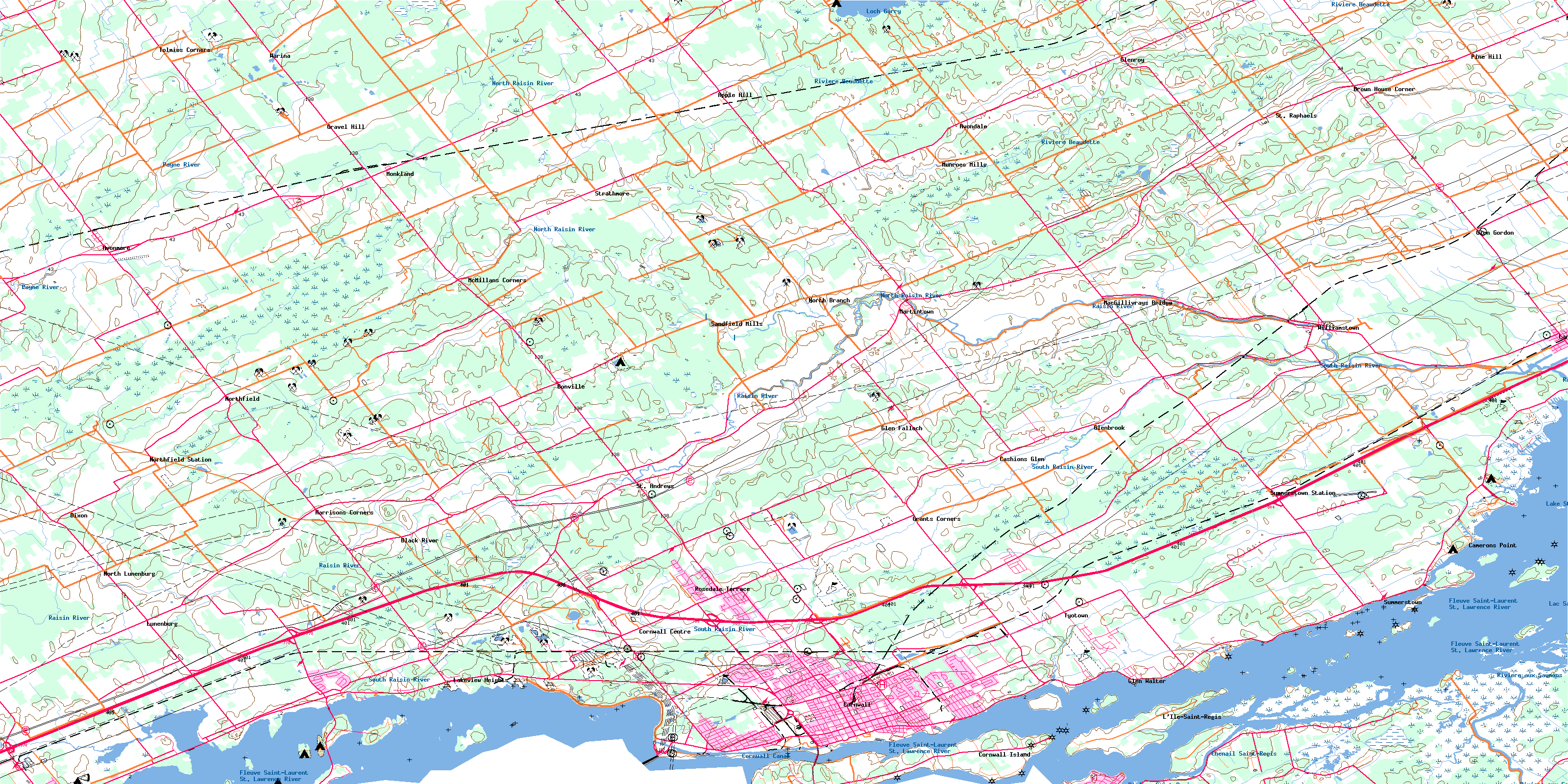
Cornwall Topo Map Online
Download Free Topo Map Sheet 031G02 at 1:50,000 scale
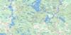
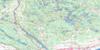
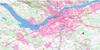
031G02 Cornwall Topo Map
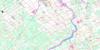
To view this map, mouse over the map preview on the right.
You can also download this topo map for free:
031G02 Cornwall high-resolution topo map image.
Maps for the Cornwall topo map sheet 031G02 at 1:50,000 scale are also available in these versions:
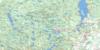
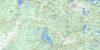
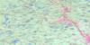
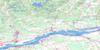
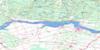
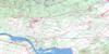
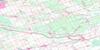
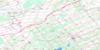
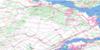
Cornwall Surrounding Area Topo Maps
 |
 |
 |
 |
 |
 |
 |
 |
 |
 |
 |
 |
 |
 |
 |
 |
© Department of Natural Resources Canada. All rights reserved.
Cornwall Gazetteer
The following places can be found on topographic map sheet 031G02 Cornwall:
Cornwall Topo Map: Bays
Hoople BayMeadow Bay
Cornwall Topo Map: Capes
Danis PointFarlinger Point
Farlingers Point
Flanigans Point
Fraser Point
Glengarry Point
Graveyard Point
Long Sault Rapids Point
McGibbons Point
Pilons Point
Pointe Hopkins
Provast Point
Stonehouse Point
Windmill Point
Cornwall Topo Map: Channels
Chenail Saint-RégisPollys Gut
Cornwall Topo Map: City
CornwallCornwall Topo Map: Geographical areas
CharlottenburghCornwall
Dundee
Glengarry
Kenyon
Lancaster
Osnabruck
Roxborough
Stormont
Cornwall Topo Map: Hydraulic construction
Bourdon DrainCharles Laplante Drain
Clarence Grant Drain
Cooper Drain
Donald McLennan Drain
Donald Smith Drain
Donihee Drain
Eastman Drain
Ferguson Drain
First Concession Drain
Fly Creek Drain
Glen Drain
Glen Falloch Drain
Glenroy Drain
Harland Drain
Henderson Drain
Joanette-Brunet Drain
John Coleman Drain
Leitch-McLennan Drain
McDermid-Richer Drain
McDonald Branch
McDonald Drain
McIntosh Drain
McLachlan Drain
McLaren-Montgomery Drain
McLellan-King Drain
McNaught Drain
Monkland Drain
Montgomery Drain
Murray Drain
Ninth Concession Drain
Oliver Magee Drain
Sam McIntosh Drain
Shaver Drain
Spring Creek Drain
Steele-Hough Drain
Wert Drain
Williamson Drain
Woods Drain
Cornwall Topo Map: Indian Reserves
Akwesasne 59Akwesasne Indian Reserve 15
Akwesasne Indian Reserve 59
Réserve indienne Akwesasne 15
Réserve indienne Akwesasne 59
Réserve indienne St. Regis 15
Réserve indienne St. Regis Akwesasne 59
St. Regis Akwesasne Indian Reserve 59
St. Regis Indian Reserve 15
Cornwall Topo Map: Islands
Bergin IslandBredin Island
Camerons Crab
Centre Woodlands Island
Clark Island
Colquhoun Island
Colquhoun Island East
Colquhoun Island West
Colquhoun Islands
Cornwall Island
Dickinson Island
East Isle
East Woodlands Island
First Crab
First Crab
Fraser Crab
Fraser Island
Grape Island
Hamilton Island
Harvey Island
Heriot Island
Heriot Island
Hoople Island
Île aux Merises
Île Bass
Île Casistatie
Île Cattle
Île Châtelain
Île Christatie
Île Colquhoun Est
Île Colquhoun Ouest
Île Corn
Île Cow
Île Dickerson
Île Dodens
Île du Canal
Île Dundee
Île Goose
Île Hen
Île Jacobs
Île Jaune
Île Little Hog
Île Mud
Île Plum
Île Ronde
Île Saint-Régis
Île Simard
Île Stanley
Île Sugar Bush
Île Thompson
Îles Three Sisters
Îlet Grass
Jacobs Island
Little Colquhoun Island
Little Hog Island
Long Sault Island
Loon Island
Macdonell Island
Mille Roches Island
Mille Roches Island
Moulinette Island
Mulcaster Island
Osnabruck Island
Phillpotts Island
Pilon Island
Renshaw Island
Royal Baker Island
Saint-Régis Dyke
Second Crab
Sheek Island
Snetsinger Island
Squaw Island
St. Francis Island
Stanley Crab
Stanley Crab
Stanley Island
Stoneburner Island
Strachan Island
The Crabs
The Crabs
Third Crab
Third Crab
Vankoughnet Island
Wales Island
West Woodlands Island
Woodlands Island
Woodlands Islands
Cornwall Topo Map: Lakes
Lac Saint-FrançoisLac St-François
Lake St. Francis
Lake St. Lawrence
Loch Garry
Cornwall Topo Map: Marine navigation features
Cornwall CanalCornwall Topo Map: Mountains
Lairds HillMacs Hill
Sandy Hill
Vinegar Hill
Cornwall Topo Map: Major municipal/district area - major agglomerations
United Counties of Stormont, Dundas and GlengarryCornwall Topo Map: Other municipal/district area - miscellaneous
CharlottenburghCornwall
Finch
Kenyon
Lancaster
Lochiel
North Glengarry
North Stormont
Osnabruck
Roxborough
South Glengarry
South Stormont
Cornwall Topo Map: Conservation areas
Inverarden House National Historic Site of CanadaLac Saint-François National Wildlife Area
Lieu historique national du Canada de la Maison-de-Sir-John-Johnson
Lieu historique national du Canada de la Maison-Inverarden
Réserve nationale de faune du lac Saint-François
Sir John Johnson House National Historic Site of Canada
Cornwall Topo Map: Provinces
OntarioQuebec
Québec
Cornwall Topo Map: Rapids
Long Sault RapidsCornwall Topo Map: Rivers
Baudet RiverBeaver Creek
Dixon Creek
Farlinger Branch
Ferguson Branch
Finney Creek
Fleuve Saint-Laurent
Fraser Creek
Grays Creek
Hoople Creek
Le Bateau
Lefebvre Branch
McIntyre Creek
Moose Creek
North Raisin River
Palen Creek
Pattingale Creek
Payne River
Raisin River
Rivière au Baudet
Rivière aux Saumons
Rivière Beaudette
Rivière Payne
Rivière Saint-Régis
Ruisseau Bittern
Ruisseau Pike
Shaver Creek
South Raisin River
St. Lawrence River
St. Lawrence River
Stoney Creek
Sutherland Creek
Wereley Creek
Werely Creek
Westleys Creek
Cornwall Topo Map: Road features
Pont du BateauCornwall Topo Map: Shoals
Crab Island ShoalDelany Shoal
Highlander Shoal
Cornwall Topo Map: Unincorporated areas
Apple HillAvondale
Avonmore
Black River
Bonville
Brown House Corner
Camerons Point
Caribou Cameron
Cashionglen
Cashions Glen
Churchill Heights
Cornwall Centre
Cornwall Island
Cornwall Junction
Dickinson Landing
Dickinsons Landing
Dixon
Dover Heights
Dundee
Eamers Corners
Glen Donald
Glen Falloch
Glen Gordon
Glen Gordon Station
Glen Walter
Glenbrook
Glenbrook Station
Glendale
Glendale
Glenroy
Glenroy Station
Glenview Heights
Grants Corners
Gravel Hill
Harrison Station
Harrisons Corners
Ingleside
Lakeview Heights
Lancaster
L'Île-Saint-Régis
Long Sault
Lunenburg
MacGillivray Bridge
MacGillivrays Bridge
Maple Grove
Martintown
McMillan Corners
McMillans Corners
Mille Roches
Monckland Station
Monkland
Moulinette
Munroe Mills
Munroes Mills
North Branch
North Lancaster
North Lunenburg
Northfield
Northfield Station
Pine Hill
Riverdale
Rosedale Terrace
Saint-Régis
Sandfield Mills
St. Andrews
St. Andrews West
St. Raphael West
St. Raphaels
Strathmore
Summerstown
Summerstown Station
Tolmies Corners
Tyotown
Uscan
Wales
Warina
Williamstown
Cornwall Topo Map: Low vegetation
Marais de la Ferme TherrienMarais Sugar Bush
Mud Lake Swamp
Newington Bog
Cornwall Topo Map: Villages
DundeeMille-Roches
© Department of Natural Resources Canada. All rights reserved.
