Alexandria Topo Map Online
Download Free Topo Map Sheet 031G07 at 1:50,000 scale
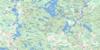
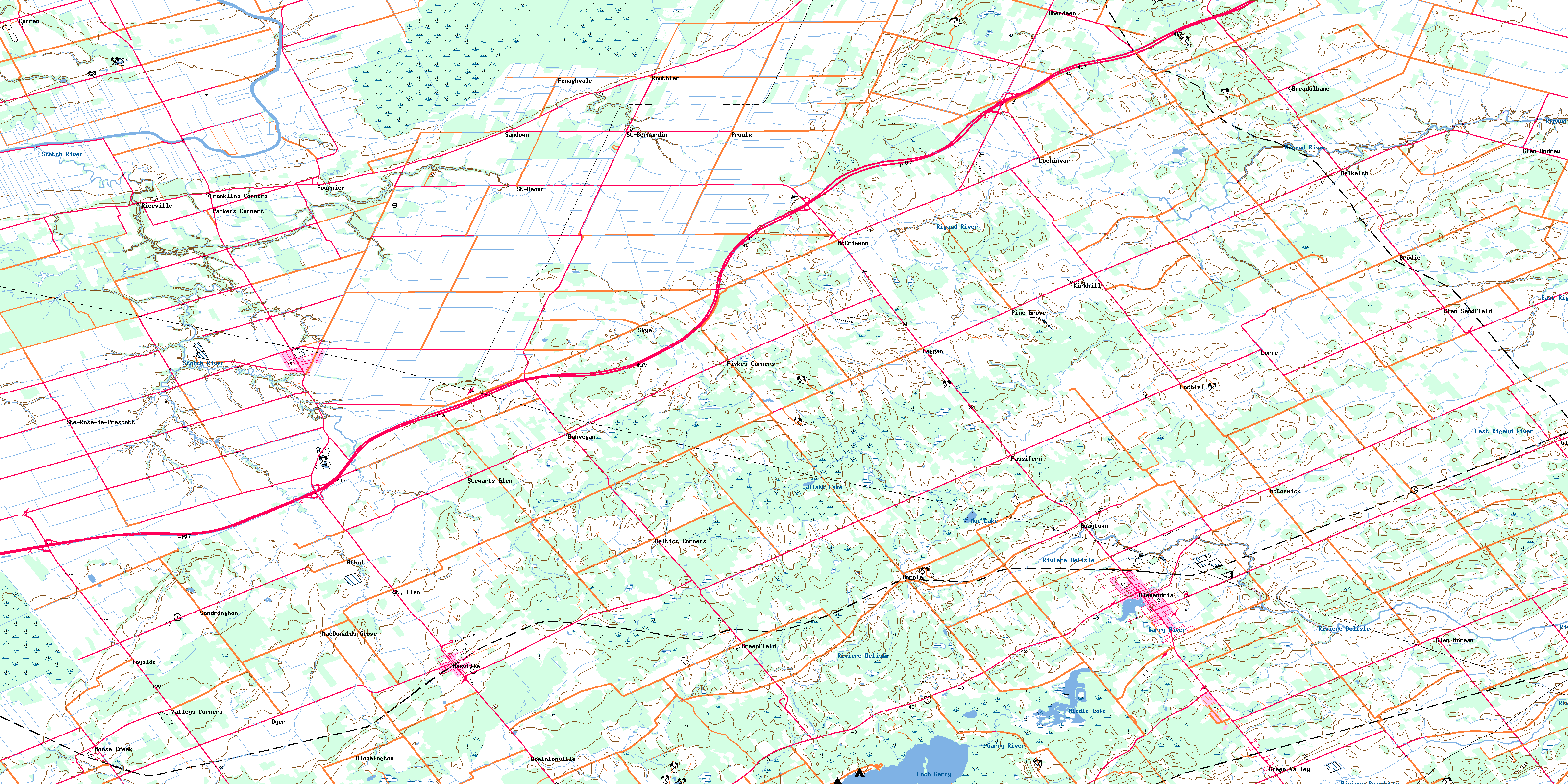
031G07 Alexandria Topo Map
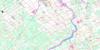
To view this map, mouse over the map preview on the right.
You can also download this topo map for free:
031G07 Alexandria high-resolution topo map image.
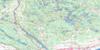
Maps for the Alexandria topo map sheet 031G07 at 1:50,000 scale are also available in these versions:
Alexandria Surrounding Area Topo Maps
 |
 |
 |
 |
 |
 |
 |
 |
 |
 |
 |
 |
 |
 |
 |
 |
© Department of Natural Resources Canada. All rights reserved.
Alexandria Gazetteer
The following places can be found on topographic map sheet 031G07 Alexandria:
Alexandria Topo Map: Geographical areas
AlfredCaledonia
Charlottenburgh
East Hawkesbury
Glengarry
Kenyon
Lancaster
Lochiel
North Plantagenet
Plantagenet
Prescott
Roxborough
Russell
South Plantagenet
Stormont
West Hawkesbury
Alexandria Topo Map: Hydraulic construction
Allan McCuaig DrainC. Beaulien Drain
Charles A. Leduc Drain
Chenier-Girard Drain
Chenier-Jeaurond Drain
Chisholm Drain
Cumming Drain
D.B. Chisholm Drain
Eddie St. Denis Drain
Fraser Drain
Harland Drain
Henry Drain
J.K. MacLeod Drain
James McDougall Drain
Joanette-Brunet Drain
K.D. Campbell Drain
Kenyon Dam
Lacombe Drain
Lanthier Drain
Lanthier-Cadieux Drain
Lauzon Creek Drain
Lochinvar Drain
Lundie Drain
MacDonald-Sabourin Drain
MacDougald Drain
MacDougall Drain
MacGillivray-MacLeod Drain
MacKenzie Drain
Marcoux Drain
McDougall Drain
McGillivray Drain
McMillan Drain
Morrison Drain
Quigley Drain
R.G. Scott Drain
Seguin Drain
Smith-Jamieson Drain
South La Graisse Drain
South La Graisse Drain
St-Denis Drain
Tayside-Legault Drain
Alexandria Topo Map: Islands
Munroes IslandAlexandria Topo Map: Lakes
Alexandria LakeBlack Lake
Loch Garry
Middle Lake
Mill Pond
Mud Lake
Alexandria Topo Map: Mountains
Bonnie HillAlexandria Topo Map: Major municipal/district area - major agglomerations
United Counties of Prescott and RussellUnited Counties of Stormont, Dundas and Glengarry
Alexandria Topo Map: Other municipal/district area - miscellaneous
AlfredAlfred and Plantagenet
Caledonia
Cambridge
Champlain
Charlottenburgh
East Hawkesbury
Finch
Kenyon
Lancaster
Lochiel
Longueuil
North Glengarry
North Plantagenet
North Stormont
Roxborough
South Glengarry
South Plantagenet
The Nation
West Hawkesbury
Alexandria Topo Map: Rivers
Baudet RiverBeaver Creek
Black Creek
Bradley Creek
Caledonia Creek
Cat Creek
Crystal Spring Creek
East Branch Scotch River
East Rigaud River
Garry River
Horse Creek
Moose Creek
Munroe Branch
Paxton Creek
Rigaud River
Rivière au Baudet
Rivière Beaudette
Rivière Delisle
Rivière Garry
Rivière Nation
Rivière Scotch
Ruisseau Caledonia
Scotch River
South Nation River
Spring Creek
West Branch Scotch River
Alexandria Topo Map: Road features
Smiths FerryAlexandria Topo Map: Unincorporated areas
AberdeenAlexandria
Athol
Baltic Corners
Baltics Corners
Bloomington
Breadalbane
Brodie
Curran
Dalkeith
Dominionville
Dornie
Dunvegan
Dyer
Fairview
Fassifern
Fenaghvale
Fiskes Corners
Fournier
Franklins Corners
Glen Andrew
Glen Norman
Glen Robertson
Glen Sandfield
Green Valley
Greenfield
Guaytown
Kirkhill
Laggan
Lalonde
Lochiel
Lochinvar
Lorne
MacDonalds Grove
Maple Row
Maxville
McCormick
McCrimmon
Moose Creek
Parkers Corners
Pine Grove
Proulx
Riceville
Rose Corner
Routhier
Sandown
Sandringham
Skye
Springhill
St. Amour
St. Bernardin
St. Elmo
St. Isidore
St-Amour
St-Bernardin
Ste. Rose de Prescott
Ste-Rose
Ste-Rose-de-Prescott
Stewarts Glen
Tayside
Valfranc
Valleys Corners
Alexandria Topo Map: Low vegetation
Alfred BogMoose Creek Bog
Alexandria Topo Map: Villages
La NationSt. Isidore de Prescott
© Department of Natural Resources Canada. All rights reserved.
