Crackingstone Peninsula Topo Map Online
Download Free Topo Map Sheet 074N07 at 1:50,000 scale
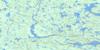
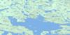
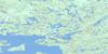
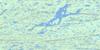
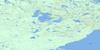
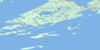
074N07 Crackingstone Peninsula Topo Map
To view this map, mouse over the map preview on the right.
You can also download this topo map for free:
074N07 Crackingstone Peninsula high-resolution topo map image.
Maps for the Crackingstone Peninsula topo map sheet 074N07 at 1:50,000 scale are also available in these versions:
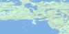
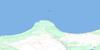
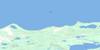
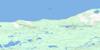
Crackingstone Peninsula Surrounding Area Topo Maps
 |
 |
 |
 |
 |
 |
 |
 |
 |
 |
 |
|
 |
 |
 |
 |
© Department of Natural Resources Canada. All rights reserved.
Crackingstone Peninsula Gazetteer
The following places can be found on topographic map sheet 074N07 Crackingstone Peninsula:
Crackingstone Peninsula Topo Map: Bays
Barritt BayBlack Bay
Chapman Bay
Dixon Bay
Edgar Bay
Elliot Bay
Grouse Bay
Gruchy Bay
Hanson Bay
Heinen Bay
Henderson Bay
Jug Bay
Keddy Bay
Langley Bay
Lodge Bay
Neiman Bay
Picnic Bay
Sharp Bay
Crackingstone Peninsula Topo Map: Capes
Box PointCrackingstone Peninsula
Crackingstone Point
Elliot Point
Feather Peninsula
Grouse Point
Gruchy Point
St. Joseph's Point
Stewart Point
Strike Point
Crackingstone Peninsula Topo Map: Channels
Blair ChannelNunim Channel
St. Marys Channel
Tipinuwak Channel
Crackingstone Peninsula Topo Map: Islands
Anderson IslandAssaf Islands
Beaverlodge Island
Cairns Island
Course Island
Duffy Island
Foster Island
Freeston Island
Grouse Island
Harkness Islands
Harmon Island
Hilyard Island
Johnston Island
Long Island
Mahood Island
McLean Islands
Mitchell Island
Mudford Island
Nistewuk Islands
Pebble Island
Pupuskew Islands
Sampson Island
Skeates Island
Stead Island
Steeden Island
Stewart Island
Tulloch Islands
Zapfe Island
Crackingstone Peninsula Topo Map: Lakes
Aadland LakeAdair Lake
Anderson Lake
Armbruster Lake
Beale Lake
Beaverlodge Lake
Beise Lake
Bisschop Lake
Blake Lake
Brown Lake
Burns Lake
Cave Lake
Chester Lake
Chimo Lake
Cogger Lake
Conn Lake
Daw Lake
Dermody Lake
Dohoo Lake
Elliot Lake
Foster Lake
Frontier Lake
Hay Lake
Heatherington Lake
Hislop Lake
Holden Lake
Howland Lake
Hugo Lake
Hunter Lake
Hurd Lake
Jackpot Lake
Jahnke Lake
Johnston Lake
Joyce Lake
Keeper Lake
Lac Athabasca
Lake Athabasca
Maynard Lake
McNeil Lake
McNie Lake
Meagher Lake
Milliken Lake
Milward Lake
Mudford Lake
Peebles Lake
Rodman Lake
Smith Lake
Spring Lake
Thompson Lake
Vemban Lake
Vic Lake
Crackingstone Peninsula Topo Map: Mountains
Beaverlodge MountainCrackingstone Peninsula Topo Map: Rivers
Elliot CreekHill Creek
Hislop Creek
Moore Creek
Thompson Creek
Zeemel Creek
Crackingstone Peninsula Topo Map: Unincorporated areas
GunnarLorado

© Department of Natural Resources Canada. All rights reserved.
074N Related Maps:
074N Tazin Lake074N01 Archibald River
074N02 Cantara Bay
074N03 William Point
074N04 Pointe Ennuyeuse
074N05 Maurice Bay
074N07 Crackingstone Peninsula
074N08 Goldfields
074N09 Forget Lake
074N10 Uranium City
074N11 Thluicho Lake
074N12E Harper Lake
074N12W Harper Lake
074N13E Thainka Lake
074N13W Thainka Lake
074N14E Zin Bay
074N14W Zin Bay
074N15 Burchnall Lake
074N16 Ena Lake
