Uranium City Topo Map Online
Download Free Topo Map Sheet 074N10 at 1:50,000 scale
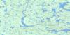
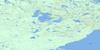
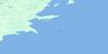
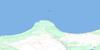
074N10 Uranium City Topo Map
To view this map, mouse over the map preview on the right.
You can also download this topo map for free:
074N10 Uranium City high-resolution topo map image.
Maps for the Uranium City topo map sheet 074N10 at 1:50,000 scale are also available in these versions:
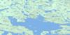
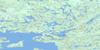
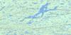
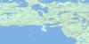
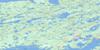
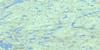
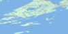
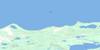
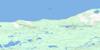
Uranium City Surrounding Area Topo Maps
 |
 |
 |
 |
 |
 |
 |
 |
 |
 |
 |
|
 |
 |
 |
 |
© Department of Natural Resources Canada. All rights reserved.
Uranium City Gazetteer
The following places can be found on topographic map sheet 074N10 Uranium City:
Uranium City Topo Map: Bays
Black BayBushell Inlet
Cabin Bay
Cinch Bay
Clearwater Bay
Crackingstone Inlet
Dowson Bay
Erickson Inlet
Farrow Inlet
Garry Bay
Griffith Bay
Hanson Bay
Olson Bay
Orbit Bay
Padget Bay
Prospectors Bay
Rae Bay
Taz Bay
Whyte Bay
Uranium City Topo Map: Capes
Crackingstone PeninsulaUranium City Topo Map: Channels
Gillies ChannelUranium City Topo Map: Hamlets
Uranium CityUranium City Topo Map: Islands
Cairns IslandCoward Island
Dennis Island
Dewar Island
Fold Island
Hofer Island
McLean Islands
Pratt Island
Stoik Island
Ulley Island
Uranium City Topo Map: Lakes
Augier LakeBahnuick Lake
Beaverlodge Lake
Bellegarde Lake
Berth Lake
Bertha Lake
Betty Lake
Blow Lake
Boom Lake
Boyce Lake
Bush Lake
Camel Lake
Carney Lake
Chance Lake
Cinch Lake
Clark Lake
Clavelle Lake
Clover Lake
Coe Lake
Court Lake
Currie Lake
Cuthill Lake
Dam Lake
Desjarlais Lake
Dezall Lake
Dive Lake
Don Lake
Doreen Lake
Eagle Lake
Elder Lake
Emu Lake
Fault Lake
Feil Lake
Finis Lake
Fold Lake
Folk Lake
Foot Lake
Frank Lake
Fredette Lake
Friesen Lake
Furulie Lake
Garry Lake
Gatzke Lake
Green Lake
Guest Lake
Gunn Lake
Guts Lake
Hal Lake
Harbottle Lake
Hardin Lake
Horse Lake
Jean Lake
Jeff Lake
Jen Lake
Jim Lake
Kadman Lake
Kaput Lake
Kisamisk Lake
Kvam Lake
Lac Athabasca
Lake Athabasca
Leask Lake
LeBlanc Lake
Leibel Lake
Mafic Lake
Maimann Lake
Martin Lake
Maunder Lake
McGraw Lake
Mead Lake
Melville Lake
Mud Pond
Neely Lake
Nero Lake
Nitche Lake
Onnie Lake
Orbit Lake
Palmer Lake
Papic Lake
Paul Lake
Pig Lake
Plug Lake
Pluton Lake
Powerline Lake
Rogers Lake
Run Lake
Seeger Lake
Shaft Lake
Short Lake
Silvester Lake
Smooth Lake
Smysniuk Lake
Spot Lake
Tam Lake
Tazin Lake
Triangle Lake
Usiske Lake
Valliere Lake
Waynert Lake
Webb Lake
Westlake Lake
White Lake
Wick Lake
Witt Lake
Wivcharuk Lake
Uranium City Topo Map: Rivers
Charlot RiverCrackingstone River
Farrow Creek
Fredette River
Garry River
Powerline Creek
Taz Creek
Wiltse River
Uranium City Topo Map: Unincorporated areas
BushellEldorado
Lorado

© Department of Natural Resources Canada. All rights reserved.
074N Related Maps:
074N Tazin Lake074N01 Archibald River
074N02 Cantara Bay
074N03 William Point
074N04 Pointe Ennuyeuse
074N05 Maurice Bay
074N07 Crackingstone Peninsula
074N08 Goldfields
074N09 Forget Lake
074N10 Uranium City
074N11 Thluicho Lake
074N12E Harper Lake
074N12W Harper Lake
074N13E Thainka Lake
074N13W Thainka Lake
074N14E Zin Bay
074N14W Zin Bay
074N15 Burchnall Lake
074N16 Ena Lake
