Thluicho Lake Topo Map Online
Download Free Topo Map Sheet 074N11 at 1:50,000 scale
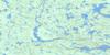
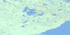
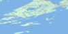
074N11 Thluicho Lake Topo Map
To view this map, mouse over the map preview on the right.
You can also download this topo map for free:
074N11 Thluicho Lake high-resolution topo map image.
Maps for the Thluicho Lake topo map sheet 074N11 at 1:50,000 scale are also available in these versions:
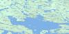
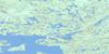
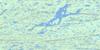
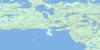
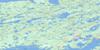
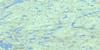
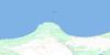
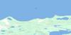
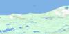
Thluicho Lake Surrounding Area Topo Maps
 |
 |
 |
 |
 |
 |
 |
 |
 |
 |
 |
|
 |
 |
 |
 |
© Department of Natural Resources Canada. All rights reserved.
Thluicho Lake Gazetteer
The following places can be found on topographic map sheet 074N11 Thluicho Lake:
Thluicho Lake Topo Map: Bays
Ellis BayGriggs Bay
Head Bay
Hunter Bay
Island Bay
Mayo Bay
Riach Bay
Thluicho Lake Topo Map: Capes
Brown PointCamsell Point
Charlot Peninsula
Halfway Point
Jewell Point
Scobie Peninsula
Smith Point
Thluicho Lake Topo Map: Hamlets
Camsell PortageThluicho Lake Topo Map: Islands
Beatty IslandCairns Island
Charlot Island
David Island
Ogilvy Island
Shaw Island
Slate Island
Wylie Island
Thluicho Lake Topo Map: Lakes
Bob LakeBull Lake
Camel Lake
Dam Lake
Dark Lake
Deep Lake
Dodd Lake
Draper Lakes
Ebertheltuntue Lake
Forcie Lake
Gulo Lake
Head Lake
Joli Lake
Lac Athabasca
Lake Athabasca
Low Lake
Maimann Lake
Munn Lake
Ootuetue Lake
Powder Lake
Pring Lake
Roberts Lake
Snook Lake
Stewart Lake
Strike Lakes
Tazin Lake
Thluicho Lake
Trovillo Lake
Tsalwor Lake
Utim Lake
Waterloo Lake
Wellington Lake
White Lake
Wilson Lakes
Zemlak Lake
Thluicho Lake Topo Map: Rivers
Charlot RiverHughes Creek
Wilson Creek
Wilson River
Thluicho Lake Topo Map: Road features
Camsell Portage
© Department of Natural Resources Canada. All rights reserved.
074N Related Maps:
074N Tazin Lake074N01 Archibald River
074N02 Cantara Bay
074N03 William Point
074N04 Pointe Ennuyeuse
074N05 Maurice Bay
074N07 Crackingstone Peninsula
074N08 Goldfields
074N09 Forget Lake
074N10 Uranium City
074N11 Thluicho Lake
074N12E Harper Lake
074N12W Harper Lake
074N13E Thainka Lake
074N13W Thainka Lake
074N14E Zin Bay
074N14W Zin Bay
074N15 Burchnall Lake
074N16 Ena Lake
