Habay Topo Map Online
Download Free Topo Map Sheet 084L15 at 1:50,000 scale
084L15 Habay Topo Map
To view this map, mouse over the map preview on the right.
You can also download this topo map for free:
084L15 Habay high-resolution topo map image.
Maps for the Habay topo map sheet 084L15 at 1:50,000 scale are also available in these versions:
Habay Surrounding Area Topo Maps
 |
 |
 |
 |
 |
 |
 |
 |
 |
 |
 |
 |
 |
 |
 |
 |
© Department of Natural Resources Canada. All rights reserved.
Habay Gazetteer
The following places can be found on topographic map sheet 084L15 Habay:
Habay Topo Map: Indian Reserves
Amber River 211Hay Lake 209
Habay Topo Map: Lakes
Hay LakeZama Lake
Habay Topo Map: Major municipal/district area - major agglomerations
Municipal District of Mackenzie No. 23Specialized Municipality of Mackenzie No. 23
Habay Topo Map: Rivers
Amber RiverHay River
Moody Creek
Omega River
Sousa Creek
Zama River
Habay Topo Map: Unincorporated areas
Habay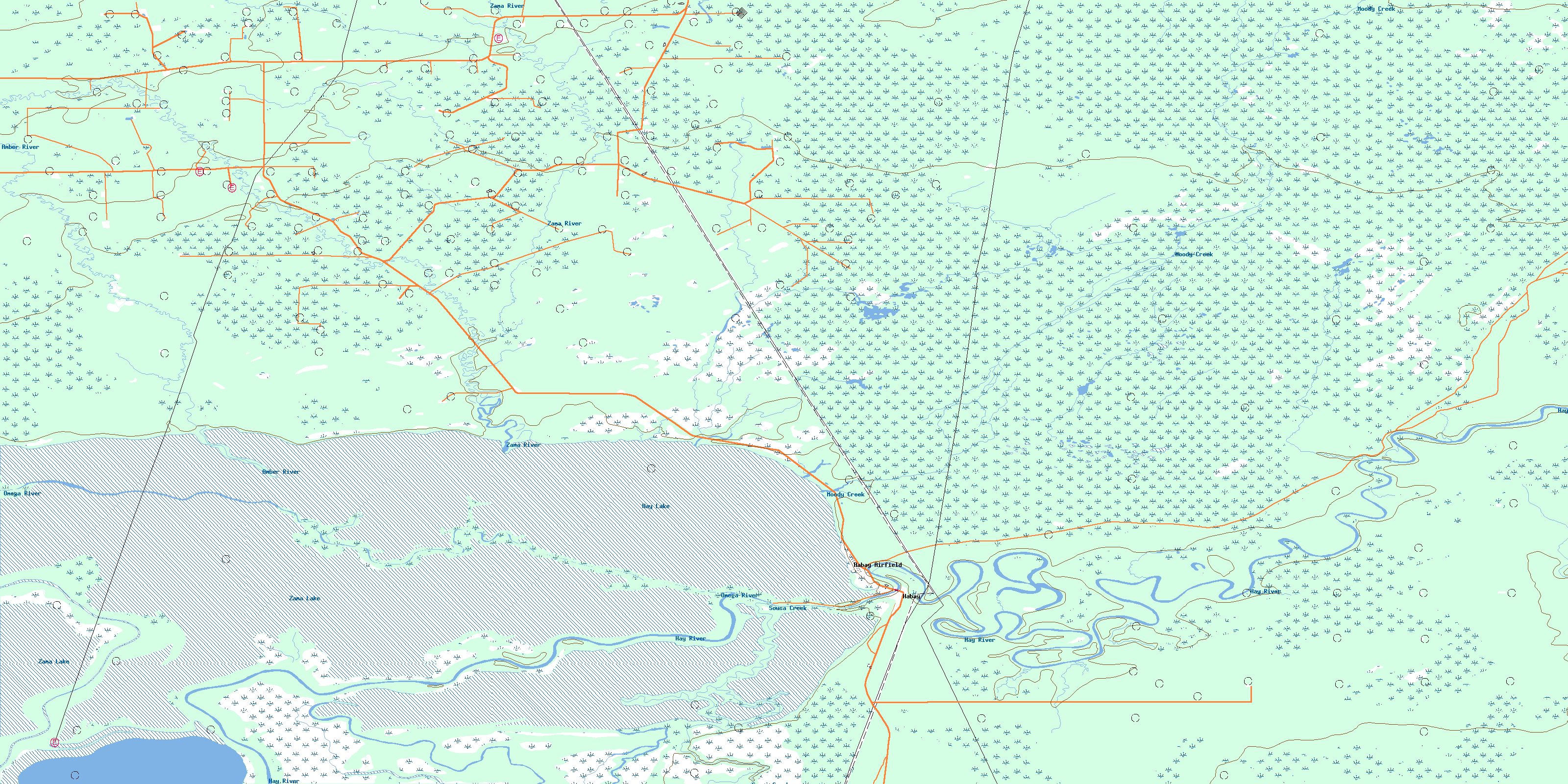
© Department of Natural Resources Canada. All rights reserved.
