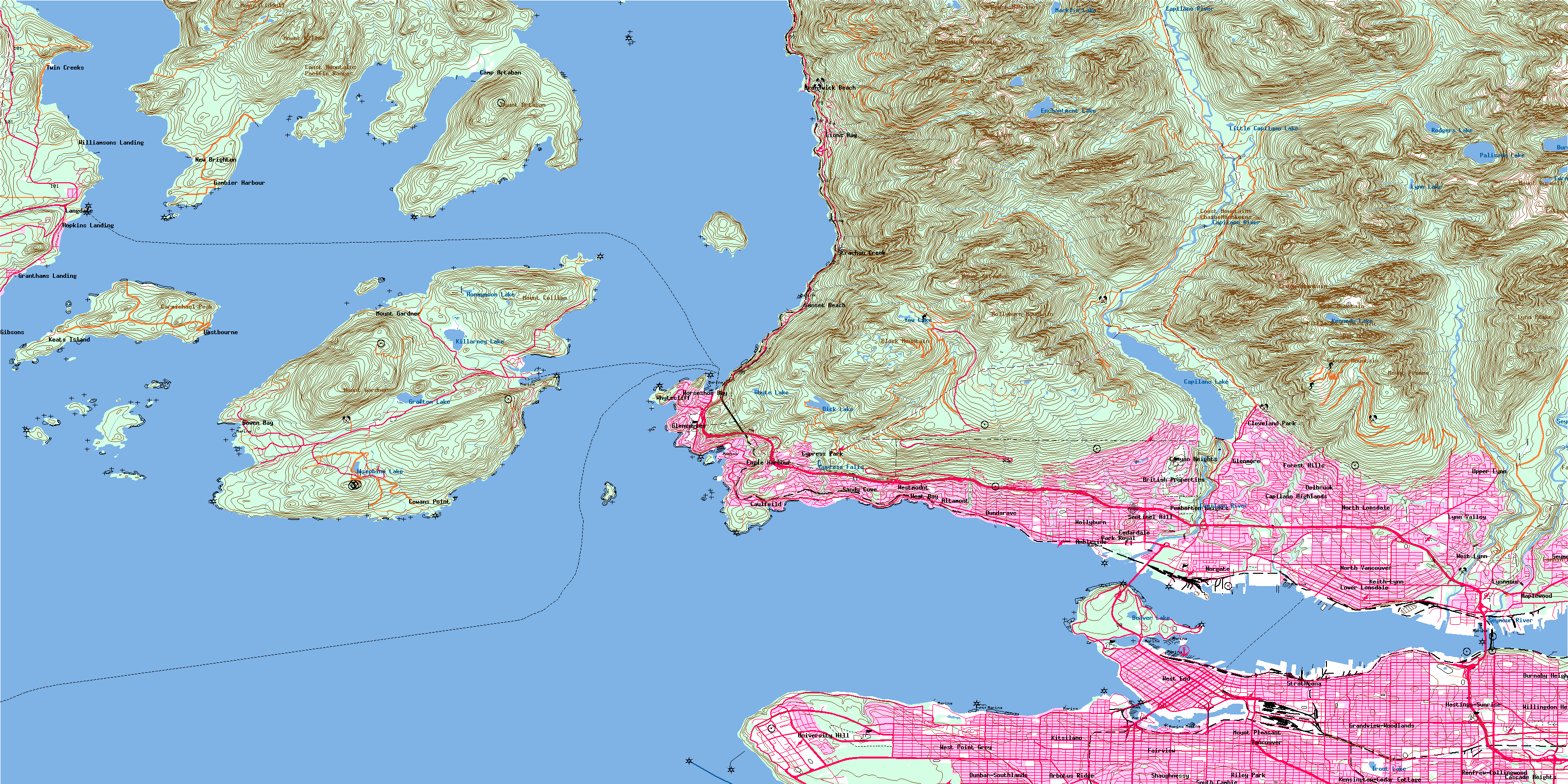
North Vancouver Topo Map Online
Download Free Topo Map Sheet 092G06 at 1:50,000 scale
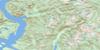
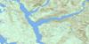
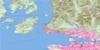
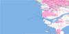
092G06 North Vancouver Topo Map
To view this map, mouse over the map preview on the right.
You can also download this topo map for free:
092G06 North Vancouver high-resolution topo map image.
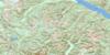
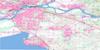
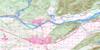
Maps for the North Vancouver topo map sheet 092G06 at 1:50,000 scale are also available in these versions:
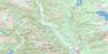
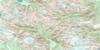
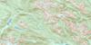
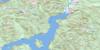
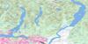
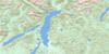
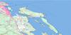
North Vancouver Surrounding Area Topo Maps
 |
 |
 |
 |
 |
 |
 |
 |
 |
 |
 |
 |
 |
 |
 |
 |
© Department of Natural Resources Canada. All rights reserved.
North Vancouver Gazetteer
The following places can be found on topographic map sheet 092G06 North Vancouver:
North Vancouver Topo Map: Bays
Alberta BayAlder Cove
Andys Bay
Apodaca Cove
Arbutus Bay
Avalon Bay
Batchelor Cove
Bowen Bay
Brigade Bay
Brokers Bay
Burgess Cove
Burrard Inlet
Cates Bay
Caulfeild Cove
Centre Bay
Cliff Cove
Coal Harbour
Columbine Bay
Copper Cove
Cowards Cove
Deep Bay
Dorman Bay
Eagle Harbour
East Bay
Echo Cove
Enchanta Bay
English Bay
Fairweather Bay
False Creek
Fisherman Cove
Fishermans Cove
Galbraith Bay
Gambier Harbour
Grace Harbour
Grafton Bay
Halkett Bay
Horseshoe Bay
Howe Sound
King Edward Bay
Konishi Bay
Larsen Bay
Lions Bay
Lodge Cove
MacKenzie Cove
Mannion Bay
Mitchell Cove
Montevista Bay
Patterson Cove
Pilot Cove
Plumper Cove
Poca Cove
Port Graves
Robson Cove
Safety Bay
Safety Cove
Sandy Cove
Seymour Bay
Smugglers Cove
Snug Cove
Starboat Cove
Thornbrough Bay
Trinity Bay
Tunstall Bay
Union Bay
Union Cove
Vancouver Harbour
West Bay
West Bay
Wharf Cove
Whyte Cove
North Vancouver Topo Map: Beaches
English Bay BeachJericho Beach
Kitsilano Beach
Point Grey Beach
Second Beach
September Morn Beach
Sunset Beach
Third Beach
Wreck Beach
North Vancouver Topo Map: Capes
Batchelor PointBoulder Point
Brockton Point
Cape Roger Curtis
Carmelo Point
Cotton Point
Elsje Point
Erwin Point
Ferguson Point
Gambier Point
Halkett Point
Hood Point
Hope Point
Kettle Point
Kitsilano Point
Lookout Point
Navvy Jack Point
Noon Breakfast Point
Observatory Point
Point Atkinson
Point Cowan
Point Grey
Point No Point
Potts Point
Prospect Point
Reardon Point
Soames Point
Tyee Point
White Cliff Point
Whytecliff Point
Witherby Point
North Vancouver Topo Map: Channels
Barfleur PassageCollingwood Channel
First Narrows
Queen Charlotte Channel
Ramillies Channel
Second Narrows
Shoal Channel
Strait of Georgia
Thornbrough Channel
North Vancouver Topo Map: City
North VancouverVancouver
North Vancouver Topo Map: Cliffs
Indian BluffSteep Bluff
North Vancouver Topo Map: District municipality
Bowen IslandNorth Vancouver
West Vancouver
North Vancouver Topo Map: Falls
Cypress FallsNorth Vancouver Topo Map: Hydraulic construction
Annieville DikeNorth Vancouver Topo Map: Indian Reserves
Capilano Indian Reserve 5Chekwelp Indian Reserve 26
Chekwelp Indian Reserve 26A
Mission Indian Reserve 1
Réserve indienne Capilano 5
Réserve indienne Chekwelp 26
Réserve indienne Chekwelp 26A
Réserve indienne Mission 1
Réserve indienne Schaltuuch 27
Réserve indienne Seymour Creek 2
Schaltuuch Indian Reserve 27
Seymour Creek Indian Reserve 2
North Vancouver Topo Map: Islands
Alexandra IslandBird Islet
Bowen Island
Bowyer Island
Christie Islet
Cynthia Island
Deadman Island
Eagle Island
Finisterre Island
Gambier Island
Grace Islands
Granville Island
Grebe Islets
Hermit Island
Home Island
Home Island (Salmon Rock)
Hutt Island
Keats Island
Little Popham Island
Mickey Island
New Island
New Islet
Pasley Island
Passage Island
Popham Island
Preston Island
Ragged Island
Round Island
Shelter Islands
Shelter Islets
Twin Islands
Weyburn Island
White Island
Whyte Islet
Worlcombe Island
North Vancouver Topo Map: Lakes
Beaver LakeBurwell Lake
Capilano Lake
Cornett Lakes
Deeks Lakes
Dick Lake
Enchantment Lake
Grafton Lake
Honeymoon Lake
Josephine Lake
Kennedy Lake
Killarney Lake
Little Capilano Lake
Lost Lagoon
Lynn Lake
Macklin Lake
Palisade Lake
Rice Lake
Rodgers Lake
Rogers Lake
Trout Lake
Whyte Lake
Yew Lake
North Vancouver Topo Map: Mountains
Black MountainBritannia Range
Brunswick Mountain
Carmichael Peak
Cathedral Mountain
Chaîne Côtière
Coast Mountains
Coliseum Mountain
Crown Mountain
Dam Mountain
Fannin Mountains
Fannin Range
Goat Mountain
Grouse Mountain
Hat Mountain
Hollyburn Mountain
Hollyburn Ridge
Little Goat Mountain
Lynn Peaks
Mount Artaban
Mount Burwell
Mount Collins
Mount Fromme
Mount Gardner
Mount Hanover
Mount Harvey
Mount Hollyburn
Mount Killam
Mount Liddell
Mount Strachan
Pacific Ranges
Sentinel Hill
Soames Hill
St. Marks Summit
Stony Hill
The Lions
The Needles
Unnecessary Mountain
North Vancouver Topo Map: Major municipal/district area - major agglomerations
Greater Vancouver Regional DistrictNorth Vancouver Topo Map: Conservation areas
Apodaca ParkChristie Islet Bird Sanctuary
Cypress Park
Halkett Bay Marine Park
Halkett Bay Park
Lieu historique national du Canada du Parc-Stanley
Plumper Cove Marine Park
Plumper Cove Park
Refuge d'oiseaux de l'îlot Christie
Stanley Park National Historic Site of Canada
North Vancouver Topo Map: Recreational sites
Cypress MountainGrouse Mountain
North Vancouver Topo Map: Rivers
Alberta CreekBluff Creek
Brothers Creek
Capilano Creek
Capilano River
Centre Creek
Charles Creek
Coliseum Creek
Connolly Creek
Crown Creek
Cypress Creek
Daniels Creek
Davies Creek
Dean Creek
Dick Creek
Disbrow Creek
Dodds Creek
Eagle Creek
Eastcap Creek
Emerald Creek
Enchantment Creek
Explosives Creek
Fellowes Creek
Gibson Creek
Godman Creek
Grafton Creek
Guild Creek
Hadden Creek
Hanes Creek
Harvey Creek
Hastings Creek
Healmond Creek
Hesketh Creek
Honeymoon Creek
Houlgate Creek
Hutchinson Creek
Hydraulic Creek
Josephine Creek
Keith Creek
Kennedy Creek
Kill Creek
Killarney Creek
Kilmer Creek
Langdale Creek
Lawson Creek
Lee Creek
Lembke Creek
Loggers Creek
Lone Tree Creek
Lynn Creek
M (Yahoo) Creek
M Creek
Mackay Creek
Macklin Creek
Magnesia Creek
Malkin Creek
Mannion Creek
Marr Creek
May Creek
McDonald Creek
McDonald Creek
Montizambert Creek
Mosquito Creek
Nelson Creek
Newman Creek
Nickey Creek
Norvan Creek
Optimist Creek
Ouillet Creek
Palisade Creek
Pascoe Creek
Pipe Creek
Pitt Creek
Rodgers Creek
Rundle Creek
Sclufield Creek
Seymour Creek
Seymour River
Sisters Creek
Soames Creek
Still Creek
Strachan Creek
Strip Creek
Terminal Creek
Thain Creek
Thames Creek
Turner Creek
Turpin Creek
Vinson Creek
Wagg Creek
Warwick Creek
Westmount Creek
Whispering Creek
Whyte Creek
Wickenden Creek
North Vancouver Topo Map: Shoals
Burnaby ShoalCalamity Point
Gumboot Bank
Hutt Rock
Loch Katrine Bank
Mariners Rest
Neptune Bank
Pam Rock
Parthia Shoal
Siwash Rock
Spanish Bank
Steamboat Rock
North Vancouver Topo Map: Towns
GibsonsNorth Vancouver Topo Map: Unincorporated areas
AltamontAmbleside
Arbutus Ridge
Ardley
Bowen Bay
British Properties
Brunswick
Brunswick Beach
Bundy
Burnaby Heights
Camp Artaban
Canyon Heights
Capilano
Capilano Highlands
Cascade Heights
Caulfeild
Cedardale
Cleveland Park
Cowans Point
Cypress Park
Delbrook
Dunbar-Southlands
Dundarave
Eagle Harbour
Eastbourne
Fairview
Fishermans Cove
Forest Hills
Gambier Harbour
Gleneagles
Glenmore
Grandview-Woodlands
Granthams Landing
Hastings
Hastings-Sunrise
Heatley Avenue
Hollyburn
Hopkins Landing
Horseshoe Bay
Keats Island
Keats Landing
Keith-Lynn
Kensington-Cedar Cottage
Kitsilano
Langdale
Lionsview
Lower Capilano
Lower Lonsdale
Lynn Creek
Lynn Valley
Lynnmour
Maplewood
Millers Landing
Mount Gardner
Mount Pleasant
New Brighton
Norgate
North Burnaby
North Lonsdale
Park Royal
Parkdale
Pasley Island
Pemberton Heights
Renfrew-Collingwood
Riley Park
Sandy Cove
Sentinel Hill
Seymour Heights
Seymour Landing
Shaughnessy
Sherman
Snug Cove
South Cambie
Stanovan
Still Creek
Strachan Creek
Strathcona
Sunset Beach
Twin Creeks
University Hill
Upper Levels
Upper Lynn
Vancouver Heights
Wadsley
West Bay
West End
West Lynn
West Point Grey
Westmount
Whytecliff
Whytecliff
Williamsons Landing
Willingdon Heights
North Vancouver Topo Map: Villages
Gibsons LandingLions Bay
© Department of Natural Resources Canada. All rights reserved.
092G Related Maps:
092G Vancouver092G01 Mission
092G02 New Westminster
092G03 Lulu Island
092G04 Nanaimo
092G05 Sechelt
092G06 North Vancouver
092G07 Port Coquitlam
092G08 Stave Lake
092G09 Stave River
092G10 Pitt River
092G11 Squamish
092G12 Sechelt Inlet
092G13 Jervis Inlet
092G14 Cheakamus River
092G15 Mamquam Mountain
092G16 Glacier Lake
