Sechelt Topo Map Online
Download Free Topo Map Sheet 092G05 at 1:50,000 scale
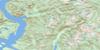
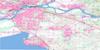
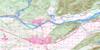
092G05 Sechelt Topo Map
To view this map, mouse over the map preview on the right.
You can also download this topo map for free:
092G05 Sechelt high-resolution topo map image.
Maps for the Sechelt topo map sheet 092G05 at 1:50,000 scale are also available in these versions:
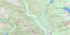
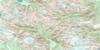
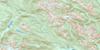
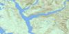
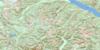
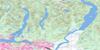
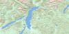
Sechelt Surrounding Area Topo Maps
 |
 |
 |
 |
 |
 |
 |
 |
 |
 |
 |
 |
 |
 |
 |
 |
© Department of Natural Resources Canada. All rights reserved.
Sechelt Gazetteer
The following places can be found on topographic map sheet 092G05 Sechelt:
Sechelt Topo Map: Bays
Buccaneer BayHowe Sound
Porpoise Bay
Sargeant Bay
Sechelt Inlet
Seechelt Inlet
Trail Bay
Water Bay
Sechelt Topo Map: Beaches
Gill BeachSechelt Topo Map: Capes
Dennis HeadGower Point
Grassy Point
Lemberg Point
Mission Point
Reception Point
Rock Point
Sechelt Peninsula
Wolf Point
Sechelt Topo Map: Channels
Shoal ChannelStrait of Georgia
Welcome Pass
Welcome Passage
Sechelt Topo Map: District municipality
SecheltSechelt Topo Map: Geographical areas
Nanaimo Land DistrictNew Westminster Land District
Sechelt Topo Map: Indian Reserves
Réserve indienne Seshelt 2Réserve indienne Swaycalse 3
Réserve indienne Tsawcome 1
Seshelt Indian Reserve 2
Swaycalse Indian Reserve 3
Tsawcome Indian Reserve 1
Sechelt Topo Map: Islands
Bertha IslandFranklin Island
Merry Island
North Thormanby Island
Poise Island
South Thormanby Island
Thormanby Islands
Trail Islands
White Islets
Sechelt Topo Map: Mountains
Chaîne CôtièreCoast Mountains
Mount Elphinstone
Mount Seafield
Pacific Ranges
Spy Glass Hill
Sechelt Topo Map: Major municipal/district area - major agglomerations
Regional District of NanaimoSechelt Topo Map: Other municipal/district area - miscellaneous
Sechelt SB 2Swaycalse SB 3
Tsawcome SB 1
Sechelt Topo Map: Conservation areas
Brothers Memorial ParkBuccaneer Bay Park
Chaster Park
Mount Elphinstone Park
Roberts Creek Park
Sargeant Bay Park
Simson Marine Park
Simson Park
Sechelt Topo Map: Rivers
Burnett CreekCairns Creek
Chapman Creek
Chaster Creek
Clack Creek
Clough Brook
Colvin Creek
Cook Creek
Dakota Creek
East Wilson Creek
Flume Creek
Gibson Creek
Gough Creek
Husdon Creek
Irgens Creek
Joe Smith Creek
Kenyon Creek
Langdale Creek
Malcolm Creek
Roberts Creek
Robinson Creek
Wakefield Creek
Wilson Creek
Wood Creek
Sechelt Topo Map: Shoals
Ballenas TroughEgerton Rock
Fraser Rock
Gordon Rock
Halibut Bank
McCall Bank
Pirate Rock
Sechelt Topo Map: Towns
GibsonsSechelt Topo Map: Unincorporated areas
Boundary RoadBuccaneer Bay
Davis Bay
Elphinstone
Gower Point
Redroofs
Roberts Creek
Sechelt Indian Government District
Selma Park
Welcome Beach
Wilson Creek
Sechelt Topo Map: Villages
Gibsons Landing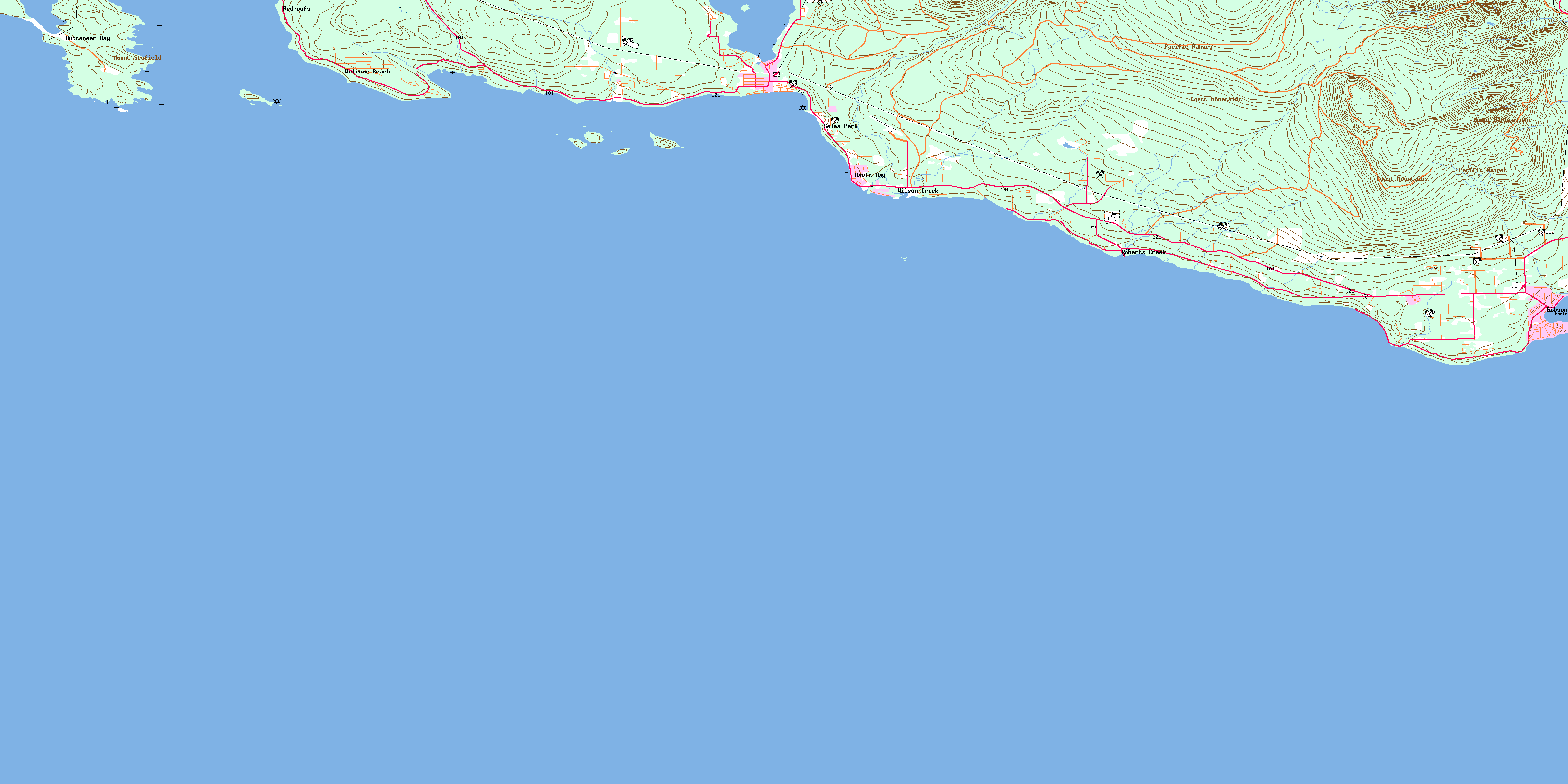
© Department of Natural Resources Canada. All rights reserved.
092G Related Maps:
092G Vancouver092G01 Mission
092G02 New Westminster
092G03 Lulu Island
092G04 Nanaimo
092G05 Sechelt
092G06 North Vancouver
092G07 Port Coquitlam
092G08 Stave Lake
092G09 Stave River
092G10 Pitt River
092G11 Squamish
092G12 Sechelt Inlet
092G13 Jervis Inlet
092G14 Cheakamus River
092G15 Mamquam Mountain
092G16 Glacier Lake
