Mitten Cove Topo Map Online
Download Free Topo Map Sheet 107D09 at 1:50,000 scale
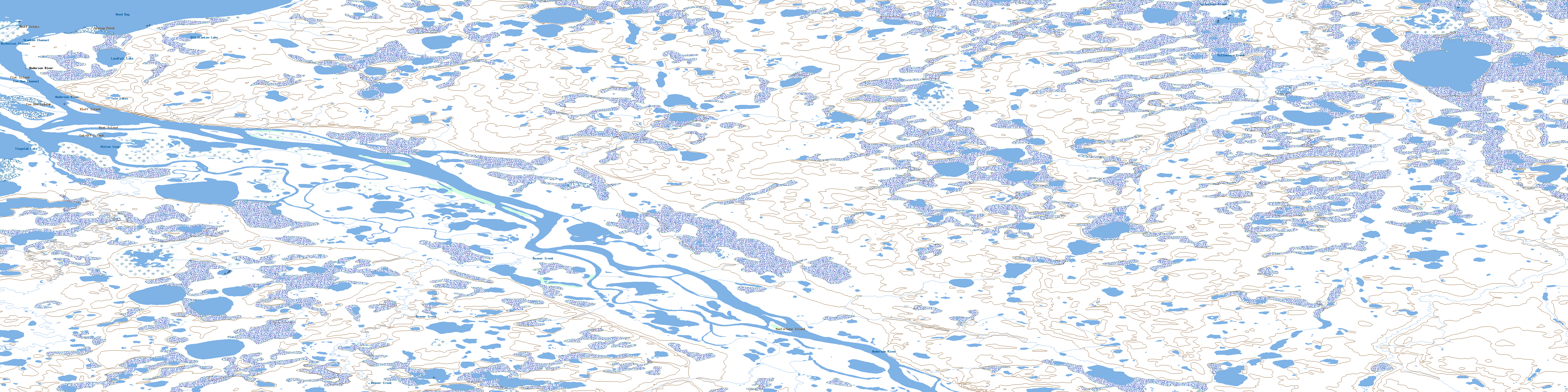
107D09 Mitten Cove Topo Map
To view this map, mouse over the map preview on the right.
You can also download this topo map for free:
107D09 Mitten Cove high-resolution topo map image.
Maps for the Mitten Cove topo map sheet 107D09 at 1:50,000 scale are also available in these versions:
Mitten Cove Surrounding Area Topo Maps
 |
 |
 |
 |
 |
 |
 |
 |
 |
 |
 |
 |
 |
 |
 |
 |
© Department of Natural Resources Canada. All rights reserved.
Mitten Cove Gazetteer
The following places can be found on topographic map sheet 107D09 Mitten Cove:
Mitten Cove Topo Map: Bays
Mitten CoveWood Bay
Mitten Cove Topo Map: Capes
Avvaq PeninsulaGrassy Point
Mitten Cove Topo Map: Channels
Fox Den ChannelMain Channel
Nicholson Channel
Stanton Channel
Mitten Cove Topo Map: Islands
Bluff IslandBoat Island
Canoe Island
Cut-Off Island
Flat Island
Fox Den Island
Gull Islets
Jaeger Island
MacFarlane Island
Mitten Cove Topo Map: Lakes
Landfall LakeOld Stanton Lake
Swan Lagoon
Tingmiak Lake
Twin Lakes
Mitten Cove Topo Map: Mountains
Eagle BluffEast Bluff
Mitten Cove Topo Map: Conservation areas
Anderson River Delta Bird SanctuaryRefuge d'oiseaux du Delta de la rivière Anderson
Mitten Cove Topo Map: Rivers
Anderson RiverBeaver Creek
Yellowlegs Creek
Mitten Cove Topo Map: Territory
Northwest TerritoriesTerritoires du Nord-Ouest
Mitten Cove Topo Map: Unincorporated areas
Anderson RiverKrekovik Landing
© Department of Natural Resources Canada. All rights reserved.
107D Related Maps:
107D Stanton107D01 No Title
107D02 Smoke River
107D03 No Title
107D04 Jonas Lake
107D05E No Title
107D05W No Title
107D06E Thumb Island
107D06W No Title
107D07 Kaglik Lake
107D08 Husky Bend
107D09 Mitten Cove
107D10 Tingmiak Lake
107D11E Campbell Island
107D11W Campbell Island
107D12E No Title
107D12W No Title
107D13E Atkinson Point
107D13W Atkinson Point
107D14E No Title
107D14W No Title
107D15E No Title
107D15W No Title
107D16E Stanton
107D16W Stanton
