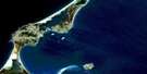
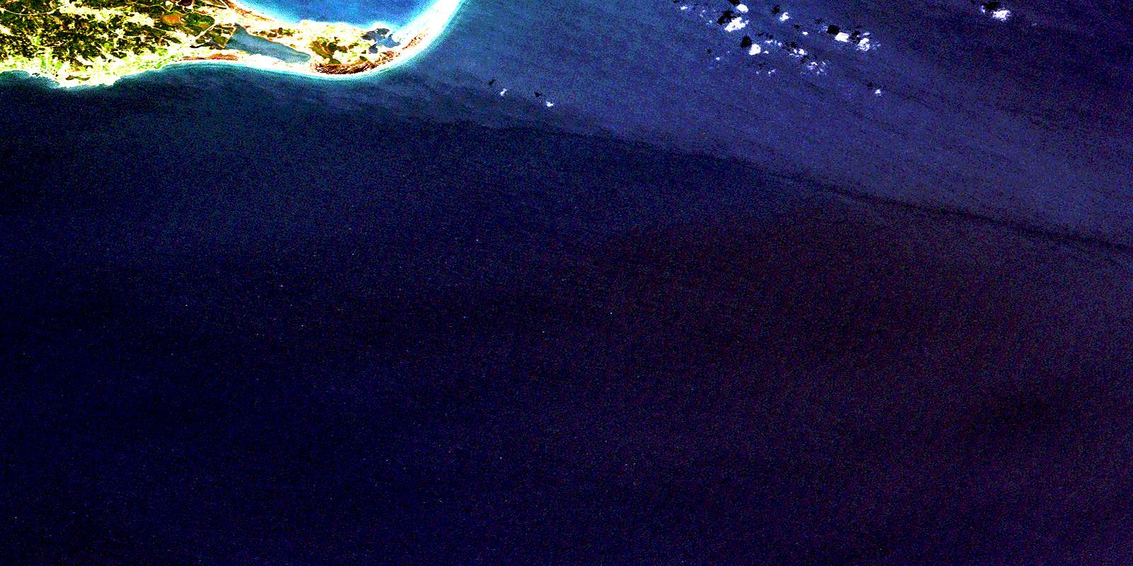
Havre-Aubert Satellite Image Map
Download Free Aerial Photo 011N04 at 1:50,000 scale
Havre-Aubert Satellite Imagery
To view this satellite map, mouse over the air photo on the right.
You can also download this satellite image map for free:
011N04 Havre-Aubert high-resolution satellite image map.
Maps for the Havre-Aubert aerial map sheet 011N04 at 1:50,000 scale are also available in these versions:
Havre-Aubert Surrounding Area Aerial Photo Maps
 |
|||
 |
|||
 |
|||
 |
 |
 |
© Department of Natural Resources Canada. All rights reserved.
Havre-Aubert Gazetteer
The following places can be found on satellite image map 011N04 Havre-Aubert:
Havre-Aubert Satellite Image: Bays
Amherst HarbourAnse à Cadet
Anse à Johnny
Anse à la Cabane
Anse au Plâtre
Anse du Bassin
Anse du Moulin
Anse Painchaud
Anse Shea
Baie de la Grande Rivière
Baie de Plaisance
Baie du Bassin
Baie du Portage
Étang du Sable
Golfe du Saint-Laurent
Golfe du Saint-Laurent
Gulf of St. Lawrence
Havre Amherst
Havre Aubert
La Petite Baie
La Rivière
L'Anse
Le Petit Bassin
L'Étang
L'Étang
Havre-Aubert Satellite Image: Beaches
Plage du CapPlage du Havre
Havre-Aubert Satellite Image: Capes
Cap BlancCap de la Light
Cap de l'Anse à Johnny
Cap du Sud
Cap Gridley
Cap Percé
Pointe à Fox
Pointe à Jonathan
Pointe à Marichite
Pointe au Tremble
Pointe aux Poux
Pointe chez Éric-Bourgeois
Pointe de la Rivière
Pointe du Bout du Banc
Pointe Shea
Havre-Aubert Satellite Image: Channels
Le GouletHavre-Aubert Satellite Image: Forests
Boisé Macé-JalobertHavre-Aubert Satellite Image: Geographical areas
Division d'enregistrement des Îles-de-la-MadeleineÎles-de-la-Madeleine
Les Îles-de-la-Madeleine
Notre-Dame-de-la-Visitation
Saint-François-Xavier-du-Bassin
Havre-Aubert Satellite Image: Islands
Île du Havre AubertÎles de la Madeleine
Rocher de la Vache Marine
Havre-Aubert Satellite Image: Lakes
Baie du BassinLa Petite Baie
Lac à Albert
Lac à Alcidas
Lac à Alcide
Lac à Ernest
Lac à Grégoire
Lac du Bassin
Lac du Maucôque
Lac Solitaire
Le Bassin
Havre-Aubert Satellite Image: Marine navigation features
Quai de L'Anse-à-la-CabaneHavre-Aubert Satellite Image: Miscellaneous
Centrale de L'Île-d'EntréeLes Îles-de-la-Madeleine
Poste de l'L'Île-d'Entrée
Havre-Aubert Satellite Image: Mountains
Butte à HélierButte à Isaac
Butte à Napoléon
Butte à Simonette
Butte chez Antoine
Butte de la Croix
Butte de la Roche
Butte du Portage
Cap de Plâtre
Collines de la Demoiselle
Dune du Bassin
Dune du Bout du Banc
Dune du Havre aux Basques
Dune Sandy Hook
La Montagne
Les Demoiselles
Havre-Aubert Satellite Image: Major municipal/district area - major agglomerations
Les Îles-de-la-MadeleineHavre-Aubert Satellite Image: Other municipal/district area - miscellaneous
Circonscription électorale des Îles-de-la-MadeleineHavre-Aubert Satellite Image: Conservation areas
Bird Rocks Bird SanctuarySite historique de La Grave
Havre-Aubert Satellite Image: Rivers
Ruisseau de la Grande PréeRuisseau de L'Étang-des-Caps
Ruisseau Lebel
Havre-Aubert Satellite Image: Shoals
Chaîne de la PasseFond Georges
Havre-Aubert Satellite Image: Towns
Cap-aux-MeulesL'Île-d'Entrée
Havre-Aubert Satellite Image: Unincorporated areas
AurignyBassin
Bassin
Havre-Aubert
Havre-Aubert
La Baie
La Grande-Montagne
La Grave
La Montagne
La Petite-Montagne
L'Ancien-Quai
L'Anse-à-la-Cabane
Le Martinet
Le Moulin
Millerand
Portage-du-Cap
Solomon
Vigneau
Havre-Aubert Satellite Image: Low vegetation
Le Bois BrûléHavre-Aubert Satellite Image: Villages
FatimaGrande-Entrée
Grosse-Île
Havre-aux-Maisons
Les Îles-de-la-Madeleine
L'Étang-du-Nord
L'Île-du-Havre-Aubert
© Department of Natural Resources Canada. All rights reserved.
