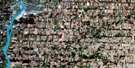
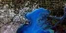
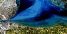
Windsor Satellite Image Map
Download Free Aerial Photo 040J06 at 1:50,000 scale
Windsor Satellite Imagery
To view this satellite map, mouse over the air photo on the right.
You can also download this satellite image map for free:
040J06 Windsor high-resolution satellite image map.
Maps for the Windsor aerial map sheet 040J06 at 1:50,000 scale are also available in these versions:
Windsor Surrounding Area Aerial Photo Maps
 |
|||
 |
 |
||
 |
 |
 |
|
 |
 |
 |
© Department of Natural Resources Canada. All rights reserved.
Windsor Gazetteer
The following places can be found on satellite image map 040J06 Windsor:
Windsor Satellite Image: Channels
Fleming ChannelWindsor Satellite Image: City
WindsorWindsor Satellite Image: Geographical areas
SandwichSandwich East
Sandwich South
Sandwich West
Windsor Satellite Image: Major municipal/district area - major agglomerations
EssexWindsor Satellite Image: Other municipal/district area - miscellaneous
SandwichSandwich
Sandwich East
Sandwich West
Windsor Satellite Image: Conservation areas
Ojibway Prairie Provincial Nature ReserveWindsor Satellite Image: Provinces
OntarioWindsor Satellite Image: Rivers
Detroit RiverRivière Détroit
Turkey Creek
Windsor Satellite Image: Towns
Ford CityLaSalle
Windsor Satellite Image: Unincorporated areas
BridgeviewBrighton Beach
East Windsor
Ojibway
Remington Park
Sandwich
South Walkerville
South Windsor
Southlawn
Sutherland
Walkerville
Yawkey

© Department of Natural Resources Canada. All rights reserved.
