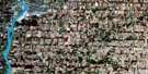
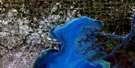
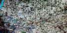
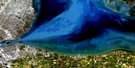
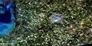
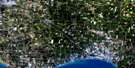
Belle River Satellite Image Map
Download Free Aerial Photo 040J07 at 1:50,000 scale
Belle River Satellite Imagery
To view this satellite map, mouse over the air photo on the right.
You can also download this satellite image map for free:
040J07 Belle River high-resolution satellite image map.
Maps for the Belle River aerial map sheet 040J07 at 1:50,000 scale are also available in these versions:
Belle River Surrounding Area Aerial Photo Maps
 |
|||
 |
 |
||
 |
 |
 |
|
 |
 |
 |
© Department of Natural Resources Canada. All rights reserved.
Belle River Gazetteer
The following places can be found on satellite image map 040J07 Belle River:
Belle River Satellite Image: Bays
Bass BayJohnston Bay
Walpole Bay
Belle River Satellite Image: Capes
Askins PointStoney Point
Stony Point
Belle River Satellite Image: Channels
Chematogan ChannelFleming Channel
Johnston Channel
Belle River Satellite Image: City
Chatham-KentWindsor
Belle River Satellite Image: Geographical areas
DoverKent
Lambton
Maidstone
Rochester
Sandwich
Sandwich East
Sandwich South
Sandwich West
Sombra
Tilbury North
Tilbury West
Belle River Satellite Image: Indian Reserves
Réserve indienne Walpole Island 46Walpole Island Indian Reserve 46
Belle River Satellite Image: Islands
Bassett IslandGrassy Bend Island
Grassy Bend Islands
Île aux Pêches
Peach Island
Peche Island
Squirrel Island
Walpole Island
Belle River Satellite Image: Lakes
Lac Sainte-ClaireLake St. Clair
Belle River Satellite Image: Major municipal/district area - major agglomerations
EssexKent
Lambton
Belle River Satellite Image: Other municipal/district area - miscellaneous
CamdenChatham
Dover
Harwich
Howard
Maidstone
Orford
Raleigh
Rochester
Romney
Sandwich
Sandwich
Sandwich East
Sandwich East
Sandwich South
Tilbury East
Tilbury North
Tilbury West
Zone
Belle River Satellite Image: Conservation areas
Tremblay Beach Conservation AreaBelle River Satellite Image: Provinces
OntarioBelle River Satellite Image: Rivers
Bassett ChannelBelle River
Belle Rivière
Detroit River
Duck Creek
Little River
Major Creek
Moison Creek
Pike Creek
Puce River
Rivière aux Puces
Rivière Détroit
Rivière Ruscom
Ruscom River
Stover Creek
Tremblay Creek
Turkey Creek
Belle River Satellite Image: Towns
Ford CityLakeshore
Tecumseh
Belle River Satellite Image: Unincorporated areas
Belle RiverDeerbrook
East Windsor
Elmstead
Emeryville
Fairplay
Fontainebleau
Forest Glade
Haycroft
Pike Creek
Pointe-aux-Roches
Puce
Riverside
Roseland
South Walkerville
St. Clair Beach
St. Joachim
St. Joachim Station
Stoney Point
Stoney Point/Pointe-aux-Roches
Tecumseh
Walkerville
Walkerville Junction
Windsor-Walkerville

© Department of Natural Resources Canada. All rights reserved.
