Essex Satellite Image Map
Download Free Aerial Photo 040J02 at 1:50,000 scale
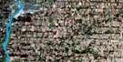
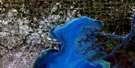
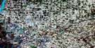
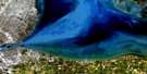
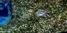
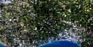
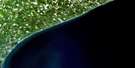
Essex Satellite Imagery
To view this satellite map, mouse over the air photo on the right.
You can also download this satellite image map for free:
040J02 Essex high-resolution satellite image map.
Maps for the Essex aerial map sheet 040J02 at 1:50,000 scale are also available in these versions:
Essex Surrounding Area Aerial Photo Maps
 |
|||
 |
 |
||
 |
 |
 |
|
 |
 |
 |
© Department of Natural Resources Canada. All rights reserved.
Essex Gazetteer
The following places can be found on satellite image map 040J02 Essex:
Essex Satellite Image: Bays
Pigeon BayEssex Satellite Image: Capes
Belle PointEssex Satellite Image: City
WindsorEssex Satellite Image: Geographical areas
ColchesterColchester North
Colchester South
Essex
Gosfield
Gosfield North
Gosfield South
Maidstone
Malden
Mersea
Rochester
Sandwich
Sandwich East
Sandwich South
Sandwich West
Tilbury North
Tilbury West
Essex Satellite Image: Hydraulic construction
McClean DrainRichmond Drain
Essex Satellite Image: Islands
Cedar IslandEssex Satellite Image: Lakes
Lac ÉriéLake Erie
Essex Satellite Image: Major municipal/district area - major agglomerations
EssexEssex Satellite Image: Other municipal/district area - miscellaneous
AnderdonColchester
Colchester North
Colchester South
Gosfield
Gosfield North
Gosfield South
Maidstone
Malden
Mersea
Rochester
Sandwich
Sandwich
Sandwich East
Sandwich South
Sandwich West
Tilbury North
Tilbury West
Essex Satellite Image: Rivers
Belle RiverBelle Rivière
Canard River
Cedar Creek
Dolson's Creek
Duck Creek
Fox Creek
Hillman Creek
Little River
Mill Creek
Moison Creek
Muddy Creek
Pike Creek
Puce River
Rivière aux Canards
Rivière aux Puces
Rivière Ruscom
Ruscom River
Stink Creek
Sturgeon Creek
Tremblay Creek
Wigle Creek
Essex Satellite Image: Towns
AmherstburgEssex
Kingsville
Lakeshore
LaSalle
Leamington
Tecumseh
Essex Satellite Image: Unincorporated areas
AlbunaAmbassador Beach
Arner
Barretville
Belcreft Beach
Blytheswood
Byrnedale
Cedar Beach
Cedarhurst Park
Cherry Lane Estates
Comber
Comet
Cottam
East Harrow
Edgars
Elford
Erie Curve
Essex
Gesto
Goldsmith
Harrow
Hillman
Kingsville
Klondyke
Leamington
Levergood Beach
Linden Beach
Lypps Beach
Maidstone
Marshfield
McGregor
McGregor Junction
Mount Carmel
New California
New Canaan
North Ridge
North Woodslee
Oakland
Oldcastle
Olinda
Oliver
Paquette
Paquette Corners
Pelton
Pleasant Park
Pleasant Valley
Rosslyn
Ruscom Station
Ruthven
Seacliffe
Seymour Beach
Sinasac Corners
South Windsor
South Woodslee
Staples
Strangfield
Tecumseh
Union
Vereker
Viney
Wigle
Woodslee
Essex Satellite Image: Low vegetation
Hillman MarshEssex Satellite Image: Villages
Essex Centre
© Department of Natural Resources Canada. All rights reserved.
