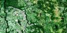
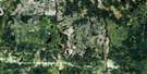
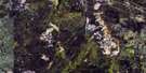
Fraserdale Satellite Image Map
Download Free Aerial Photo 042H13 at 1:50,000 scale
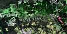
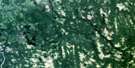
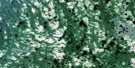
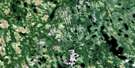
Fraserdale Satellite Imagery
To view this satellite map, mouse over the air photo on the right.
You can also download this satellite image map for free:
042H13 Fraserdale high-resolution satellite image map.
Maps for the Fraserdale aerial map sheet 042H13 at 1:50,000 scale are also available in these versions:
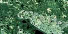
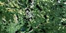
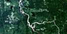
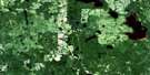
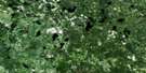
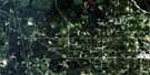
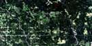
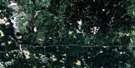
Fraserdale Surrounding Area Aerial Photo Maps
 |
 |
 |
 |
 |
 |
 |
 |
 |
 |
 |
 |
 |
 |
 |
 |
© Department of Natural Resources Canada. All rights reserved.
Fraserdale Gazetteer
The following places can be found on satellite image map 042H13 Fraserdale:
Fraserdale Satellite Image: Geographical areas
AvonClay
Cockshutt
Howells
Marceau
Parliament
Pinard
Sheldon
Traill
Fraserdale Satellite Image: Lakes
Avon LakeBaker Lake
Clay Lake
Dave Lake
Howells Lake
Lepp Lake
Marceau Lake
Nonigose Lake
Scott Lake
Smith Lake
Fraserdale Satellite Image: Conservation areas
Little Abitibi Provincial ParkFraserdale Satellite Image: Rapids
Shore RapidsFraserdale Satellite Image: Rivers
Aaron CreekAbitibi River
Avon Creek
Baal Creek
Burntwood Creek
Cable Creek
Clay Creek
Dagger Creek
Gaudaur Creek
Howells Creek
Marceau River
Mattagami River
Newpost Creek
North Sauve Creek
Onakawana River
Parent Creek
Pike River
Pinard Creek
Poolton Creek
Redsucker River
Rivière Abitibi
Rivière Mattagami
Rivière Redsucker
Scott Creek
Smith Creek
Traill Creek
Tyne Creek
Fraserdale Satellite Image: Road features
Little Lakes RouteFraserdale Satellite Image: Unincorporated areas
Abitibi CanyonFraserdale
Relay
Fraserdale Satellite Image: Valleys
Abitibi Canyon
© Department of Natural Resources Canada. All rights reserved.
042H Related Maps:
042H Cochrane042H01 Mistango Lake
042H02 Abitibi
042H03 Cochrane
042H04 Bradburn Lake
042H05 Smooth Rock Falls
042H06 Gardiner
042H07 Little Abitibi Lake
042H08 Twopeak Lake
042H09 North Burntbush Lake
042H10 Montreuil Lake
042H11 Island Falls
042H12 Abimatinu River
042H13 Fraserdale
042H14 Takwata Lake
042H15 Tomorrow Lake
042H16 Lawagamau Lake
