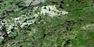
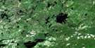
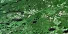
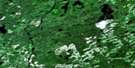
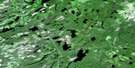
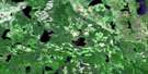
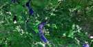
Lac Des Iles Satellite Image Map
Download Free Aerial Photo 052H04 at 1:50,000 scale
Lac Des Iles Satellite Imagery
To view this satellite map, mouse over the air photo on the right.
You can also download this satellite image map for free:
052H04 Lac Des Iles high-resolution satellite image map.
Maps for the Lac Des Iles aerial map sheet 052H04 at 1:50,000 scale are also available in these versions:
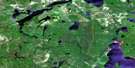
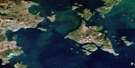
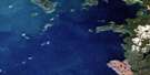
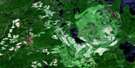
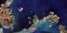
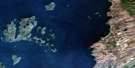
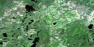
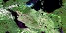
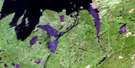
Lac Des Iles Surrounding Area Aerial Photo Maps
 |
 |
 |
 |
 |
 |
 |
 |
 |
 |
 |
 |
 |
 |
 |
 |
© Department of Natural Resources Canada. All rights reserved.
Lac Des Iles Gazetteer
The following places can be found on satellite image map 052H04 Lac Des Iles:
Lac Des Iles Satellite Image: Bays
Southeast Angle BayLac Des Iles Satellite Image: Channels
Central ChannelLac Des Iles Satellite Image: Geographical areas
WardropeLac Des Iles Satellite Image: Lakes
Arundel LakeBeeney Lake
Buck Lake
Camp Lake
Combe Lake
Coons Lake
Cowan Lake
Creppy Lake
Demars Lake
Eleph Lake
Empey Lake
Errey Lake
Fiveash Lake
Gall Lake
Hasson Lake
Hunkin Lake
Keni Lake
Lac des Iles
Lackie Lake
Legris Lake
Lob Lake
McKernan Lake
McNall Lake
Mittay Lake
Muskeg Lake
Orth Lake
Ruston Lake
Sallows Lake
Senga Lake
Shelby Lake
Shorty Lake
Stennett Lake
Stonefish Lake
Taman Lake
Tib Lake
Toulouse Lake
Towle Lake
Trumper Lake
Vande Lake
Vandenbrooks Lake
Varris Lake
Vester Lake
Wakinoo Lake
Wearn Lake
Yoho Lake
Lac Des Iles Satellite Image: Rivers
Block CreekBuck Creek
Dog River
East Dog River
Gall Creek
Gull River
Jack Creek
Muskeg Creek
Rivière des Iles
Senga Creek
Sharp Creek
Shelby Creek
Trumper Creek
Wakinoo Creek
Yoho Creek

© Department of Natural Resources Canada. All rights reserved.
052H Related Maps:
052H Nipigon052H01 Nipigon
052H02 Shillabeer Lake
052H03 Eaglehead Lake
052H04 Lac Des Iles
052H05 Armistice Lake
052H06 Cheeseman Lake
052H07 Black Sturgeon Lake
052H08 Orient Bay
052H09 Shakespeare Island
052H10 Grand Bay
052H11 Kabitotikwia Lake
052H12 Holinshead Lake
052H13 Uneven Lake
052H14 Gull Bay
052H15 Kelvin Island
052H16 Livingstone Point
