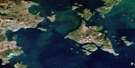
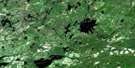
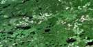
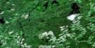
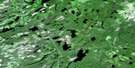
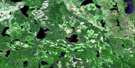
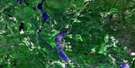
Kelvin Island Satellite Image Map
Download Free Aerial Photo 052H15 at 1:50,000 scale
Kelvin Island Satellite Imagery
To view this satellite map, mouse over the air photo on the right.
You can also download this satellite image map for free:
052H15 Kelvin Island high-resolution satellite image map.
Maps for the Kelvin Island aerial map sheet 052H15 at 1:50,000 scale are also available in these versions:
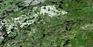
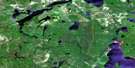
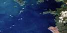
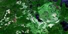
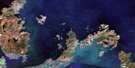
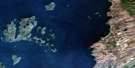
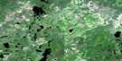
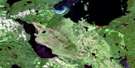
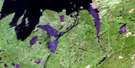
Kelvin Island Surrounding Area Aerial Photo Maps
 |
 |
 |
 |
 |
 |
 |
 |
 |
 |
 |
 |
 |
 |
 |
 |
© Department of Natural Resources Canada. All rights reserved.
Kelvin Island Gazetteer
The following places can be found on satellite image map 052H15 Kelvin Island:
Kelvin Island Satellite Image: Bays
Bud's HarbourEnglish Bay
Gull Bay
Henry's Harbour
Kaiashk Bay
Little Caribou Harbour
Moose's Harbour
Pike Bay
Wabinosh Bay
West Bay
Kelvin Island Satellite Image: Capes
Champlain PointEnglish Point
Nazoteka Point
Redstone Point
Rocking Chair Point
Snake Point
Kelvin Island Satellite Image: Channels
Inner ChannelOuter Channel
Kelvin Island Satellite Image: Islands
Anderson IslandsBalash Island
Bell Island
Birch Island
Blacksmith Island
Boles Island
Cattle Island
Dawson Island
Dog Island
Dray Island
Dry Beaver Islands
Dry-beaver Islands
Endakwis Island
Frog Island
Gaunt Island
Geikie Island
Jackfish Island
Keam Islands
Kelvin Island
Kidney Islands
Little Caribou Islands
Mink Island
Mountain Islands
Pike Bay Islands
Round Island
Snake Islands
The Rabbits
Undercliff Island
Wilson Island
Kelvin Island Satellite Image: Lakes
Cry LakeFrith Lake
Howlett Lake
Kettle Lake
Lac Nipigon
Lake Nipigon
Roder Lake
Stark Lake
Vooges Lake
Kelvin Island Satellite Image: Mountains
Mount RoyalUndercliff Mountain
Kelvin Island Satellite Image: Conservation areas
Lake Nipigon Conservation ReserveWest Bay Provincial Nature Reserve
Kelvin Island Satellite Image: Shoals
Echo RockFrog Island Shoal

© Department of Natural Resources Canada. All rights reserved.
052H Related Maps:
052H Nipigon052H01 Nipigon
052H02 Shillabeer Lake
052H03 Eaglehead Lake
052H04 Lac Des Iles
052H05 Armistice Lake
052H06 Cheeseman Lake
052H07 Black Sturgeon Lake
052H08 Orient Bay
052H09 Shakespeare Island
052H10 Grand Bay
052H11 Kabitotikwia Lake
052H12 Holinshead Lake
052H13 Uneven Lake
052H14 Gull Bay
052H15 Kelvin Island
052H16 Livingstone Point
