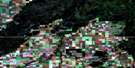
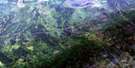
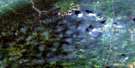
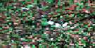
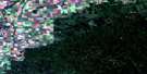
Cumberland House Satellite Image Map
Download Free Aerial Photo 063E16 at 1:50,000 scale
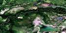
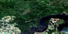
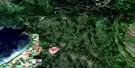
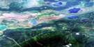
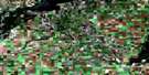
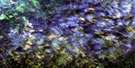
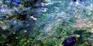
Cumberland House Satellite Imagery
To view this satellite map, mouse over the air photo on the right.
You can also download this satellite image map for free:
063E16 Cumberland House high-resolution satellite image map.
Maps for the Cumberland House aerial map sheet 063E16 at 1:50,000 scale are also available in these versions:
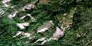
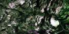
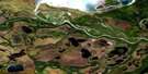
Cumberland House Surrounding Area Aerial Photo Maps
 |
 |
 |
 |
 |
 |
 |
 |
 |
 |
 |
 |
 |
 |
 |
 |
© Department of Natural Resources Canada. All rights reserved.
Cumberland House Gazetteer
The following places can be found on satellite image map 063E16 Cumberland House:
Cumberland House Satellite Image: Bays
Budds BayClark Bay
Cumberland House Satellite Image: Capes
Budds PointSpruce Point
Cumberland House Satellite Image: Channels
Bigstone CutoffOld Channel
Cumberland House Satellite Image: Indian Reserves
Budd's Point 20DCumberland 20
Cumberland House Satellite Image: Islands
Bell IslandCumberland Island
Pine Island
Spruce Island
Cumberland House Satellite Image: Lakes
Beaton LakeBelanger Lake
Between Lake
Bewley Lake
Big Lake
Bloodsucker Lake
Bog Lake
Cheeseman Lake
Corner Lake
Cow Lake
Cross Lake
Cumberland Lake
Dan Lake
Egg Lake
Highbank Lake
Junction Lake
Little Egg Lake
McGregor Lakes
Plane Lake
Wapisew Lake
Waterhen Lake
Cumberland House Satellite Image: Conservation areas
Bigstone Cutoff Recreation SiteCumberland House Provincial Park
Cumberland House Satellite Image: Rivers
Bigstone RiverBirch River
Junction Creek
Mink Creek
Petabec Creek
Rivière Saskatchewan
Saskatchewan River
Saskeram River
Tearing River
Willow Creek
Cumberland House Satellite Image: Road features
Elm PortageCumberland House Satellite Image: Unincorporated areas
Pemmican PortageCumberland House Satellite Image: Villages
Cumberland House
© Department of Natural Resources Canada. All rights reserved.
063E Related Maps:
063E Pasquia Hills063E01 Leaf Lake
063E02 Fir River
063E03 Connell Creek
063E04 Arborfield
063E05 Carrot River
063E06 Battle Heights
063E07 Red Earth
063E08 Otosquen
063E09 Mountain Cabin
063E10 Sipanok Channel
063E11 Tobin Lake
063E12 Pemmican Point
063E13 Missipuskiow River
063E14 New Channel
063E15 Old Channel
063E16 Cumberland House
