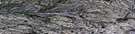
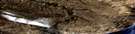
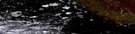
Raddi Lake Satellite Image Map
Download Free Aerial Photo 097H12 at 1:50,000 scale
Raddi Lake Satellite Imagery
To view this satellite map, mouse over the air photo on the right.
You can also download this satellite image map for free:
097H12 Raddi Lake high-resolution satellite image map.
Maps for the Raddi Lake aerial map sheet 097H12 at 1:50,000 scale are also available in these versions:
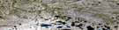
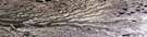
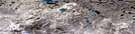
Raddi Lake Surrounding Area Aerial Photo Maps
 |
 |
 |
 |
 |
 |
 |
 |
 |
 |
 |
 |
 |
 |
© Department of Natural Resources Canada. All rights reserved.
Raddi Lake Gazetteer
The following places can be found on satellite image map 097H12 Raddi Lake:
Raddi Lake Satellite Image: Bays
Thesiger BayRaddi Lake Satellite Image: Islands
Banks IslandRaddi Lake Satellite Image: Lakes
Raddi LakeSwan Lake
Raddi Lake Satellite Image: Mountains
Sand HillsRaddi Lake Satellite Image: Conservation areas
Banks Island No. 1 Bird SanctuaryRefuge d'oiseaux de l'Île-Banks-Numéro-Un
Refuge d'oiseaux No. 1 de l'île Banks
Raddi Lake Satellite Image: Rivers
Atitok RiverMasik River
Sachs River
Raddi Lake Satellite Image: Territory
Northwest TerritoriesTerritoires du Nord-Ouest

© Department of Natural Resources Canada. All rights reserved.
