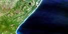
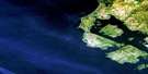
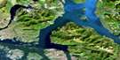
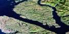
Kitkatla Inlet Satellite Image Map
Download Free Aerial Photo 103G15 at 1:50,000 scale
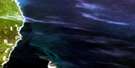
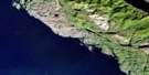
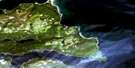
Kitkatla Inlet Satellite Imagery
To view this satellite map, mouse over the air photo on the right.
You can also download this satellite image map for free:
103G15 Kitkatla Inlet high-resolution satellite image map.
Maps for the Kitkatla Inlet aerial map sheet 103G15 at 1:50,000 scale are also available in these versions:
Kitkatla Inlet Surrounding Area Aerial Photo Maps
 |
 |
 |
|
 |
 |
 |
|
 |
 |
 |
|
 |
© Department of Natural Resources Canada. All rights reserved.
Kitkatla Inlet Gazetteer
The following places can be found on satellite image map 103G15 Kitkatla Inlet:
Kitkatla Inlet Satellite Image: Bays
Dries InletGurd Inlet
Kitkatla Inlet
Kitkatlah Inlet
Kitkatlah Inlet
North Arm Kitkatlah Inlet
Oval Bay
Porcher Inlet
Serpentine Inlet
Welcome Harbour
Willis Bay
Kitkatla Inlet Satellite Image: Capes
Cape GeorgeChief Point
Fan Point
Goschen Point
Goschen Spit
Gurd Point
Joachim Point
Joachim Spit
Nubble Point
Oval Point
Porcher Peninsula
Snass Point
Viscount Point
Whiteley Point
Kitkatla Inlet Satellite Image: Channels
Browning EntranceFreeman Passage
Hecate Strait
Kitkatla Channel
Kitkatla Inlet Satellite Image: Islands
Absalom IslandCessford Islands
Clamshell Island
Coquitlam Island
Dancey Island
Fan Island
Goschen Island
Gurd Island
Moore Island
Ness Islands
Phoenix Islands
Porcher Island
Prager Islands
Robert Island
Shakes Islands
Snass Islands
Wilcox Group
Kitkatla Inlet Satellite Image: Mountains
Bell RangeFalse Cone
Flat Hill
Mount Nubble
Nubble Mountain
Oval Hill
Kitkatla Inlet Satellite Image: Major municipal/district area - major agglomerations
Regional District of Kitimat-StikineKitkatla Inlet Satellite Image: Rivers
Camp CreekCanyon Creek
Kitkalah Creek
Kitkatla Creek
Phoenix Creek
Porcher Creek
Kitkatla Inlet Satellite Image: Shoals
Barren RocksBass Rock
Hall Rock
Joachim Rock
Oval Bank
Oval Rock
Ste. Croix Rock
Theresa Rock
Winter Rock

© Department of Natural Resources Canada. All rights reserved.
