Mount Peyton Topo Map Online
Download Free Topo Map Sheet 002D14 at 1:50,000 scale
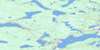
002D14 Mount Peyton Topo Map
To view this map, mouse over the map preview on the right.
You can also download this topo map for free:
002D14 Mount Peyton high-resolution topo map image.
Maps for the Mount Peyton topo map sheet 002D14 at 1:50,000 scale are also available in these versions:
Mount Peyton Surrounding Area Topo Maps
 |
 |
 |
 |
 |
 |
 |
 |
 |
 |
 |
 |
 |
 |
 |
 |
© Department of Natural Resources Canada. All rights reserved.
Mount Peyton Gazetteer
The following places can be found on topographic map sheet 002D14 Mount Peyton:
Mount Peyton Topo Map: Channels
The NarrowsMount Peyton Topo Map: Islands
Long IslandMount Peyton Topo Map: Lakes
Borney LakeBurnt Lake
Christmas Pond
Cooper Pond
Crowe Lake
Dowd Pond
Frozen Ocean Lake
Gander Lake
Gull Lake
Haynes Lake
Lewis Pond
Otter Lake
Rattling Lake
Red Fox Pond
Rothery Pond
Sunday Lake
Trappers Lake
Upper Christmas Pond
Mount Peyton Topo Map: Mountains
Little LookoutMount Peyton
Mount Peyton Topo Map: Rivers
Caledonia BrookCareless Brook
Clarks Brook
Cooper Brook
Joe's Feeder
Jumper Brook
Jumpers Brook
Northwest Gander River
Rattling Brook
Red Rock Brook
Salmon River
Winter Brook
Yellow Fox Brook
Mount Peyton Topo Map: Towns
Norris Arm
© Department of Natural Resources Canada. All rights reserved.
002D Related Maps:
002D Gander Lake002D01 Tug Pond
002D02 Meta Pond
002D03 Mount Sylvester
002D04 Twillick Brook
002D05 Burnt Hill
002D06 Great Gull Lake
002D07 Kepenkeck Lake
002D08 Port Blandford
002D09 Glovertown
002D10 Dead Wolf Pond
002D11 Eastern Pond
002D12 Miguels Lake
002D13 Grand Falls
002D14 Mount Peyton
002D15 Gander
002D16 Gambo
