North Rustico Topo Map Online
Download Free Topo Map Sheet 011L06 at 1:50,000 scale
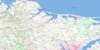
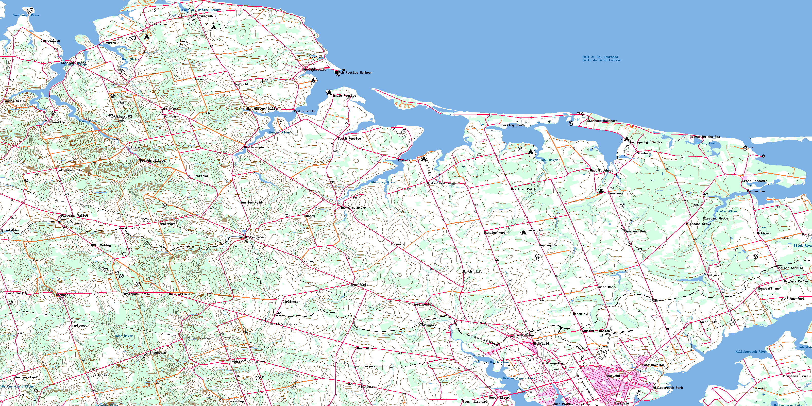
011L06 North Rustico Topo Map
To view this map, mouse over the map preview on the right.
You can also download this topo map for free:
011L06 North Rustico high-resolution topo map image.
Maps for the North Rustico topo map sheet 011L06 at 1:50,000 scale are also available in these versions:
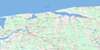
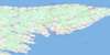
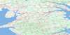
North Rustico Surrounding Area Topo Maps
 |
|||
 |
 |
 |
 |
 |
 |
 |
 |
© Department of Natural Resources Canada. All rights reserved.
North Rustico Gazetteer
The following places can be found on topographic map sheet 011L06 North Rustico:
North Rustico Topo Map: Bays
Brackley BayChapel Creek
Covehead Bay
Covehead Harbour
Currys Cove
Doyle Cove
Doyles Cove
Golfe du Saint-Laurent
Granville Creek
Gulf of St. Lawrence
Jimmy Angus Cove
Lukes Creek
MacDonalds Cove
MacDougalls Cove
Marshfield Creek
McCallum Creek
Mermaid Cove
New London Bay
New London Harbour
North Rustico Harbour
Oyster Cove
Rustico Bay
Todd Creek
Tracadie Bay
Tracadie Harbour
Walkers Cove
Walkers Cove
Winter Bay
Winter Creek
North Rustico Topo Map: Beaches
Brackley BeachCavendish Beach
Dalvay Beach
Heartz Shore
North Rustico Beach
Shaws Beach
Stanhope Beach
North Rustico Topo Map: Capes
Beachgrove PointBrackley Point
Cape Stanhope
Cape Turner
Cavendish Capes
Cove Head
Currys Point
Dockies Point
Doyles Point
Falcon Point
Grand Pere Point
Hornes Point
Kellys Point
Lockes Point
McMillan Point
Munns Point
Orby Head
Pickering Point
Pickerings Point
Queens Point
Red Point
Strawberry Point
Warrens Point
North Rustico Topo Map: City
CharlottetownNorth Rustico Topo Map: Geographical areas
CharlottetownLot 21
Lot 22
Lot 23
Lot 24
Lot 29
Lot 30
Lot 31
Lot 32
Lot 33
Lot 34
Lot 35
Lot 48
Lot 67
Queens
North Rustico Topo Map: Islands
Ellis IslandMacLeods Island
McEwens Island
Poplar Island
Prince Edward Island
Robinsons Island
Rustico Island
North Rustico Topo Map: Lakes
Andrews PondBagnalls Pond
Balderstons Pond
Bells Pond
Bradalbane Pond
Breadalbane Pond
Campbell Pond
Campbells Pond
Carraghers Pond
Cass Pond
Clarkes Pond
Clarke's Pond
Coles Pond
Dalvay Lake
Dalvay Pond
Elliotts Pond
Gates Pond
Graham Rogers Lake
Hardys Pond
Henrys Pond
Lake of Shining Waters
Long Pond
Lower Simpsons Pond
MacEacherns Lake
MacKeys Pond
MacNeills Pond
Malletts Pond
Marshalls Pond
Matters Pond
McKays Pond
McMillans Pond
Mermaid Pond
Moores Pond
Murphys Pond
Officers Pond
Parsons Pond
Rackhams Pond
Rollings Pond
Sherrens Pond
Stevensons Pond
Taylors Pond
Upper Simpsons Pond
Warrens Pond
Willis Pond
North Rustico Topo Map: Mountains
Mount Ryan HillNorth Rustico Topo Map: Conservation areas
Ardgowan National Historic Site of CanadaBrookvale Provincial Park
Dalvay-by-the-Sea Hotel National Historic Site of Canada
Dalvay-by-the-Sea National Historic Site of Canada
Devil's Punchbowl Provincial Park
L.M. Montgomery's Cavendish National Historic Site of Canada
Lieu historique national du Canada Ardgowan
Lieu historique national du Canada Dalvay-by-the-Sea
Lieu historique national du Canada de l'Hôtel-Dalvay-by-the-Sea
Lieu historique national du Canada du Cavendish-de-L.-M.-Montgomery
Parc national du Canada de l'Île-du-Prince-Édouard
Prince Edward Island National Park of Canada
North Rustico Topo Map: Provinces
Île-du-Prince-ÉdouardPrince Edward Island
North Rustico Topo Map: Rivers
Andersons CreekAppletree Creek
Auld Creek
Bells Creek
Black River
Black River
Brocklesby River
Brocklesby River
Clyde River
Coles Creek
Crooked Creek
Curtis Creek
De Sable River
DeSable River
Doirons Creek
Douses Creek
Dunk River
East (Hillsborough) River
East Branch Westmoreland River
Eliot River
Ellens Creek
Founds River
French Fort Creek
Frenchfort Creek
Grahams Creek
Grahams Road Brook
Granville Creek
Hermitage Creek
Hillsborough River
Hope River
Hornes Creek
Hornes Creek
Howells Brook
Hunter River
Johnston River
Johnstons River
Kehough Creek
MacArthurs Creek
MacIntyres Creek
Matheson Creek
Mill Brook
Mill Cove Brook
Mill Creek
Millers Creek
Milton Creek
North (Yorke) River
North Creek
North River
Old Mill River
Parsons Creek
Quinns Brook
Scotts Creek
Smelt Creek
Southwest River
Spring Garden Creek
Stanley River
Trout River
Warren Grove Creek
Watts Creek
West (Eliot) River
West River
Westmoreland River
Westmoreland River
Westmorland River
Westmorland River
Wheatley River
Winter River
Winter River
Wrights Creek
Yorke River
North Rustico Topo Map: Towns
CornwallNorth Rustico Topo Map: Unincorporated areas
Anglo RusticoBayview
Bedford
Bedford Corner
Bedford Station
Bonwell
Brackley
Brackley Beach
Brackley Point
Brookfield
Brookvale
Bungay
Campbellton
Campbelton
Cavendish
Clyde
Colville
Corran Ban
Corranban
Corranban Bridge
Covehead
Covehead Road
Cymbria
Dalvay by the Sea
Darlington
Donaldston
Dunstaffnage
East Royalty
East Wiltshire
Ebenezer
Elliott
Elliotts
Emyvale
Found Mills
Founds Mills
Frederickton
Fredericton
Fredericton Station
French Fort
French Village
Frenchfort
Glen Valley
Glynde River
Grand Tracadie
Granville
Green Bay
Green Gables
Greenvale
Greenville
Hampshire
Harrington
Hartsville
Hazel Grove
Hazelgrove
Highfield
Hillsborough Park
Hope River
Hunter River
Hunters River
Johnstons River
Kelly Cross
Kellys Cross
Kingston
LewisPoint
Lincoln
Little York
Little York
Loyalist
Maplewood
Marshfield
Martin
Mayfield
Mermaid
Mermaid Farm
Mill Cove
Millcove
Millvale
Milton
Milton Station
Mount Ryan
New Glasgow
New Glasgow Mills
New Wiltshire
North Milton
North River
North Rustico Harbour
North Wiltshire
Oyster Bed Bridge
Oysterbed Bridge
Parkdale
Pleasant Grove
Pleasant Valley
Rennies Road
Rose Valley
Royalty Junction
Rustico
Rusticoville
Sherwood
South Granville
South Rustico
Spring Park
Springton
Springvale
St. Ann
St. Dunstan
St. Dunstan's
St. Marys
St. Patricks
Stanchel
Stanhope
Stanhope Bayshore
Stanhope by the Sea
Stanley Bridge
Suffolk
Thorndyke
Toronto
Trilby
Tyrone
Union
Union Road
Upper Westmorland
West Covehead
West Royalty
Westmoreland
Westmorland
Wheatley River
Wiltshire
Winsloe
Winsloe North
Winsloe Road
York
North Rustico Topo Map: Villages
BrackleyBreadalbane
Darlington
Grand Tracadie
Hampshire
Hunter River
Kingston
Miltonvale Park
New Haven-Riverdale
North River
North Rustico
North Shore
North Wiltshire
Pleasant Grove
Stanley Bridge, Hope River, Bayview, Cavendish and North Rustico
Union Road
Warren Grove
West Royalty
Winsloe
Winsloe South
York
© Department of Natural Resources Canada. All rights reserved.
