Mount Stewart Topo Map Online
Download Free Topo Map Sheet 011L07 at 1:50,000 scale
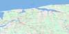
011L07 Mount Stewart Topo Map
To view this map, mouse over the map preview on the right.
You can also download this topo map for free:
011L07 Mount Stewart high-resolution topo map image.
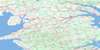
Maps for the Mount Stewart topo map sheet 011L07 at 1:50,000 scale are also available in these versions:
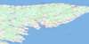
Mount Stewart Surrounding Area Topo Maps
 |
|||
 |
 |
 |
 |
 |
 |
 |
 |
© Department of Natural Resources Canada. All rights reserved.
Mount Stewart Gazetteer
The following places can be found on topographic map sheet 011L07 Mount Stewart:
Mount Stewart Topo Map: Bays
Golfe du Saint-LaurentGulf of St. Lawrence
MacIntyres Creek
Pigots Creek
Savage Harbour
St. Peters Bay
Tracadie Bay
Mount Stewart Topo Map: Beaches
Feehans ShoreMacPhees Shore
Mount Stewart Topo Map: Capes
Battery PointBeaver Point
Cable Head
Carrs Point
Deroche Point
Doyles Point
Feehans Point
MacKinnons Point
MacPhees Point
Pigots Point
Pisquid Point
Point Deroche
Red Head
Red Point
Swallow Point
Mount Stewart Topo Map: Geographical areas
KingsLot 35
Lot 36
Lot 37
Lot 38
Lot 39
Lot 40
Lot 41
Lot 42
Lot 48
Lot 51
Lot 52
Lot 53
Lot 54
Lot 55
Lot 59
Lot 66
Queens
Mount Stewart Topo Map: Indian Reserves
Morell 2Scotchfort 4
Mount Stewart Topo Map: Islands
Canavoy IslandGlenfinnan Island
Gull Island
Prince Edward Island
Rams Island
Mount Stewart Topo Map: Lakes
Afton LakeBells Pond
Bog Pond
Bowley Pond
Brazels Pond
Burges Pond
Callaghans Pond
Clarks Pond
Coffin Douglas Pond
Cranes Pond
Deroche Pond
Douglas Pond
Doyles Pond
Feehans Pond
Glenfinnan Lake
Glenfinnan Pond
Jenkins Ponds
Jordans Pond
Keefes Lake
Leards Pond
Leards Pond
Lewis Pond
Long Pond
Lot 40 Pond
MacAulays Pond
MacDonalds Pond
MacEwens Pond
MacKinnons Pond
Mooneys Pond
O'Keefe Lake
O'Keefes Lake
Pigots Pond
Pisquid Pond
Point Deroche Pond
Quigleys Pond
Reardons Pond
Schooner Pond
St. Peters Lake
Stukeley Pond
Warrens Pond
Websters Pond
Whitlocks Pond
Wiseners Pond
Mount Stewart Topo Map: Mountains
Cobbs HillFox Hill
Haydens Hill
Moores Hill
Sand Hills
Mount Stewart Topo Map: Conservation areas
Cable Head Provincial ParkCrowbush Cove Provincial Park
Marie Provincial Park
Mount Stewart Provincial Park
O'Keefe Lake Provincial Park
Parc national du Canada de l'Île-du-Prince-Édouard
Prince Edward Island National Park of Canada
St. Peters Provincial Park
Mount Stewart Topo Map: Provinces
Île-du-Prince-ÉdouardPrince Edward Island
Mount Stewart Topo Map: Rivers
Allisary CreekBambrick Creek
Beatons Creek
Berrigans Creek
Black Brook
Black River
Boughton River
Bristol Creek
Britain Creek
Byrnes Creek
Clark Brook
Clarks Brook
Clarks Creek
Cow Creek
Cow River
Douglas Brook
East (Hillsborough) River
East Branch Morell River
Fanning Brook
French Creek
French Fort Creek
Frenchfort Creek
Glenfinnan River
Goose River
Goose River
Graystone Creek
Hillsborough River
Hollow River
Jay Brook
Jays Brook
Johnston River
Johnstons River
Lowes Creek
MacAulays Creek
MacDougalls Creek
MacEwens Creek
MacKinnons Creek
MacLeods Creek
Marie River
McAskill River
Midgell River
Mill Cove Brook
Mill Creek
Mill Creek
Millers Creek
Morell River
Narrow Creek
Narrows Creek
Oar River
Ore River
Oyster Creek
Pine Brook
Pipers Creek
Pisquid River
Schooner Creek
Seal Creek
Silver Stream
Smelt Creek
St. Andrews Creek
St. Peters River
Tannery Creek
Trout River
West Branch Morell River
Mount Stewart Topo Map: River features
The SMount Stewart Topo Map: Unincorporated areas
48 RoadAfton Road
Allisary
Ashton
Auburn
Augustus
Baldwin Road
Bangor
Blooming Point
Blooming Point North
Bridgetown
Bristol
Byrne Road
Byrnes Road
Cable Head
Cable Head
Cable Head East
Cable Head West
Canavoy
Cardross
Cherry Hill
Church Road
Clarktown
Corraville
Deroche Point
Dingwell
Donagh
Douglas
Dromore
Dromore West
Dundas
Dundas Centre
Dundee
Elliottvale
Elliotvale
Fanning Brook
Five Houses
Forest Hill
Forgan Hill
Fort Augustus
French Village
Glenaladale
Glenfanning
Glenfinnan
Glenroy
Goose River
Green Meadows
Greenwich
Head of Cardigan
Head of Hillsborough
Johnston River
Johnstons River
Leard Mills
Leards Mill
Lorne Valley
Lot 40
Lot 40 Station
Maple Hill
Maple Leaf
Marie
Martinvale
McCannell Wharf
Midgell
Milburn
Monaghan
Morel
Morell East
Morell Rear
Mount Hope
Peake Station
Peakes
Peakes Road
Pisquid
Pisquid West
Point Deroche
Primrose
Riverton
Ruskin
Savage Harbour
Scotchfort
Sinnott Road
Southampton
St. Andrews
St. Patrick Road
St. Peter
St. Peters Harbour
St. Teresa
St. Teresa West
Strathcona
Tarantum
Tenmile House
Tracadie
Tracadie Cross
Upton
Watervale
Webster Corner
Websters Corner
West St. Peters
Windon
Mount Stewart Topo Map: Low vegetation
Indian MarshMount Stewart Topo Map: Villages
Central KingsLorne Valley
Morell
Mount Stewart
St. Peters
St. Peters Bay
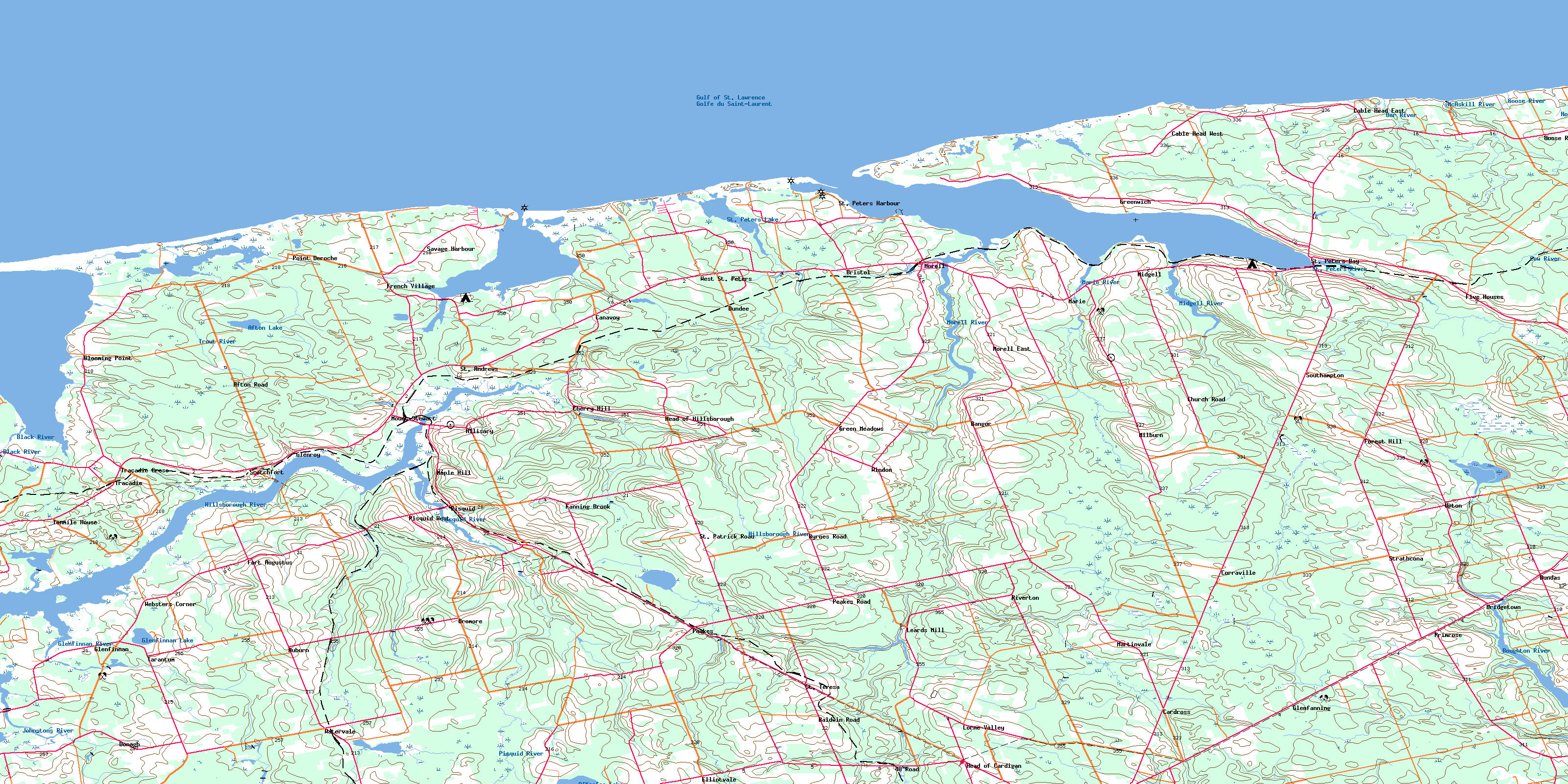
© Department of Natural Resources Canada. All rights reserved.
