Cape Chidley Topo Map Online
Download Free Topo Map Sheet 025A08 at 1:50,000 scale
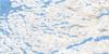
025A08 Cape Chidley Topo Map
To view this map, mouse over the map preview on the right.
You can also download this topo map for free:
025A08 Cape Chidley high-resolution topo map image.
Maps for the Cape Chidley topo map sheet 025A08 at 1:50,000 scale are also available in these versions:
Cape Chidley Surrounding Area Topo Maps
 |
|||
 |
 |
||
 |
 |
 |
© Department of Natural Resources Canada. All rights reserved.
Cape Chidley Gazetteer
The following places can be found on topographic map sheet 025A08 Cape Chidley:
Cape Chidley Topo Map: Bays
Bowdoin HarbourCrowell Inlet
Crowell Inlet
Jaynes Bay
Tunnissugjuak Inlet
Cape Chidley Topo Map: Capes
Cape ChidleyCape Chidley
Cape Labrador
Gould Point
Lecasse Point
Swaine Point
Thomas Point
Cape Chidley Topo Map: Channels
Gray StraitGrenfell Sound
Grenfell Sound
MacGregor Strait
McLelan Strait
McLelan Strait
Cape Chidley Topo Map: Islands
Argo IslandAustin Island
Cabot Island
Cabot Island
Cape Chidley Islands
Gasper Islands
Killinek Island
Killinek Island
Killiniq Island
Killiniq Island
North Star Island
Parmenter Island
Pert Island
Robinson Island

© Department of Natural Resources Canada. All rights reserved.
