Le Dome Topo Map Online
Download Free Topo Map Sheet 035J05 at 1:50,000 scale
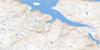
035J05 Le Dome Topo Map
To view this map, mouse over the map preview on the right.
You can also download this topo map for free:
035J05 Le Dome high-resolution topo map image.
Maps for the Le Dome topo map sheet 035J05 at 1:50,000 scale are also available in these versions:
Le Dome Surrounding Area Topo Maps
 |
|||
 |
 |
 |
|
 |
 |
 |
 |
© Department of Natural Resources Canada. All rights reserved.
Le Dome Gazetteer
The following places can be found on topographic map sheet 035J05 Le Dome:
Le Dome Topo Map: Bays
Fjord de SalluitKugluk Cove
Le Dome Topo Map: Capes
Cap AugierCap Boisseau
Cap Brassier
Cap de l'Estre
Cap De L'Estre
Cap Josselin
Cap Jurie
Cap Louys-Martin
Cap Tiblemont
Cap Valets
Pointe Aupaluttaaluk
Pointe Taliruapik
Le Dome Topo Map: Channels
Détroit d'HudsonFord Channel
Passe Ford
Le Dome Topo Map: Islands
Île QikirtaaruapikÎle Qikirtaq
Sugluk Island
Le Dome Topo Map: Lakes
Lac IqalugalikLac Napirviik Tasingak
Le Dome Topo Map: Mountains
Colline QirvaalukLe Dôme
Piémont Pattavik
Le Dome Topo Map: Rivers
Ruisseau IqalugalikRuisseau Kiassautialuk
© Department of Natural Resources Canada. All rights reserved.
