Val Rita Topo Map Online
Download Free Topo Map Sheet 042G07 at 1:50,000 scale
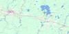
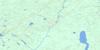
042G07 Val Rita Topo Map
To view this map, mouse over the map preview on the right.
You can also download this topo map for free:
042G07 Val Rita high-resolution topo map image.
Maps for the Val Rita topo map sheet 042G07 at 1:50,000 scale are also available in these versions:
Val Rita Surrounding Area Topo Maps
 |
 |
 |
 |
 |
 |
 |
 |
 |
 |
 |
 |
 |
 |
 |
 |
© Department of Natural Resources Canada. All rights reserved.
Val Rita Gazetteer
The following places can be found on topographic map sheet 042G07 Val Rita:
Val Rita Topo Map: Falls
Bakatase FallsBig Beaver Falls
Val Rita Topo Map: Geographical areas
CargillCumming
Ecclestone
Idington
McCrea
Owens
Parnell
Sulman
Williamson
Val Rita Topo Map: Lakes
Bergsma LakeBiz Lake
Breben Lake
Cargill Lake
Cargill Lake
Clegg Lake
Echo Lake
Glen Lake
Hull Lake
Lac Barroque
Lac de Midas
Lac des Isles
Lac McCready
Lepage Lake
Lost Lake
Marsh Lake
Sand Lake
Sideburn Lake
Smith Lake
Solomon Lake
Teetzel Lake
Therrien Lake
Todd Lake
Val Rita Topo Map: Other municipal/district area - miscellaneous
Idington and McCraeOpasatika
Owens, Williamson and Idington
Val Rita-Harty
Val Rita Topo Map: Rapids
Camp Three RapidsVal Rita Topo Map: Rivers
Alder CreekBig Beaver Creek
Crow Creek
Ecclestone Creek
Glen Creek
Gosselin Creek
Hull Creek
Kapuskasing River
Lambert Creek
Little Lost River
Lost River
Martel Creek
Mather Creek
Opasatika River
Opazatika River
Owens Creek
Owens Creek
Parnell Creek
Pit Creek
Rivière de Kapuskasing
Rivière Opasatika
Saganash River
Solomon Creek
South Crow Creek
Teetzel Creek
Val Rita Topo Map: Unincorporated areas
HartyLepage
Val Rita
Valrita
© Department of Natural Resources Canada. All rights reserved.
042G Related Maps:
042G Kapuskasing042G01 Wakusimi River
042G02 Woman Falls
042G03 Opasatika Lake
042G04 Roche Lake
042G05 Mead
042G06 Rock River
042G07 Val Rita
042G08 Kapuskasing
042G09 Pearce Lake
042G10 Opasatika
042G11 Mattice
042G12 Hearst
042G13 Hanlan Lake
042G14 Shannon Lake
042G15 Hillmer Lake
042G16 Bennet Lake
