Mcivor Lake Topo Map Online
Download Free Topo Map Sheet 053L16 at 1:50,000 scale
053L16 Mcivor Lake Topo Map
To view this map, mouse over the map preview on the right.
You can also download this topo map for free:
053L16 Mcivor Lake high-resolution topo map image.
Maps for the Mcivor Lake topo map sheet 053L16 at 1:50,000 scale are also available in these versions:
Mcivor Lake Surrounding Area Topo Maps
 |
 |
 |
 |
 |
 |
 |
 |
 |
 |
 |
 |
 |
 |
 |
 |
© Department of Natural Resources Canada. All rights reserved.
Mcivor Lake Gazetteer
The following places can be found on topographic map sheet 053L16 Mcivor Lake:
Mcivor Lake Topo Map: Bays
Bayly BayJohnson Bay
Sutherland Bay
Tractor Trail Bay
Mcivor Lake Topo Map: Capes
Buyers PointCochrane Point
Fisher Peninsula
Fraser Point
Johnson Peninsula
Mcivor Lake Topo Map: Channels
Sepaskak NarrowsMcivor Lake Topo Map: Indian Reserves
God's River 86AMcivor Lake Topo Map: Islands
Archies IslandCampbell Island
Dukes Island
Franks Island
Green Island
Houle Island
Kendra Island
Max Bee Island
Muskwumi Island
Nokachamis Island
Towotawach Island
Mcivor Lake Topo Map: Lakes
Fishing Eagle LakeGods Lake
Kaministikowak Lake
Kapuskaykamak Lake
McIvor Lake
Reginald Hall Lake
Seller Lake
Semmens Lake
Tapper Lake
William Paterson Lake
Mcivor Lake Topo Map: Rivers
Gods RiverMcIvor Creek
Mcivor Lake Topo Map: Unincorporated areas
Gods River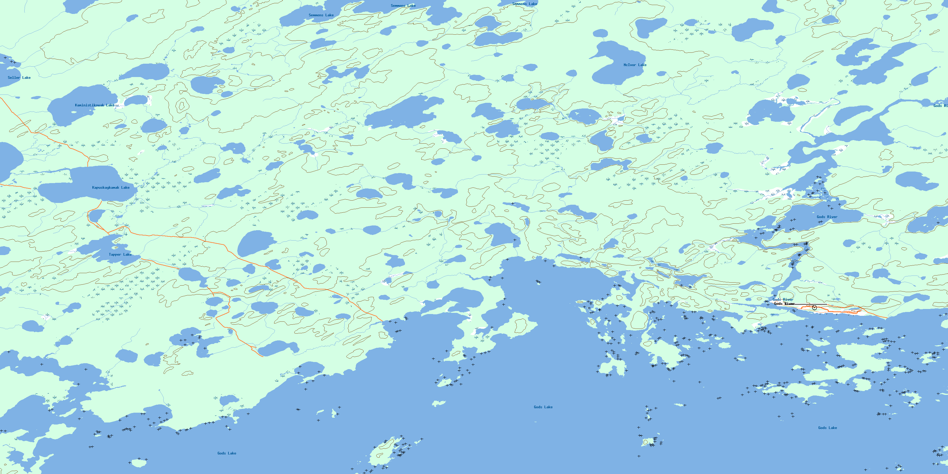
© Department of Natural Resources Canada. All rights reserved.
053L Related Maps:
053L Oxford House053L01 Mistuhe Lake
053L02 Kakeenukamak Lake
053L03 Opom Lake
053L04 Nikik Lake
053L05 Bolton Lake
053L06 Joint Lake
053L07 Kanuchuan Rapids
053L08 Murray Lake
053L09 Gods Lake
053L10 Vermilyea Lake
053L11 Munro Lake
053L12 Windy Lake
053L13 Carghill Island
053L14 Oxford House
053L15 Knee Lake
053L16 Mcivor Lake
