Kanuchuan Rapids Topo Map Online
Download Free Topo Map Sheet 053L07 at 1:50,000 scale
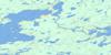
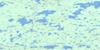
053L07 Kanuchuan Rapids Topo Map
To view this map, mouse over the map preview on the right.
You can also download this topo map for free:
053L07 Kanuchuan Rapids high-resolution topo map image.
Maps for the Kanuchuan Rapids topo map sheet 053L07 at 1:50,000 scale are also available in these versions:
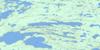
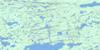
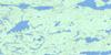
Kanuchuan Rapids Surrounding Area Topo Maps
 |
 |
 |
 |
 |
 |
 |
 |
 |
 |
 |
 |
 |
 |
 |
 |
© Department of Natural Resources Canada. All rights reserved.
Kanuchuan Rapids Gazetteer
The following places can be found on topographic map sheet 053L07 Kanuchuan Rapids:
Kanuchuan Rapids Topo Map: Bays
Andrew BayFathers Fishing Bay
Pikokosip Bay
Sawmill Bay
Wasakamak Bay
Wesachewan Bay
Wolf Bay
Kanuchuan Rapids Topo Map: Indian Reserves
Andrew BayGod's Lake 23
Kanuchuan Rapids Topo Map: Islands
Fox IslandsMcColm Island
Kanuchuan Rapids Topo Map: Lakes
Beaver Hill LakeBeaverhill Lake
Gods Lake
Goose Lake
Kipiskwakun Lake
Mistuhe Lake
Mwoakwu Lake
Touchwood Lake
Kanuchuan Rapids Topo Map: Mountains
Peterson EskerKanuchuan Rapids Topo Map: Rapids
Kanuchuan RapidsWaypapeekowin Rapids
Waypapeekuwin Rapids
White Deer Rapids
Kanuchuan Rapids Topo Map: Rivers
Island Lake RiverKanuchuan River
Mooskamoonik Creek

© Department of Natural Resources Canada. All rights reserved.
053L Related Maps:
053L Oxford House053L01 Mistuhe Lake
053L02 Kakeenukamak Lake
053L03 Opom Lake
053L04 Nikik Lake
053L05 Bolton Lake
053L06 Joint Lake
053L07 Kanuchuan Rapids
053L08 Murray Lake
053L09 Gods Lake
053L10 Vermilyea Lake
053L11 Munro Lake
053L12 Windy Lake
053L13 Carghill Island
053L14 Oxford House
053L15 Knee Lake
053L16 Mcivor Lake
