Oskikebuk Lake Topo Map Online
Download Free Topo Map Sheet 063L13 at 1:50,000 scale
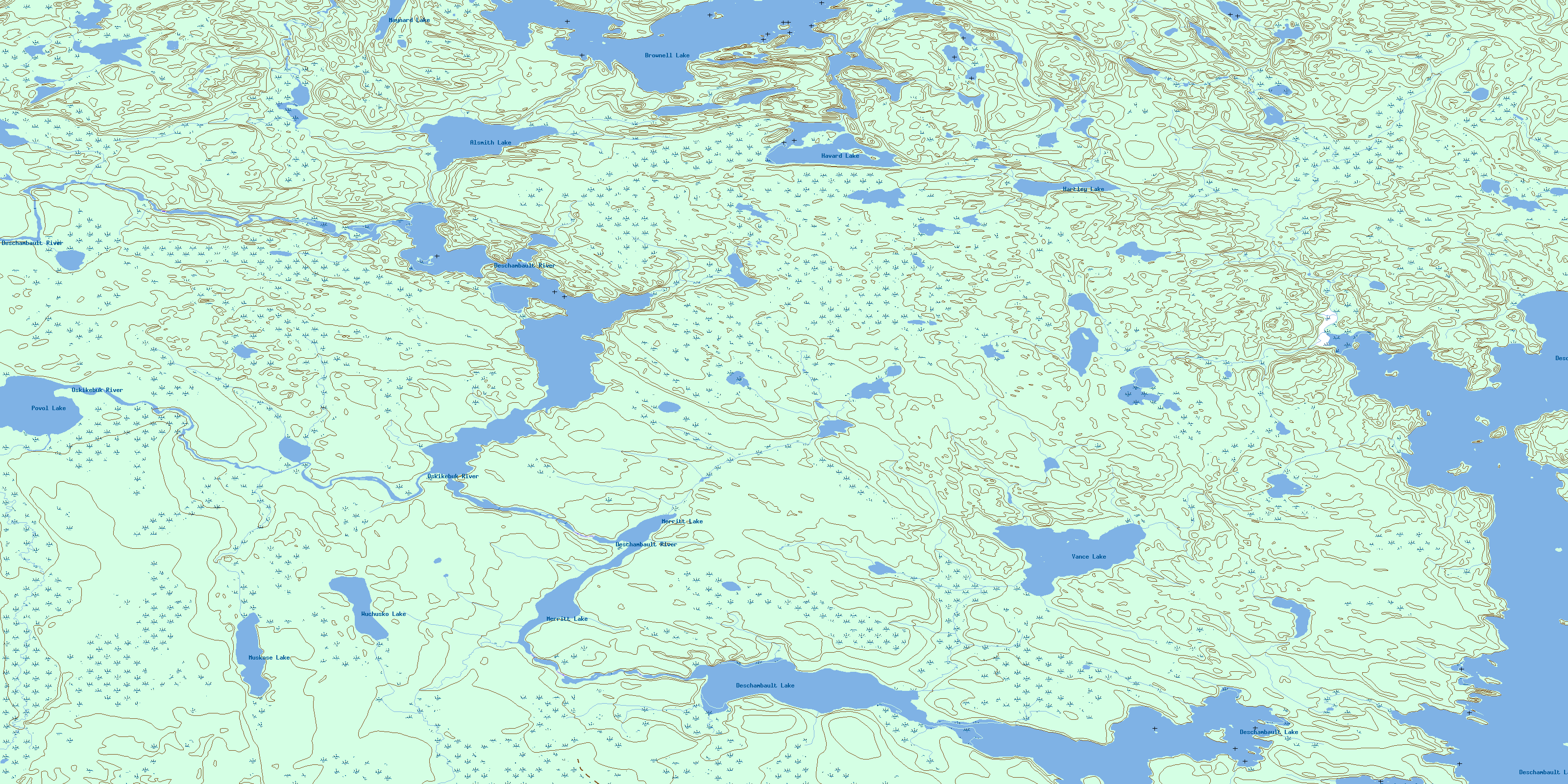
063L13 Oskikebuk Lake Topo Map
To view this map, mouse over the map preview on the right.
You can also download this topo map for free:
063L13 Oskikebuk Lake high-resolution topo map image.
Maps for the Oskikebuk Lake topo map sheet 063L13 at 1:50,000 scale are also available in these versions:
Oskikebuk Lake Surrounding Area Topo Maps
 |
 |
 |
 |
 |
 |
 |
 |
 |
 |
 |
 |
 |
 |
 |
 |
© Department of Natural Resources Canada. All rights reserved.
Oskikebuk Lake Gazetteer
The following places can be found on topographic map sheet 063L13 Oskikebuk Lake:
Oskikebuk Lake Topo Map: Bays
West ArmOskikebuk Lake Topo Map: Channels
Deschambault ChannelOskikebuk Lake Topo Map: Lakes
Alsmith LakeBrownell Lake
Deschambault Lake
Hartley Lake
Havard Lake
Maynard Lake
Merritt Lake
Muskose Lake
Oskikebuk Lake
Povol Lake
Vance Lake
Wuchusko Lake
Oskikebuk Lake Topo Map: Rivers
Brownell CreekDeschambault River
Maynard Creek
Oskikebuk River
© Department of Natural Resources Canada. All rights reserved.
063L Related Maps:
063L Amisk Lake063L01 Archibald Lake
063L02 Pine Bluff
063L03 Loyns Lake
063L04 Red Bobs Lake
063L05 Seager Wheeler Lake
063L06 Saunders Lake
063L07 Suggi Lake
063L08 Leonard Lake
063L09 Denare Beach
063L10 Hanson Lake
063L11 Limestone Lake
063L12 Ballantyne Bay
063L13 Oskikebuk Lake
063L14 Viney Lake
063L15 Birch Portage
063L16 Annabel Lake
