Canada Topographic Maps

Matador Topo Map Online

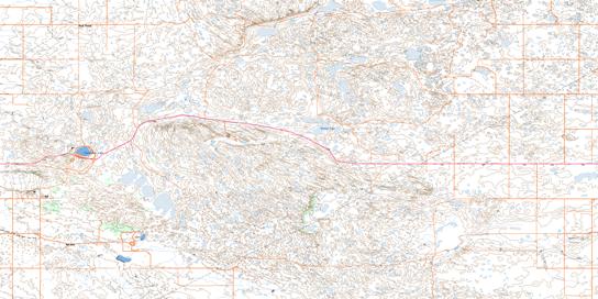
Download Free Topo Map Sheet 072J13 at 1:50,000 scale

072J13 Matador Topo Map

To view this map, mouse over the map preview on the right.

You can also download this topo map for free:
072J13 Matador high-resolution topo map image.

Maps for the Matador topo map sheet 072J13 at 1:50,000 scale are also available in these versions:

  1. Buy Digital Topo Maps on Data-DVD
  2. Buy Waterproof Topographic Map
  3. Buy Topographic Paper Map
  4. Free Digital Satellite Image

Matador Surrounding Area Topo Maps

072J13 Matador Topo Map Thumbnail 072J14 Beechy Topo Map Thumbnail 072J15 Riverhurst Topo Map Thumbnail 072J16 Eyebrow Topo Map Thumbnail
072J12 Stewart Valley Topo Map Thumbnail 072J11 Main Centre Topo Map Thumbnail 072J10 Halvorgate Topo Map Thumbnail 072J09 Eskbank Topo Map Thumbnail
072J05 Swift Current Topo Map Thumbnail 072J06 Herbert Topo Map Thumbnail 072J07 Chaplin Topo Map Thumbnail 072J08 Mortlach Topo Map Thumbnail
072J04 Wymark Topo Map Thumbnail 072J03 Hallonquist Topo Map Thumbnail 072J02 Hodgeville Topo Map Thumbnail 072J01 Courval Topo Map Thumbnail
© Department of Natural Resources Canada. All rights reserved.

Matador Gazetteer

The following places can be found on topographic map sheet 072J13 Matador:

Matador Topo Map: Cliffs

Coteau (The)
The Coteau

Matador Topo Map: Lakes

Clearwater Lake
Minnie Lake

Matador Topo Map: Other municipal/district area - miscellaneous

Lacadena No. 228
Victory No. 226

Matador Topo Map: Conservation areas

Clearwater Lake Regional Park

Matador Topo Map: Rivers

Bull Creek
James Creek
Matador Creek

Matador Topo Map: Unincorporated areas

Gunderson
High Point
Matador
Matador Topographic map 072J13 at 1:50,000 Scale
© Department of Natural Resources Canada. All rights reserved.
 
Buy Topographic Maps DVD
Newsletter Sign-up

Yes, I want to receive map store discounts.


Bookmark and Share