Eyehill Creek Topo Map Online
Download Free Topo Map Sheet 073C12 at 1:50,000 scale
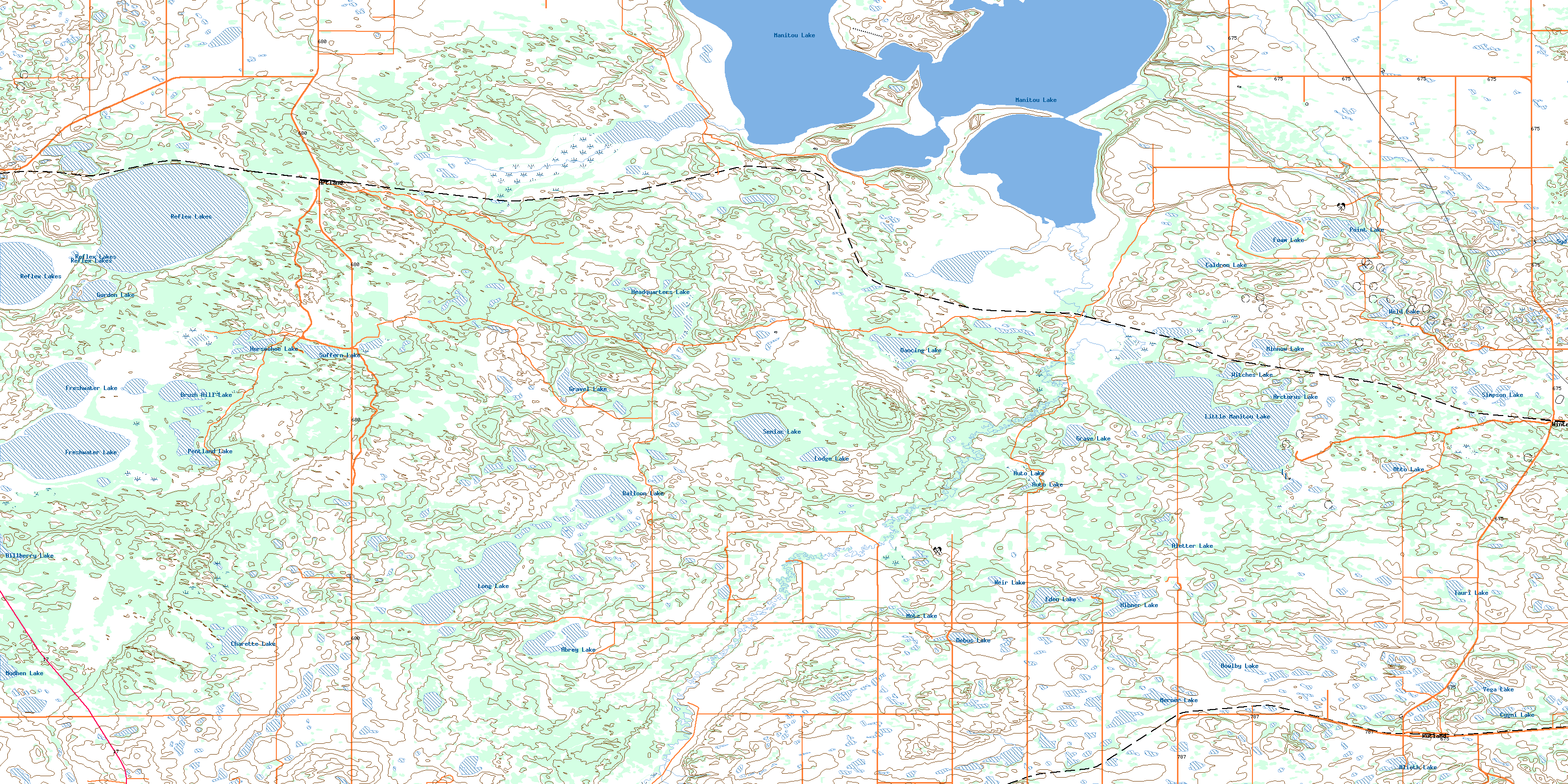
073C12 Eyehill Creek Topo Map
To view this map, mouse over the map preview on the right.
You can also download this topo map for free:
073C12 Eyehill Creek high-resolution topo map image.
Maps for the Eyehill Creek topo map sheet 073C12 at 1:50,000 scale are also available in these versions:
Eyehill Creek Surrounding Area Topo Maps
 |
 |
 |
 |
 |
 |
 |
 |
 |
 |
 |
 |
 |
 |
 |
 |
© Department of Natural Resources Canada. All rights reserved.
Eyehill Creek Gazetteer
The following places can be found on topographic map sheet 073C12 Eyehill Creek:
Eyehill Creek Topo Map: Indian Reserves
Poundmaker 114-7AEyehill Creek Topo Map: Islands
Manito IslandManitou Island
Eyehill Creek Topo Map: Lakes
Abrey LakeAletter Lake
Alioth Lake
Arcturus Lake
Auto Lake
Balloon Lake
Bowlby Lake
Brush Hill Lake
Caldron Lake
Charette Lake
Cherry Lake
Cygni Lake
Dancing Lake
Debus Lake
Dillberry Lake
Eden Lake
Foam Lake
Freshwater Lake
Gordon Lake
Gordon Lake
Grave Lake
Gravel Lake
Headquarters Lake
Hibner Lake
Horseshoe Lake
Limit Lake
Little Manito Lake
Little Manitou Lake
Lodge Lake
Long Lake
Manito Lake
Manitou Lake
Merner Lake
Minnow Lake
Minnow Lake
Motz Lake
Mudhen Lake
Muskrat Lake
Otto Lake
Pentland Lake
Point Lake
Reflex Lake
Reflex Lakes
Senlac Lake
Simpson Lake
Suffern Lake
Syd Lake
Tauri Lake
Vega Lake
Weir Lake
Weld Lake
West Fish Lake
Witches Lake
Eyehill Creek Topo Map: Other municipal/district area - miscellaneous
Hillsdale No. 440Manitou Lake No. 442
Senlac No. 411
Eyehill Creek Topo Map: Conservation areas
Suffern Lake Regional ParkEyehill Creek Topo Map: Rivers
Eyehill CreekEyehill Creek Topo Map: Unincorporated areas
ArtlandRutland
Winter
Yonker
Zumbro
© Department of Natural Resources Canada. All rights reserved.
