Mckinlay Lake Topo Map Online
Download Free Topo Map Sheet 097F05 at 1:50,000 scale
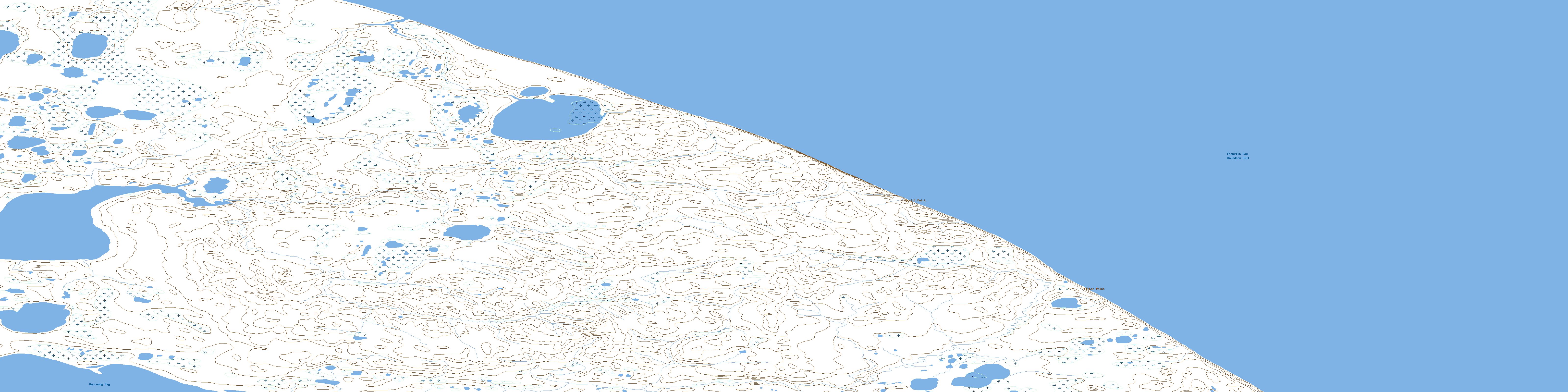
097F05 Mckinlay Lake Topo Map
To view this map, mouse over the map preview on the right.
You can also download this topo map for free:
097F05 Mckinlay Lake high-resolution topo map image.
Maps for the Mckinlay Lake topo map sheet 097F05 at 1:50,000 scale are also available in these versions:
Mckinlay Lake Surrounding Area Topo Maps
 |
|||
 |
|||
 |
 |
 |
 |
© Department of Natural Resources Canada. All rights reserved.
Mckinlay Lake Gazetteer
The following places can be found on topographic map sheet 097F05 Mckinlay Lake:
Mckinlay Lake Topo Map: Bays
Amundsen GulfCy Peck Inlet
Franklin Bay
Harrowby Bay
North Star Harbour
Mckinlay Lake Topo Map: Capes
Avvaq PeninsulaTraill Point
Mckinlay Lake Topo Map: Lakes
McKinlay LakeMckinlay Lake Topo Map: Mountains
Whale BluffsMckinlay Lake Topo Map: Territory
Northwest TerritoriesTerritoires du Nord-Ouest
© Department of Natural Resources Canada. All rights reserved.
