Cape Parry Topo Map Online
Download Free Topo Map Sheet 097F01 at 1:50,000 scale
097F01 Cape Parry Topo Map
To view this map, mouse over the map preview on the right.
You can also download this topo map for free:
097F01 Cape Parry high-resolution topo map image.
Maps for the Cape Parry topo map sheet 097F01 at 1:50,000 scale are also available in these versions:
Cape Parry Surrounding Area Topo Maps
 |
|||
 |
|||
 |
 |
 |
 |
© Department of Natural Resources Canada. All rights reserved.
Cape Parry Gazetteer
The following places can be found on topographic map sheet 097F01 Cape Parry:
Cape Parry Topo Map: Bays
Amundsen GulfBalaena Bay
Bath Bay
Boldon Bay
Browns Harbour
Cornwell Bay
Cow Cove
Darnley Bay
Franklin Bay
Gillet Bay
Kendall Inlet
Sellwood Bay
Tyne Bay
Wise Bay
Cape Parry Topo Map: Capes
Cape BankslandCape Buchan
Cape Parry
Devon Point
Ooligbuck Point
Parry Peninsula
Police Point
Cape Parry Topo Map: Islands
Booth IslandBooth Islands
Canoe Island
Fiji Island
Kamakark Island
Moore Islands
Okak Island
Sardlat Island
Cape Parry Topo Map: Shoals
Minim ReefUyarukaluk Rock
Cape Parry Topo Map: Territory
Northwest TerritoriesTerritoires du Nord-Ouest
Cape Parry Topo Map: Unincorporated areas
Cape Parry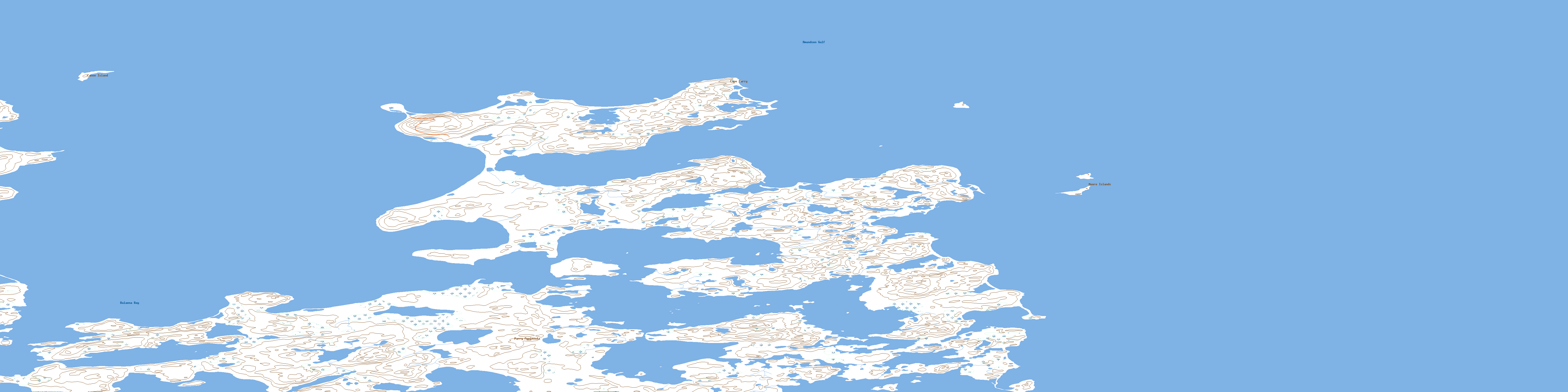
© Department of Natural Resources Canada. All rights reserved.
