Cape Cardwell Topo Map Online
Download Free Topo Map Sheet 097H07 at 1:50,000 scale
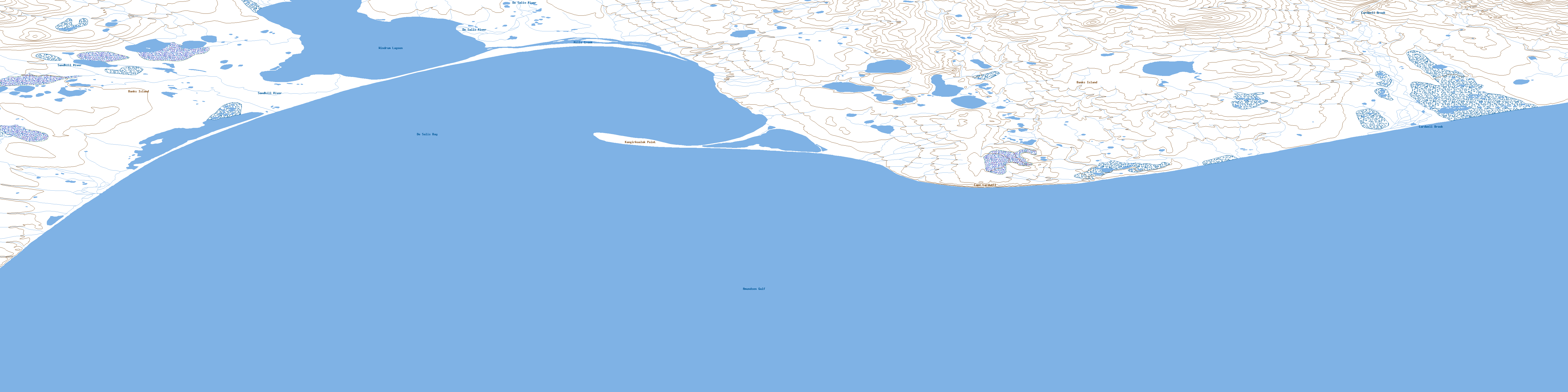
097H07 Cape Cardwell Topo Map
To view this map, mouse over the map preview on the right.
You can also download this topo map for free:
097H07 Cape Cardwell high-resolution topo map image.
Maps for the Cape Cardwell topo map sheet 097H07 at 1:50,000 scale are also available in these versions:
Cape Cardwell Surrounding Area Topo Maps
 |
 |
 |
 |
 |
 |
 |
 |
 |
 |
 |
 |
 |
 |
© Department of Natural Resources Canada. All rights reserved.
Cape Cardwell Gazetteer
The following places can be found on topographic map sheet 097H07 Cape Cardwell:
Cape Cardwell Topo Map: Bays
Amundsen GulfDe Salis Bay
Cape Cardwell Topo Map: Capes
Cape CardwellKangirkualuk Point
Cape Cardwell Topo Map: Islands
Banks IslandCape Cardwell Topo Map: Lakes
Windrum LagoonCape Cardwell Topo Map: Rivers
Cardwell BrookDe Salis River
Mills Creek
Sandhill River
Cape Cardwell Topo Map: Territory
Northwest TerritoriesTerritoires du Nord-Ouest
© Department of Natural Resources Canada. All rights reserved.
