Cumshewa Inlet Topo Map Online
Download Free Topo Map Sheet 103G04 at 1:50,000 scale
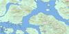
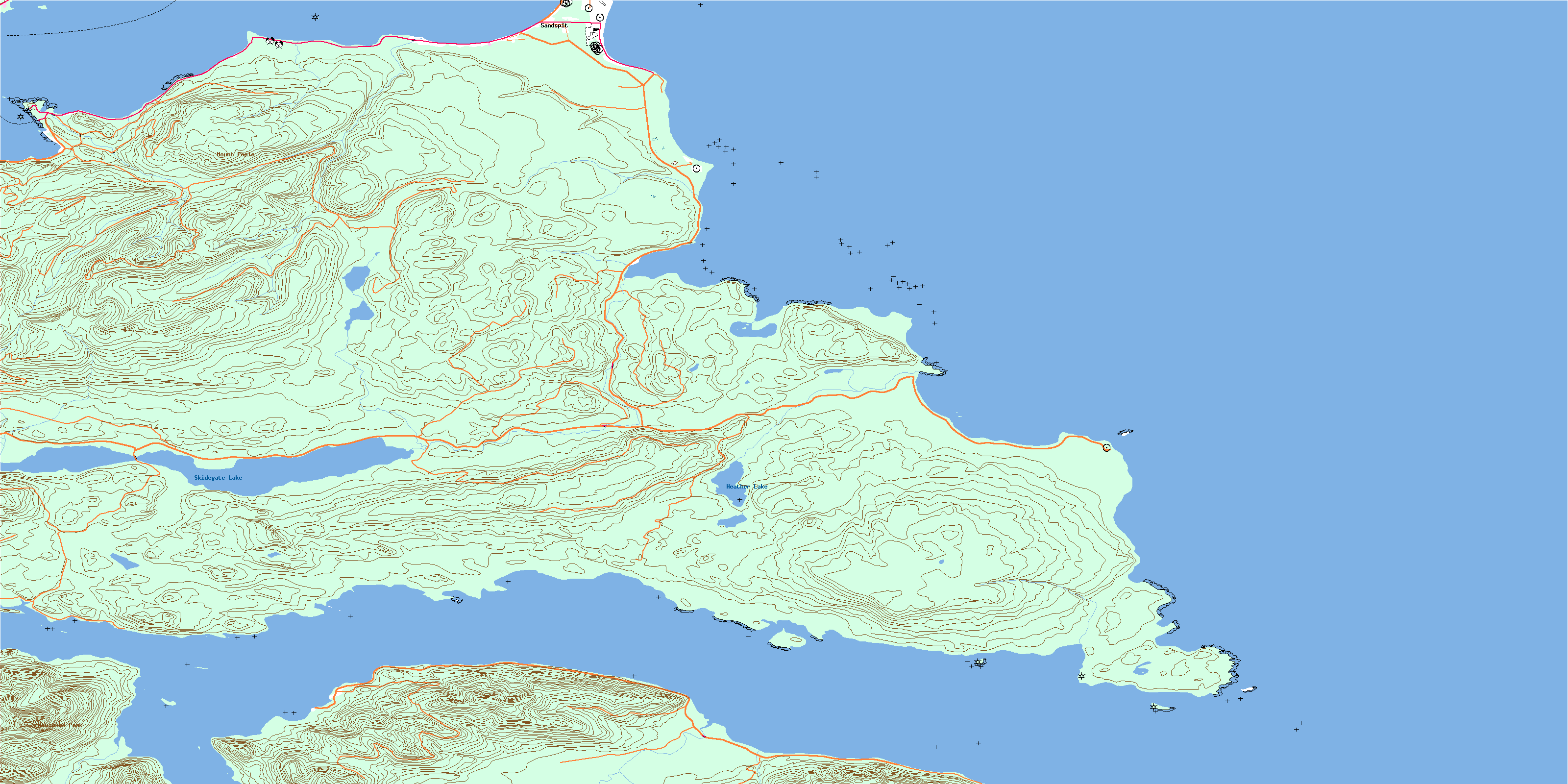
103G04 Cumshewa Inlet Topo Map
To view this map, mouse over the map preview on the right.
You can also download this topo map for free:
103G04 Cumshewa Inlet high-resolution topo map image.
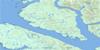
Maps for the Cumshewa Inlet topo map sheet 103G04 at 1:50,000 scale are also available in these versions:
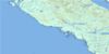
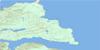
Cumshewa Inlet Surrounding Area Topo Maps
 |
 |
 |
|
 |
 |
 |
|
 |
 |
 |
|
 |
© Department of Natural Resources Canada. All rights reserved.
Cumshewa Inlet Gazetteer
The following places can be found on topographic map sheet 103G04 Cumshewa Inlet:
Cumshewa Inlet Topo Map: Bays
Alliford BayBeattie Anchorage
Boat Cove
Carmichael Arm
Copper Bay
Cumshewa Inlet
Dawson Cove
Deland Bay
Dogfish Bay
Gillatt Arm
Gray Bay
McCoy Cove
Sheldens Bay
Shingle Bay
Skidegate Inlet
Cumshewa Inlet Topo Map: Capes
Alliford PointBarge Point
Cape Chroustcheff
Conglomerate Point
Cumshewa Head
Gray Point
Kitson Point
Kwuna Point
Oliver Point
Onward Point
Renner Point
Cumshewa Inlet Topo Map: Channels
Carmichael PassageHecate Strait
Cumshewa Inlet Topo Map: Indian Reserves
Cumshewas Indian Reserve 7Kaste Indian Reserve 6
New Clew Indian Reserve 10
Réserve indienne Cumshewas 7
Réserve indienne Kaste 6
Réserve indienne New Clew 10
Réserve indienne Skidegate 1
Skidegate Indian Reserve 1
Cumshewa Inlet Topo Map: Islands
Cumshewa IslandDavey Islets
Gillatt Island
Graham Island
Haans Islet
Îles de la Reine-Charlotte
Jewell Island
Kingui Island
Louise Island
Mabbs Islet
McLellan Island
Moresby Island
Nedden Island
Oliver Islet
Queen Charlotte Islands
Tree Island
Cumshewa Inlet Topo Map: Lakes
Heather LakeSkidegate Lake
Swamp Lake
Cumshewa Inlet Topo Map: Mountains
Cumshewa MountainMount Poole
Newcombe Peak
Cumshewa Inlet Topo Map: Rivers
Agnes CreekAlliford Creek
Blaine Creek
Central Creek
Chadsey Creek
Copper Creek
Haans Creek
Letitia Creek
MacIntyre Creek
Mathers Creek
Sachs Creek
Cumshewa Inlet Topo Map: Shoals
Cumshewa RocksDavies Shoal
Duval Rock
Fairbairn Shoals
McLean Shoal
Cumshewa Inlet Topo Map: Unincorporated areas
AeroAlliford Bay
Cumshewa
New Clew
Sandspit
© Department of Natural Resources Canada. All rights reserved.
