Tlell Topo Map Online
Download Free Topo Map Sheet 103G12 at 1:50,000 scale
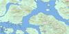
103G12 Tlell Topo Map
To view this map, mouse over the map preview on the right.
You can also download this topo map for free:
103G12 Tlell high-resolution topo map image.
Maps for the Tlell topo map sheet 103G12 at 1:50,000 scale are also available in these versions:
Tlell Surrounding Area Topo Maps
 |
 |
 |
|
 |
 |
 |
|
 |
 |
 |
|
 |
© Department of Natural Resources Canada. All rights reserved.
Tlell Gazetteer
The following places can be found on topographic map sheet 103G12 Tlell:
Tlell Topo Map: Capes
Cape BallTlell Topo Map: Channels
Hecate StraitTlell Topo Map: Islands
Graham IslandTlell Topo Map: Lakes
Hickey LakeTlell Topo Map: Conservation areas
Naikoon ParkTlell Park
Tlell Topo Map: Rivers
Cape Ball CreekCape Ball River
Geikie Creek
Mayer River
Tlell River
Tlell Topo Map: Shoals
Dogfish BankDogfish Banks
Tlell Topo Map: Unincorporated areas
Tlell
© Department of Natural Resources Canada. All rights reserved.
