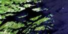
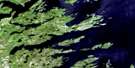
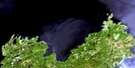
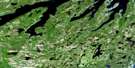
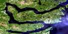
Old Perlican Satellite Image Map
Download Free Aerial Photo 002C03 at 1:50,000 scale
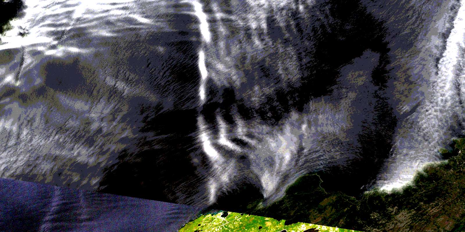
Old Perlican Satellite Imagery
To view this satellite map, mouse over the air photo on the right.
You can also download this satellite image map for free:
002C03 Old Perlican high-resolution satellite image map.
Maps for the Old Perlican aerial map sheet 002C03 at 1:50,000 scale are also available in these versions:
Old Perlican Surrounding Area Aerial Photo Maps
 |
|||
 |
 |
||
 |
 |
||
 |
 |
 |
© Department of Natural Resources Canada. All rights reserved.
Old Perlican Gazetteer
The following places can be found on satellite image map 002C03 Old Perlican:
Old Perlican Satellite Image: Bays
Back CoveBesom Cove
Big Brook Cove
Brook Cove
Brownsdale Cove
Bull Gulch
Bullocks Gulch
Burn Cove
Caplin Cove
Cooks Cove
Crab Cove
Elijah Cove
Greene Cove
Hants Harbour
Ireland's Eye Harbour
Island Point Cove
Jacobs Cove
Lead Cove
Long Gulch
Maids Brook Cove
Mizzen Cove
Mount Fagner Cove
New Chelsea Cove
Old Perlican Cove
Russels Cove
Sibleys Cove
Skerwink Cove
Smith Sound
Swimming Gulch
Trinity Bay
War Head Cove
Old Perlican Satellite Image: Beaches
Goods BeachOld Perlican Satellite Image: Capes
Abrahams HeadAvalon Peninsula
Barbours Head
Bay de Verde Peninsula
Besom Point
British Harbour Point
Bull Gulch Point
Burseys Point
Caplin Cove Head
Chelsea Head
Custers Head
East of Brownsdale
Easter Point
Hant's Head
Ireland's Eye Point
Island Point
Lower Island Point
Mansfield Point
Middle Head
Mizzen Point
Mount Fagner Head
Pancake Head
Salvage Point
Seal Point
Skerwink Point
Taylor Point
Upper Island Point
War Head
West of Brownsdale
Wester Head
White Point
Old Perlican Satellite Image: Islands
Anthony IslandBrandies
Duck Island
Georges Island
Grassy Isle
Green Island
Ireland's Eye
Little Islands
Offer Island
Perlican Island
Pigeon Island
Ragged Island
Ragged Islands
Shag Islands
Spear Head Island
Tickle Island
Old Perlican Satellite Image: Lakes
Bell PondBesom Cove Pond
Big Brook Pond
Big Brook Steady
Big Steadies
Black Duck Pond
Black Duck Pond
Boar Pond
Burnt Point Steady
Charlies Ponds
Church Pond
Church Pond
Dabblers Pond
Five Mile Pond
Five Mile Pond Lower Gully
Five Mile Pond Upper Gully
Gull Pond
Gull Pond
Iron Box Pond
Island Pond
Island Pond
Kings Head Pond
Lance Cove Pond
Lance Cove Pond
Lily Pond
Little Bell Pond
Little Island Pond
Long Boar Pond
Long Pond
Maids Pond
Mares Pond
Middle Pond
Mount Fagner Pond
Pitmans Pond
Seal Cove Pond
Shorts Pond
Sibleys Cove Pond
Sibleys Cove Small Pond
Simmons Pond
Small Steadies
Sow Pond
The Gullies
Three Corner Gully
Trout Pond
Whales Brook Pond
Old Perlican Satellite Image: Mountains
Adams LookoutBerrypicking Hill
Big Hill
Diamond Hill
Gaze Hill
Huts Hill
Miners Hills
Mount Fagner
Nuddick
Pattys Hill
Southside Hill
Sugar Rock Hill
The Tolt
Twelve O'Clock Hill
Old Perlican Satellite Image: Rivers
Besom Cove BrookBig Brook
Big Brook
Black Duck Pond Brook
Brown Brook
Burnt Wood Brook
Great Brook
Maids Brook
Mount Fagner Brook
Sibleys Cove Brook
Southwest Brook
The Brook
Whales Brook
Old Perlican Satellite Image: Shoals
Arthur RockBig Rock
Black Ledge
Darby Ledge
Friday Ledge
Green Ledge
Gunner Rock
Hants Harbour Rock
Harbour Rock
Hodder Rock
Ice Ledge
Knife Rock
Middle Head Rock
Moses Reed Rock
New Ledge
Ragged Rock
Riff Raff Rocks
Salvage Rock
Salvage Rocks
Seal Rocks
Skerries
Skerwink Rock
Swile Cove Rock
Tail of the Bank
The Flats
Tilleys Path End
White Rocks
Old Perlican Satellite Image: Towns
Hant's HarbourOld Perlican
Old Perlican Satellite Image: Unincorporated areas
BrownsdaleIreland's Eye
Lead Cove
New Chelsea
New Chelsea-New Melbourne-Brownsdale-Sibley's Cove-Lead Cove
New Melbourne
New Melbourne-Brownsdale-Sibley's Cove-Lead Cove
Sibleys Cove
Old Perlican Satellite Image: Valleys
Bull GulchOld Perlican Satellite Image: Low vegetation
BerrymarshFive Mile Pond Marshes
Frog Marsh
Lance Cove Pond Marsh
Perlican Barrens
© Department of Natural Resources Canada. All rights reserved.
