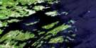
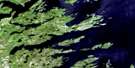
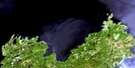
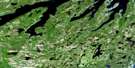
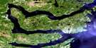
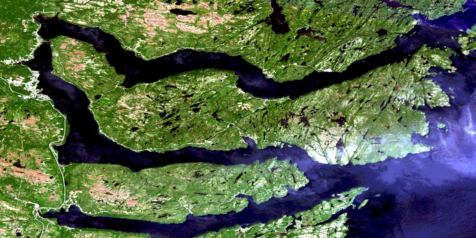
Random Island Satellite Image Map
Download Free Aerial Photo 002C04 at 1:50,000 scale
Random Island Satellite Imagery
To view this satellite map, mouse over the air photo on the right.
You can also download this satellite image map for free:
002C04 Random Island high-resolution satellite image map.
Maps for the Random Island aerial map sheet 002C04 at 1:50,000 scale are also available in these versions:
Random Island Surrounding Area Aerial Photo Maps
 |
|||
 |
 |
||
 |
 |
||
 |
 |
 |
© Department of Natural Resources Canada. All rights reserved.
Random Island Gazetteer
The following places can be found on satellite image map 002C04 Random Island:
Random Island Satellite Image: Bays
Aspen CoveBaileys Cove
Beaver Cove
Black Duck Cove
Black Duck Cove
Bluff Head Cove
Britannia Cove
British Harbour
Broad Cove
Broad Cove
Burnt Brook Cove
Cable Cove
Caplin Cove
Caplin Cove
Chair Cove
Connolly's Cove
Dark Hole
Dark Hole
Deer Harbour
Elliotts Cove
Flowers Cove
Fords Harbour
Fox Harbour
Ganny Cove
George Cove
Greens Bight
Hatchet Cove
Heart's Ease Inlet
Hickman Harbour
Hickmans Harbour
Hobbs Hole
Hodge's Cove
House Cove
House Cove
Ireland's Eye Harbour
Island Cove
Ivany Cove
Jonathon Cove
Lady Cove
Lance Cove
Leonards Cove
Little Harbour
Little Harbour
Little Harbour
Little Heart's Ease Harbour
Long Cove
Long Harbour
Loreburn Cove
Lower Lance Cove
Lower Rocky Cove
Lower Shoal Harbour
Maggotty Cove
McGraths Cove
Middle Lance Cove
North Bight
Northwest Arm
Northwest Arm
Nut Cove
Passenger Cove
Popes Harbour
Porridge Cove
Queens Cove
Random Head Harbour
Random Sound
Rider Harbour
Robinson Bight
Rocky Harbour
Round Harbour
Russells Cove
Salmon Cove
Ship Cove
Shoal Harbour
Skimmer Cove
Smith Sound
Snooks Harbour
South Bight
Southern Bight
Southwest Arm
Spraggs Cove
St. Jones Within Harbour
The Bottom
Traytown Harbour
Trinity Bay
Upper Lance Cove
Upper Rocky Bight
Warwick Harbour
Random Island Satellite Image: Beaches
Red BeachRandom Island Satellite Image: Capes
Aspey PointBald Nap Point
Bar Mead
Birchy Point
Bluff Head
Bluff Point
Bluff Point
Bounds Mead
Brickyard Point
Bullocks Point
Burn Point
Chair Cove Head
Crow Cliff Point
Daltons Head
East Head
East Random Head
Flat Rock Point
Fosters Point
Gooseberry Point
Grassy Head
Grindstone Head
Hatchet Cove Point
Haydon Point
Heart's Ease Point
Horsestinger Point
Lady Point
Lance Cove Head
Long Point
Lower Harbour Point
Man Point
Passenger Point
Pigeon Point
Pittman Point
Pudding Point
Red Point
Sandy Point
Sandy Point
Silldown Point
Smith Point
Southeast Point
Strongs Point
Taylor Point
Tilton Head
Tolt Point
Upper Harbour Point
Warwick Harbour Point
West Point
West Random Head
Wolf Head
Random Island Satellite Image: Channels
Strong TickleThe Bar
The Thoroughfare
Random Island Satellite Image: Cliffs
Bottom BluffCold East Flake
Middle Cliff
Random Island Satellite Image: Islands
Connor IslandCopper Island
Flat Island
Fox Island
Gooseberry Island
Grassy Island
Green Islands
Haydon Island
Hickman Islands
Hodge's Cove Island
Indian Islands
Ireland's Eye
Long Island
Motion Islands
North Bird Island
Pigeon Island
Random Island
Rat Island
South Bird Island
Strong Island
Sullivan Island
Verge Island
West Strong Island
Random Island Satellite Image: Lakes
Anglo PondAnglo Water Pond
Arts Dam Pond
Arts Long Pond
Aspey Cove Pond
Aspey First Pond
Back Arm Pond
Bailey Cove Pond
Bailey Pond
Bald Head Pond
Bald Nap Pond
Beaver Brook Pond
Beaver Pond
Beaver Pond
Beaver Pond
Berry Hill Pond
Berts Dam Pond
Big Drake Pond
Big Long Pond
Big Pond
Big Pond
Birchy Pond
Black Duck Cove Pond
Black Duck Pond
Bluff Head Big Pond
Bluff Head Pond
Bluff Pond
Breakheart Pond
Britch Pond
Brits Pond
Bugden Pond
Bugden Pond
Burn Point Pond
Cable Cove Pond
Calipso Pond
Calling Cove Pond
Canvass Head Pond
Church Pond
Churchill Pond
Clam Pond
Claude Pond
Cooper Pond
Dam Pond
Dam Pond
Dam Pond
Dam Pond
Daniels Cove Pond
Dartmans Pond
Deans Cove Pond
Deep Bight Pond
Deer Harbour Pond
Delbys Cove Pond
Double Pond
Eastern Angle Pond
Eatons Pond
Elbow Pond
Elliotts Cove Pond
Fagans Pond
Figure-Eight Pond
First Pond
Fish Point Pond
Fords Harbour Long Pond
Fourth Pond
Georges Pond
Gillclicker Pond
Gooseberry Cove Pond
Greens Bight Pond
Gull Pond
Gull Pond
Gulliford Pond
Gutter Long Pond
Harry Pond
Hatchet Cove Pond
Heart's Ease Pond
Hickmans Harbour Big Pond
HollowayPond
Humpy Pond
Ice Hill Gully
Indian Pond
Island Pond
Island Pond
Island Pond
Island Pond
Jacks Pond
John Penney Pond
Johnny Stones Pond
Kettle Pond
Kings Pond
Lady Pond
Lambert Pond
Lamberts Gullies
Lily Pond
Little Beaver Pond
Little Deans Cove Pond
Little Gull Pond
Little Harbour Pond
Little Island Pond
Little Long Pond
Little Long Pond
Little Marsh Pond
Lond Pond
Lond Pond
Long Cove Pond
Long Gush Pond
Long Harbour Pond
Long Narrow Pond
Long Pond
Long Pond
Long Pond
Long Pond
Long Pond
Long Pond
Long Pond
Loon Pond
Lower Rocky Pond
Maggoty Cove Pond
March Dam Pond
Marches Dam Pond
Millers Pond
Moody Pond
Moody Pond
Muddy Pond
Nine Island Pond
Nine Island Pond
Northwest Pond
Nut Cove Pond
Nut Cove Pond
Oats Pond
Otter Pond
Otter Pond
Pickle Pond
Pie Duck Pond
Pigeon Pond
Ploughs Pond
Popes Harbour Pond
Quarry Pond
Rabbit Pond
Random Harbour Pond
Red Clift Ponds
Red Pond
Rocky Pond
Rocky Pond
Rocky Pond
Rocky Pond
Samuels Cove Pond
Sandy Pond
Second Pond
Second Pond
Six Penny Pond
Smooth Heel Pond
Snooks Harbour Pond
Spar Pond
Spraggs Cove Pond
St. Jones Pond
St. Jones Pond Gully
Summers Pond
Tea Pond
Third Pond
Tickle Harbour Pond
Tickle Pond
Tit Pond
Tommy Laite Pond
Trout Pond
Trout Pond
Trout Pond Gullies
Tween Bridge Pond
Twin Ponds
Uncle Pond
Upper Gull Pond
Valley Pond
Verges Pond
Warwick Harbour Pond
West Point Pond
West Pond
Whale Back Pond
White Point Pond
Wolf Point Pond
Random Island Satellite Image: Mountains
Bakers LoafBig Hill
Ginpicker Hill
Indian Lookout
Overlooking
Red Point Hill
Spirit Hill
The Tolt
Treble Range
Random Island Satellite Image: Conservation areas
Newfoundland T'Railway Provincial ParkSmith Sound Provincial Park
Random Island Satellite Image: Rivers
Black BrookBlue Hill Brook
Dark Hole Brook
Deep Bight River
Georges Brook
Hickmans Harbour Brook
Hodges Cove Brook
Hodge's Cove Brook
Lower Brook
Lower Rocky Brook
Lower Shoal Harbour River
Mill Brook
Muddy Hole Brook
Northwest Brook
Ryders Brook
Shoal Harbour River
Snooks Brook
Southern Bight Brook
Southwest Brook
Upper Rocky Brook
Random Island Satellite Image: Shoals
Bald Nap ShoalBeaver Rock
Black Rock
Copper Rock
Deer Rock
Fosters Rock
Gun Ledge
Heartsease Ledge
Holloway Rock
Horse Ledge
Indian Rock
Middle Rock
Molloy Ledge
Mouse Rock
Offer Rock
Petley Rock
Quarry Rock
Red Man
Southwest Rock
Thoroughfare Rock
Verge Rock
White Rocks
Random Island Satellite Image: Towns
ClarenvilleClarenville-Shoal Harbour
Random Island Satellite Image: Unincorporated areas
AdeytownAspen
Aspey Brook
Barton
Black Duck Cove
Britannia
Burgoynes Cove
Burgoynes Cove
Butter Cove
Caplin Cove
Caplin Cove-Southport
Clarenville South
Clifton
Deep Bight
Deer Harbour
Delbys Cove
Elliott's Cove
Elliott's Cove-Snook's Harbour-Aspey Brook
Fosters Point
Fosters Point
Ganny Cove
Georges Brook
George's Brook
George's Brook-Milton
Gin Cove
Gooseberry Cove
Harcourt
Harcourt-Monroe-Waterville
Hatchet Cove
Hickman's Harbour
Hickman's Harbour-Robinson Bight
Hillview
Hillview
Hillview-Adeytown
Hillview-Adeytown-Hatchet Cove-St. Jones Within
Hodge's Cove
Island Cove
Ivanhoe
Lady Cove
Little Heart's Ease
Loreburn
Lower Lance Cove
Mills Siding
Milton
Monroe
New Burnt Cove
North West Brook
North West Brook - Ivany's Cove
Northern Bight
Petley
Popes Harbour
Queen's Cove
Random Heights
Random Island West
Random Sound West
Robinson Bight
Shoal Harbour
Snooks Harbour
Somerset
Southport
St. Jones Within
Thoroughfare
Traytown
Vardyville
Waterville
Weybridge
White Rock
Random Island Satellite Image: Low vegetation
George MeadStake Marsh
© Department of Natural Resources Canada. All rights reserved.
