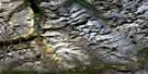
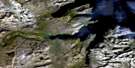
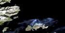
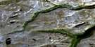
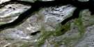
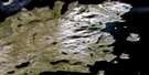
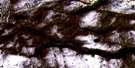
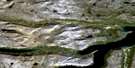
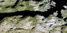
Cape Uivak-Fish Island Satellite Image Map
Download Free Aerial Photo 014L07 at 1:50,000 scale
Cape Uivak-Fish Island Satellite Imagery
To view this satellite map, mouse over the air photo on the right.
You can also download this satellite image map for free:
014L07 Cape Uivak-Fish Island high-resolution satellite image map.
Maps for the Cape Uivak-Fish Island aerial map sheet 014L07 at 1:50,000 scale are also available in these versions:
Cape Uivak-Fish Island Surrounding Area Aerial Photo Maps
 |
 |
||
 |
 |
 |
|
 |
 |
 |
|
 |
 |
 |
 |
© Department of Natural Resources Canada. All rights reserved.
Cape Uivak-Fish Island Gazetteer
The following places can be found on satellite image map 014L07 Cape Uivak-Fish Island:
Cape Uivak-Fish Island Satellite Image: Bays
Iterungnek FiordJerusalem Bay
Kiyuktok Cove
Maidmonts Harbour
Saglek Anchorage
Saglek Bay
Saglek Fiord
St. John's Harbour
The Bight
Tigigakyuk Inlet
Torr Bay
Cape Uivak-Fish Island Satellite Image: Beaches
The StrandCape Uivak-Fish Island Satellite Image: Capes
Cape UivakCape Uivuk
White Point
Cape Uivak-Fish Island Satellite Image: Channels
Hare Islands TickleCape Uivak-Fish Island Satellite Image: Islands
Hare IslandsKingitoaksuk Island
Lister Island
Maidmonts Island
Mentzel Island
Mikkitok Island
Nulliak Island
Okaliak Island
Ukkalek Island
Upernavik Island
Cape Uivak-Fish Island Satellite Image: Mountains
The DomesCape Uivak-Fish Island Satellite Image: Rivers
Kiyuktok BrookCape Uivak-Fish Island Satellite Image: Seas
Labrador SeaMer du Labrador

© Department of Natural Resources Canada. All rights reserved.
