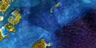
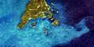
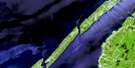
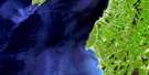
Campobello Island Satellite Image Map
Download Free Aerial Photo 021B15 at 1:50,000 scale
Campobello Island Satellite Imagery
To view this satellite map, mouse over the air photo on the right.
You can also download this satellite image map for free:
021B15 Campobello Island high-resolution satellite image map.
Maps for the Campobello Island aerial map sheet 021B15 at 1:50,000 scale are also available in these versions:
Campobello Island Surrounding Area Aerial Photo Maps
 |
|||
 |
 |
||
 |
|||
 |
© Department of Natural Resources Canada. All rights reserved.
Campobello Island Gazetteer
The following places can be found on satellite image map 021B15 Campobello Island:
Campobello Island Satellite Image: Bays
Baie de FundyBay of Fundy
Bay of Fundy
Big Whale Cove
Brandy Cove
Chocolate Cove
Clam Cove
Clarks Cove
Coates Cove
Conroy Cove
Cummings Cove
Curry Cove
Dark Harbour
Deep Cove
Deep Gulch Cove
Dinner Cove
Doctors Cove
Eastern End Cove
Eastern Head Cove
Flagg Cove
Friar Bay
Friar Roads
Friars Bay
Great Duck Pond
Harbour de Lute
Harbour Lute
Head Harbour
Herring Bay
Herring Cove
Hibernia Cove
Johns Cove
Leonardville Harbour
Liberty Cove
Little Whale Cove
Long Island Bay
Lower Duck Pond
Meadow Brook Cove
Mill Cove
Mill Cove Creek
Money Cove
North Harbour
Northern Harbour
Northwest Harbour
Otter Cove
Passamaquoddy Bay
Pauls Cove
Paul's Cove
Pettes Cove
Pollock Cove
Quoddy Road
Quoddy Roads
Ragged Cove
Sawpit Cove
Sawyers Cove
Schooner Cove
Ship Cove
Snug Cove
Southern Cove
Southwest Cove
The Gully
Union Cove
Welch Creek
Whale Cove
Campobello Island Satellite Image: Beaches
Bull Dog BeachDunn Beach
Friars Bay Beach
Gardners Beach
Herring Cove Beach
Indian Beach
Indian Beach
Little Ship Beach
Mallock Beach
Raccoon Beach
Red Beach
Ship Beach
Whistle Beach
Wilsons Beach
Campobello Island Satellite Image: Capes
Ashburton HeadBald Head
Birch Point
Brandy Head
Brown Head
Calders Head
Charleys Point
Clam Cove Head
Clines Point
Cranberry Point
Cubs Point
Deer Island Point
Deer Point
Deer Point
Dinner Head
Duck Point
East Quoddy Head
Eastern Head
Fish Head
Friar Head
Friars Head
Gardners Point
Gilligan Point
Gooseberry Point
Graveyard Point
Herring Bay Head
Indian Head
Liberty Point
Long Eddy Point
Long Point
Longs Eddy Point
Man of War Head
McKenzies Point
Mill Cove Point
Mink Point
Mink Point
Mulholland Point
Nancy Head
Net Point
Northern Head
Oak Head
Owen Head
Pea Point
Poors Point
Raccoon Point
Ragged Point
Red Head
Scott Head
Southern Head
Swallow Tail
The Dock
Wilsons Head
Wilsons Point
Windmill Point
Campobello Island Satellite Image: Caves
Hole in the WallCampobello Island Satellite Image: Channels
Grand Manan ChannelHead Harbour Passage
Lubec Channel
Lubec Narrows
Quoddy Narrows
Western Passage
Campobello Island Satellite Image: Cliffs
Seven Days WorkWhiterock Cliffs
Campobello Island Satellite Image: Geographical areas
CampobelloCharlotte
West Isles
Campobello Island Satellite Image: Islands
Bains IslandBar Island
Bean Island
Beans Island
Campobello Island
Casco Bay Island
Casco Island
Cherry Island
Cherry Islet
Deer Island
Dinner Island
Dinner Islet
Duck Islands
East Wolf Island
Eastern Wolf Island
Fatpot Island
Flat Wolf Island
Flat Wolf Island
Grand Manan
Grand Manan Island
Green Island
Green Rock
Head Harbour Island
Hospital Island
Hospital Islands
Indian Island
Little Island
Marble Island
Mink Island
Mowat Island
Nubble Island
Pope Islet
Popes Island
Rouen Islet
Sandy Island
Simpsons Island
South Wolf Island
Southern Wolf Island
Spectacle Island
Spectacle Island
Spectacle Islands
Spruce Island
Spruce Island
St. Helena Island
The Pup
The Specs
The Wolves
Thrumcap Island
Thumb Cap
Tinker Islet
Tinkers Island
White Horse Island
White Horse Islet
White Island
Campobello Island Satellite Image: Lakes
Beals Eddy PondBig Pond
Dicks Pond
Eastern Pond
Eel Lake
Hopper Pond
Jack Sinclair Pond
Lake Glensevern
Leonards Lake
Lily Pond
Little Duck Pond
Little Lake
Little Pond
Mill Cove Pond
Ohio Pond
Rich Pond
Southern Cove Pond
Upper Duck Pond
Whale Beach Pond
Wilson Pond
Campobello Island Satellite Image: Mountains
Barrow Well HillBeech Hill
Bucks Mountain
Bunker Hill
Cates Lookout
Coke Hill
Coldkill Hill
Daddy Good Mountain
Dunbar Hill
Dunbar Hill
Eagle Mountain
Fox Hill
Hanna Dow Hill
Hannabury Hill
Petes Hill
Raccoon Hill
Spragues Hill
Stovers Hill
Welch Hill
Campobello Island Satellite Image: Conservation areas
Herring Cove Provincial ParkParc international Roosevelt Campobello
Roosevelt Campobello International Park
Campobello Island Satellite Image: Provinces
New BrunswickNouveau-Brunswick
Campobello Island Satellite Image: Rapids
The Old SowCampobello Island Satellite Image: Rivers
Carr BrookDark Harbour Brook
Dock Brook
Eel Brook
Grand Brook
Hibernia Brook
Hopper Brook
Leonards Brook
Mill Creek
Mill Stream
Money Cove Brook
Stanley Brook
Campobello Island Satellite Image: Sea features
Indian RiverQuoddy River
Campobello Island Satellite Image: Shoals
Argument ShoalsBack Cove Ledges
Bag Ledge
Bains Ledges
Beans Ledges
Black Rock
Boil Rock
Bowens Rock
Butlers Ledge
Buttermilk Rock
Chain Ledge
Cod Rock
Dinner Island Ledge
Dinner Islet Ledge
Duck Rock
East Rock
Flaggs Bank
Gooseberry Ledges
Green Island Shoal
Green Islet Shoal
Growler Ledge
Gull Rock
Gun Rock
Halftide Ledge
Halibut Ledges
Head Harbour Ledges
Horseshoe Rock
Inner Middle Ground
Krabble Rock
Little White Horse Ledges
Middle Ground
Molasses Rock
Mourners Delight
Nancy Rock
Net Ledges
Net Rocks
New England Ledge
North Rock
Nubble Ledge
Owen Basin
Parker Ledges
Pompey Ledges
Pope Shoal
Popes Shoal
Racer Rock
Round Rock
Sandy Island Ledge
Sandy Ledge
Seal Rock
Simpsons Ledge
Split Rock
St. Helena Ledges
Stovers Ledge
Sugar Loaf Rock
The Bishop
The Boring Stone
The Nubble
The Nubble
Tinkers Lower Ledge
Tinkers Upper Ledge
Turks Rock
Two Hour Rock
Upper Sandy Ledges
Campobello Island Satellite Image: Unincorporated areas
Chocolate CoveCummings Cove
Fairhaven
Indian Island
Leonardville
Lords Cove
Malloch Beach
North Harbour
North Head
North Road
Northern Harbour
Otter Cove
Richardson
Rocky Corner
Tattons Corner
Welshpool
Wilsons Beach
Campobello Island Satellite Image: Low vegetation
Abrahams PlainPetes Meadow
Campobello Island Satellite Image: Villages
Grand Manan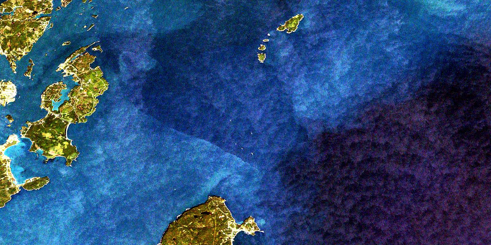
© Department of Natural Resources Canada. All rights reserved.
