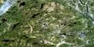
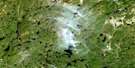
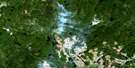
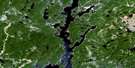
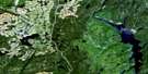
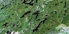
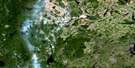
Lac Blanzy Satellite Image Map
Download Free Aerial Photo 022K06 at 1:50,000 scale
Lac Blanzy Satellite Imagery
To view this satellite map, mouse over the air photo on the right.
You can also download this satellite image map for free:
022K06 Lac Blanzy high-resolution satellite image map.
Maps for the Lac Blanzy aerial map sheet 022K06 at 1:50,000 scale are also available in these versions:
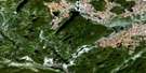
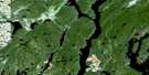
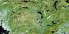
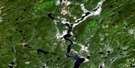
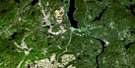
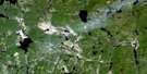
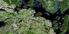
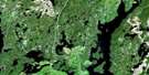
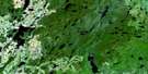
Lac Blanzy Surrounding Area Aerial Photo Maps
 |
 |
 |
 |
 |
 |
 |
 |
 |
 |
 |
 |
 |
 |
 |
 |
© Department of Natural Resources Canada. All rights reserved.
Lac Blanzy Gazetteer
The following places can be found on satellite image map 022K06 Lac Blanzy:
Lac Blanzy Satellite Image: Bays
Baie ArthurBaie de la Blanzy
Baie de la Castoréum
Baie de la Vaillance
Baie des Vingt-Deux
Baie du Condo
Baie du Coude
Baie du Pimbina
Baie du Ronfleur
Baie Poulin
Lac Blanzy Satellite Image: Channels
Passe Rap-RapLac Blanzy Satellite Image: Islands
Île de la SéparationÎle Hulot
Lac Blanzy Satellite Image: Lakes
Lac à la VaseLac à Ti-Bert
Lac Assis
Lac au Second
Lac Banane
Lac Beaulieu
Lac Blanzy
Lac Carré
Lac Choiseul
Lac de la Cantine
Lac de la Fatigue
Lac de la Fleurette
Lac de la Pantoufle
Lac de la Poire
Lac de la Vaillance
Lac des Bonneville
Lac des Crocs-en-Jambe
Lac des Quatre Loups
Lac des Quatre Martres
Lac des Trois Dimensions
Lac Double
Lac du Blé d'Inde
Lac du Bouchon
Lac du Condo
Lac du Coude
Lac du Maïs
Lac du Moteur Grugé
Lac du Non-Retour
Lac du Porc-Épic
Lac du Pourquoi
Lac du Ronfleur
Lac Francoeur
Lac Gagnon
Lac Hulot
Lac Jacques-Lachance
Lac Joe-Paul
Lac Lebreux
Lac Lévesque
Lac Lunettes
Lac Otis
Lac Tabarnouche
Lacs de la Séparation
Lacs Doubles
Lacs Triplets
Petit lac à l'Argent
Réservoir aux Outardes 4
Réservoir Outardes Quatre
Lac Blanzy Satellite Image: Other municipal/district area - miscellaneous
Rivière-aux-OutardesLac Blanzy Satellite Image: Rivers
Rivière à la VaseRivière à l'Argent
Rivière à Loutre
Rivière aux Outardes
Rivière aux Poissons
Rivière Blanzy
Rivière Castoréum
Rivière Hulot
Rivière Villéon
Ruisseau Capoutosécate

© Department of Natural Resources Canada. All rights reserved.
022K Related Maps:
022K Lac Berte022K01 Lac Saint-Pierre
022K02 Lac Gaillard
022K03
022K04 Lac Praslin
022K05 Lac Tremaudan
022K06E Lac Blanzy
022K06W Lac Blanzy
022K07 Lac Okaopeo
022K08 Lac Clairval
022K09 Lac Lemay
022K10 Lac De La Cache
022K11 Lac Hermas
022K12E Lac A L'Argent
022K12W Lac A L'Argent
022K13 Lac Auriac
022K14E Lac Guinecourt
022K14W Lac Guinecourt
022K15 Lac Du Bois Long
022K16 Lac Mistachagagane
