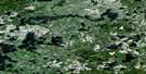
Madsen Satellite Image Map
Download Free Aerial Photo 052K13 at 1:50,000 scale
Madsen Satellite Imagery
To view this satellite map, mouse over the air photo on the right.
You can also download this satellite image map for free:
052K13 Madsen high-resolution satellite image map.
Maps for the Madsen aerial map sheet 052K13 at 1:50,000 scale are also available in these versions:
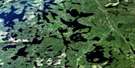
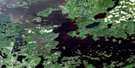
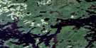
Madsen Surrounding Area Aerial Photo Maps
 |
 |
 |
 |
 |
 |
 |
 |
 |
 |
 |
 |
 |
 |
 |
 |
© Department of Natural Resources Canada. All rights reserved.
Madsen Gazetteer
The following places can be found on satellite image map 052K13 Madsen:
Madsen Satellite Image: Channels
Starratt ChannelMadsen Satellite Image: Geographical areas
BairdByshe
Heyson
Willans
Madsen Satellite Image: Lakes
Bouzan LakeBoyden Lake
Bug Lake
Dedee Lake
Dixie Lake
Faulkenham Lake
Flat Lake
Genessee Lake
Gullrock Lake
Halden Lake
Hiewall Lake
High Lake
Insect Lake
Keg Lake
Killoran Lake
Pakwash Lake
Pakwash Lakes
Petersen Lake
Roger Lake
Russett Lake
Snib Lake
Sparks Lake
Stone Lake
Sully Lake
Tote Road Lake
Two Island Lake
Upper Medicine Stone Lake
Wales Lake
Willans Lake
Madsen Satellite Image: Other municipal/district area - miscellaneous
BalmertownGolden
Madsen Satellite Image: Conservation areas
Pakwash Provincial ParkMadsen Satellite Image: Rivers
Bouzan CreekBoyden Creek
Bug River
Caribou Creek
Chukuni River
Coin Creek
Dedee Creek
Dixie Creek
Dom Creek
Killoran Creek
Roger Creek
Stone Creek
Sully Creek
Madsen Satellite Image: Road features
Snowshoe PortageMadsen Satellite Image: Towns
Red LakeMadsen Satellite Image: Unincorporated areas
MadsenStarratt-Olsen
© Department of Natural Resources Canada. All rights reserved.
052K Related Maps:
052K Lac Seul052K01 Hudson
052K02 Route Lake
052K03 Cliff Lake
052K04 Big Canyon Lake
052K05 Oak Lake
052K06 Wabaskang Lake
052K07 Mcintyre Bay
052K08 Lac Seul
052K09 Wapesi Lake
052K10 Aerofoil Lake
052K11 Ear Falls
052K12 Wegg Lake
052K13 Madsen
052K14 Pakwash Lake
052K15 Bluffy Lake
052K16 Papaonga Lake
