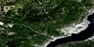
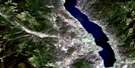
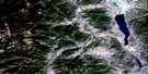
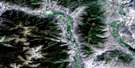
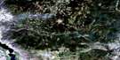
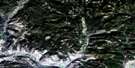
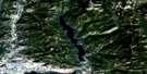
Burrell Creek Satellite Image Map
Download Free Aerial Photo 082E09 at 1:50,000 scale
Burrell Creek Satellite Imagery
To view this satellite map, mouse over the air photo on the right.
You can also download this satellite image map for free:
082E09 Burrell Creek high-resolution satellite image map.
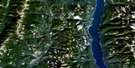
Maps for the Burrell Creek aerial map sheet 082E09 at 1:50,000 scale are also available in these versions:
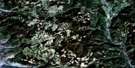
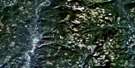
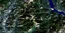
Burrell Creek Surrounding Area Aerial Photo Maps
 |
 |
 |
 |
 |
 |
 |
 |
 |
 |
 |
 |
 |
 |
 |
 |
© Department of Natural Resources Canada. All rights reserved.
Burrell Creek Gazetteer
The following places can be found on satellite image map 082E09 Burrell Creek:
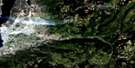
Burrell Creek Satellite Image: Falls
Bowman FallsBurrell Creek Satellite Image: Lakes
Bear Paw LakeCinnamon Lake
Lily Pad Lake
Lower Arrow Lake
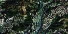
Burrell Creek Satellite Image: Mountains
Christina RangeColumbia Mountains
Franklin Mountain
Midway Mountains
Midway Range
Monashee Mountains
Mount Franklin
Mount McKinley
Mount O'Leary
Mount Sloan
Sangrida Peak
Selkirk Mountains
Tenderloin Mountain
Valhalla Mountains
Valhalla Range
Valhalla Ranges
Valkyr Mountains
Valkyr Range
Burrell Creek Satellite Image: Major municipal/district area - major agglomerations
Regional District of Kootenay-BoundaryBurrell Creek Satellite Image: Conservation areas
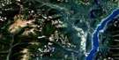
Granby ParkBurrell Creek Satellite Image: Rivers
Bluejoint CreekBowman Creek
Burrell Creek
Cane Creek
Cinnamon Creek
Columbia River
Dane Creek
Deer Creek
Dinsmore Creek
Eclipse Creek
Fleuve Columbia
Franklin Creek
Gladstone Creek
Gloucester Creek
Granby River
Howe Creek
Hutchison Creek
I X L Creek
Johnston Creek
Last Chance Creek
McFarlane Creek
Michaud Creek
Molly Creek
Nicoll Creek
North Cinnamon Creek
Octopus Creek
Philippa Creek
Pinto Creek
Sangrida Creek
Smith Creek
Sunshine Creek
Twin Creek
Twobit Creek
Two-bit Creek
Van Houten Creek
Walter Creek
Worthington Creek

© Department of Natural Resources Canada. All rights reserved.
082E Related Maps:
082E Penticton082E01 Grand Forks
082E02 Greenwood
082E03 Osoyoos
082E04 Keremeos
082E05 Penticton
082E06 Beaverdell
082E07 Almond Mountain
082E08 Deer Park
082E09 Burrell Creek
082E10 Christian Valley
082E11 Wilkinson Creek
082E12 Summerland
082E13 Peachland
082E14 Kelowna
082E15 Damfino Creek
082E16 Edgewood
