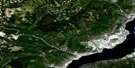
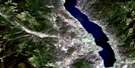
Penticton Satellite Image Map
Download Free Aerial Photo 082E05 at 1:50,000 scale
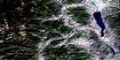
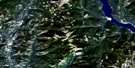
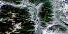
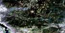
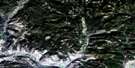
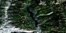
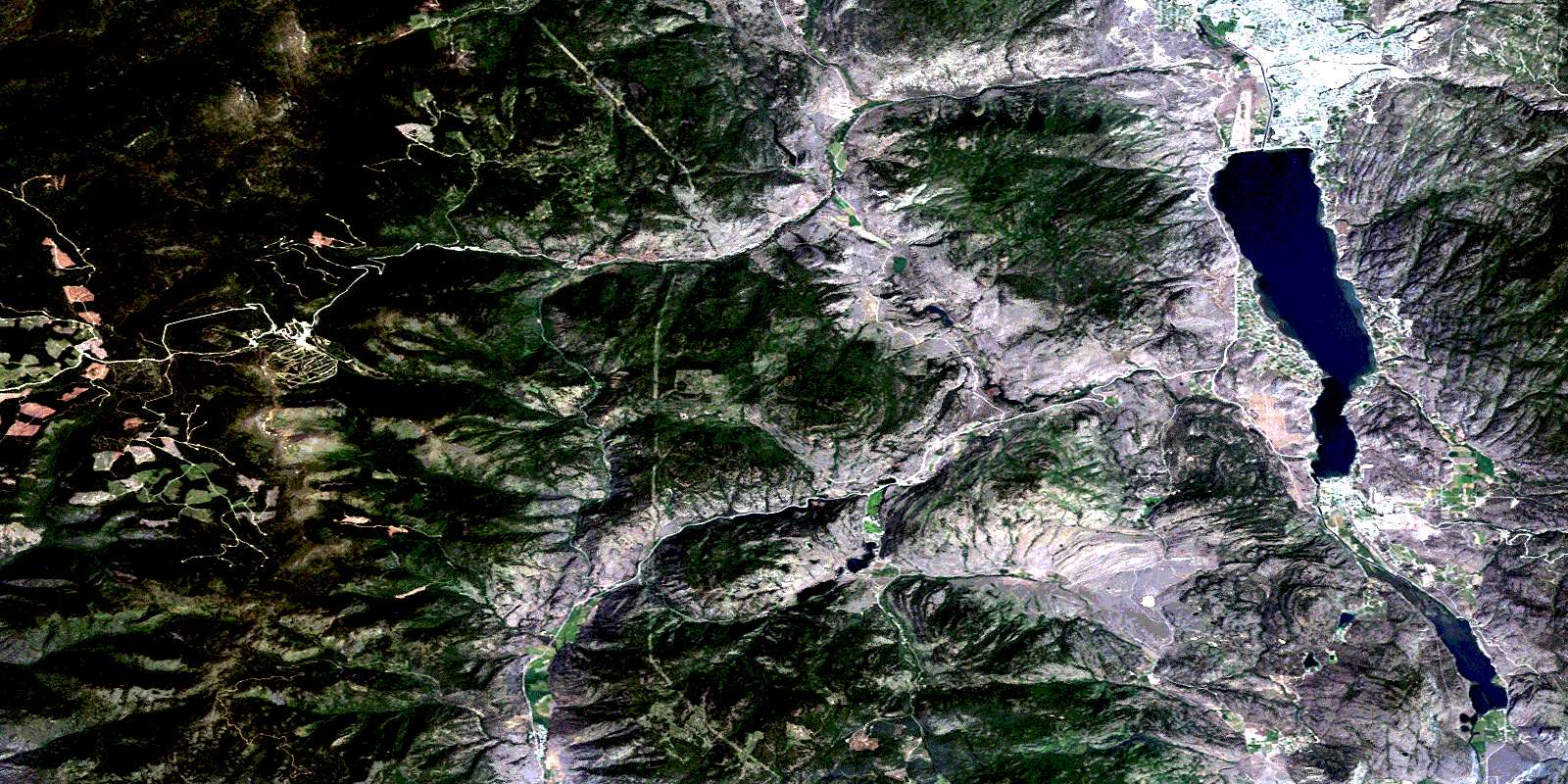
Penticton Satellite Imagery
To view this satellite map, mouse over the air photo on the right.
You can also download this satellite image map for free:
082E05 Penticton high-resolution satellite image map.
Maps for the Penticton aerial map sheet 082E05 at 1:50,000 scale are also available in these versions:
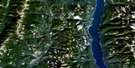
Penticton Surrounding Area Aerial Photo Maps
 |
 |
 |
 |
 |
 |
 |
 |
 |
 |
 |
 |
 |
 |
 |
 |
© Department of Natural Resources Canada. All rights reserved.
Penticton Gazetteer
The following places can be found on satellite image map 082E05 Penticton:
Penticton Satellite Image: City
PentictonPenticton Satellite Image: Cliffs
McIntyre BluffPenticton Satellite Image: Falls
Okanagan FallsPenticton Satellite Image: Geographical areas
Kamloops Division Yale Land DistrictOsoyoos Division Yale Land District
Similkameen Division Yale Land District
Penticton Satellite Image: Indian Reserves
Keremeos Forks Indian Reserve 12 & 12AKeremeos Forks Indian Reserve 12A
Penticton 2
Penticton Indian Reserve 1
Penticton Indian Reserve 2
Réserve indienne Keremeos Forks 12 & 12A
Réserve indienne Keremeos Forks 12A
Réserve indienne Penticton 1
Réserve indienne Penticton 2
Penticton Satellite Image: Lakes
Aeneas LakeBrent Lake
Farleigh Lake
Ford Lake
Green Lake
Horn Lake
Kitley Lake
Mahoney Lake
Marron Lake
Nickel Plate Lake
Prather Lake
Skaha Lake
Toy Lake
Trout Lake
Twin Lakes
Vaseux Lake
White Lake
Yellow Lake
Penticton Satellite Image: Mountains
Apex MountainBeaconsfield Mountain
Blue Mountain
Dividend Mountain
Eagle Bluff
Green Mountain
Hedges Butte
Mount Brent
Mount Hawthorne
Mount Keogan
Mount Laidlaw
Mount McLellan
Mount Parker
Mount Riordan
Okanagan Highland
Orofino Mountain
Penticton Satellite Image: Major municipal/district area - major agglomerations
Regional District of Central KootenayPenticton Satellite Image: Conservation areas
Apex Mountain ParkApex Mountain Recreation Area
Christie Memorial Park
Clearwater Park
Keremeos Columns Park
Nickel Plate Park
Okanagan Falls Park
Refuge d'oiseaux du lac Vaseux
Réserve nationale de faune de Vaseux-Bighorn
Vaseux Lake Bird Sanctuary
Vaseux Lake Park
Vaseux-Bighorn National Wildlife Area
Penticton Satellite Image: Plains
Interior PlateauMeyers Flat
Thompson Plateau
Penticton Satellite Image: Rivers
Bradshaw CreekBroken Creek
Cahill Creek
Cedar Creek
Clark Creek
Derenzy Creek
Ellis Creek
Farleigh Creek
Felis Creek
Fragment Creek
Gillies Creek
Harkin Creek
Hedley Creek
Horn Creek
Irrigation Creek
June Creek
Kearns Creek
Keremeos Creek
Klohtelt Creek
Loak Creek
Manuel Creek
Marama Creek
Marron River
Marsel Creek
Matheson Creek
McCaig Creek
McKay Creek
McLean Creek
Nickel Plate Creek
Okanagan River
Olalla Creek
Old Tom Creek
Orofino Creek
Park Rill
Penticton Creek
Shatford Creek
Shingle Creek
Shoemaker Creek
Shuttle Creek
Shuttleworth Creek
Skaha Creek
South KeremeosCreek
Steward Creek
Strayhorse Creek
Thomas Creek
Toy Creek
Vaseux Creek
Winters Creek
Yellowlake Creek
Penticton Satellite Image: Shoals
Sheep RockPenticton Satellite Image: Unincorporated areas
Allen GroveApex Mountain
Eagle Bluff
East Penticton
Kaleden
Marron Valley
McIntyre
Meyers Flat
Okanagan Falls
Olalla
Skaha
South Penticton
West Penticton
Willowbrook
Penticton Satellite Image: Valleys
Dry GulchDry Gulch Creek
© Department of Natural Resources Canada. All rights reserved.
082E Related Maps:
082E Penticton082E01 Grand Forks
082E02 Greenwood
082E03 Osoyoos
082E04 Keremeos
082E05 Penticton
082E06 Beaverdell
082E07 Almond Mountain
082E08 Deer Park
082E09 Burrell Creek
082E10 Christian Valley
082E11 Wilkinson Creek
082E12 Summerland
082E13 Peachland
082E14 Kelowna
082E15 Damfino Creek
082E16 Edgewood
