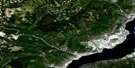
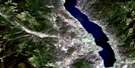
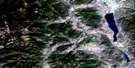
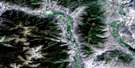
Damfino Creek Satellite Image Map
Download Free Aerial Photo 082E15 at 1:50,000 scale
Damfino Creek Satellite Imagery
To view this satellite map, mouse over the air photo on the right.
You can also download this satellite image map for free:
082E15 Damfino Creek high-resolution satellite image map.
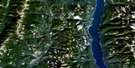
Maps for the Damfino Creek aerial map sheet 082E15 at 1:50,000 scale are also available in these versions:
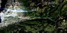
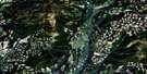
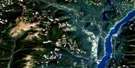
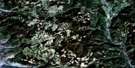
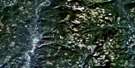
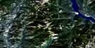
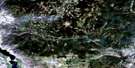
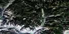
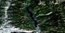
Damfino Creek Surrounding Area Aerial Photo Maps
 |
 |
 |
 |
 |
 |
 |
 |
 |
 |
 |
 |
 |
 |
 |
 |
© Department of Natural Resources Canada. All rights reserved.
Damfino Creek Gazetteer
The following places can be found on satellite image map 082E15 Damfino Creek:
Damfino Creek Satellite Image: Lakes
Derickson LakeGraystoke Lake
Linden Lake
Loch Katrine
Loch Larsen
Loch Long
Loch Lost
Loch Oichie
Nevertouch Lake
Reith Lakes
St. Margaret Lake
Two John Lake
Damfino Creek Satellite Image: Mountains
Columbia MountainsJubilee Mountain
Lightning Peak
Midway Mountains
Midway Range
Monashee Mountains
Mount Moore
Okanagan Highland
Damfino Creek Satellite Image: Major municipal/district area - major agglomerations
Regional District of Central KootenayRegional District of Central Okanagan
Regional District of Kootenay-Boundary
Damfino Creek Satellite Image: Conservation areas
Granby ParkDamfino Creek Satellite Image: Plains
Interior PlateauThompson Plateau
Damfino Creek Satellite Image: Rivers
Bruer CreekDamfino Creek
Dictator Creek
Dry Creek
Fish Hawk Creek
Goatskin Creek
Gunnar Creek
Haggart Creek
Kettle River
Loch Katrine Creek
Mike Creek
Mission Creek
Mohr Creek
Nevertouch Creek
Pearson Creek
Rendell Creek
Ryder Creek
Split Creek
Stanley Creek
Stevenson Creek
Stove Creek
Teepee Creek
Waterloo Creek
West Kettle River
Westkettle River
Whitefoot Creek
Winnifred Creek
Woodmouse Creek

© Department of Natural Resources Canada. All rights reserved.
082E Related Maps:
082E Penticton082E01 Grand Forks
082E02 Greenwood
082E03 Osoyoos
082E04 Keremeos
082E05 Penticton
082E06 Beaverdell
082E07 Almond Mountain
082E08 Deer Park
082E09 Burrell Creek
082E10 Christian Valley
082E11 Wilkinson Creek
082E12 Summerland
082E13 Peachland
082E14 Kelowna
082E15 Damfino Creek
082E16 Edgewood
